178.176.52.5 - IP Lookup: Free IP Address Lookup, Postal Code Lookup, IP Location Lookup, IP ASN, Public IP
Country:
Region:
City:
Location:
Time Zone:
Postal Code:
IP information under different IP Channel
ip-api
Country
Region
City
ASN
Time Zone
ISP
Blacklist
Proxy
Latitude
Longitude
Postal
Route
Luminati
Country
ASN
Time Zone
Europe/Moscow
ISP
PJSC MegaFon
Latitude
Longitude
Postal
IPinfo
Country
Region
City
ASN
Time Zone
ISP
Blacklist
Proxy
Latitude
Longitude
Postal
Route
IP2Location
178.176.52.5Country
Region
moskovskaya oblast'
City
krasnoznamensk
Time Zone
Europe/Moscow
ISP
Language
User-Agent
Latitude
Longitude
Postal
db-ip
Country
Region
City
ASN
Time Zone
ISP
Blacklist
Proxy
Latitude
Longitude
Postal
Route
ipdata
Country
Region
City
ASN
Time Zone
ISP
Blacklist
Proxy
Latitude
Longitude
Postal
Route
Popular places and events near this IP address

Golitsyno, Moscow Oblast
Town in Moscow Oblast, Russia
Distance: Approx. 3653 meters
Latitude and longitude: 55.61472222,36.98722222
Golitsyno (Russian: Голи́цыно) is a town in Odintsovsky District of Moscow Oblast, Russia, located 40 kilometers (25 mi) west of Moscow. Population: 17,593 (2010 Census); 16,189 (2002 Census); 23,315 (1989 Soviet census).

Aprelevka
Town in Moscow Oblast, Russia
Distance: Approx. 5776 meters
Latitude and longitude: 55.55,37.06666667
Aprelevka (Russian: Апре́левка) is a town in Naro-Fominsky District of Moscow Oblast, Russia, located along the Moscow–Kaluga railway, 42 kilometers (26 mi) from Moscow. Population: 18,349 (2010 Census); 18,357 (2002 Census); 21,178 (1989 Soviet census).
Titov Main Test and Space Systems Control Centre
Distance: Approx. 800 meters
Latitude and longitude: 55.594,37.047
The Titov Main Test and Space Systems Control Centre (Russian: Главный испытательный центр испытаний и управления космическими средствами (ГИЦИУ КС), romanized: Glavny Ispytatelny Tsentr Ispytany i Upravleniya Kosmicheskimi Sredstvami (GITSIU COP)) (also referenced as the Titov Space Control Centre and Titov Space Centre) is the main Russian military and commercial satellite control centre. It is run by the Russian Space Forces of the Russian Aerospace Forces. Located roughly 40 kilometres (25 mi) southwest of Moscow in closed town of Krasnoznamensk, the centre was built in 1957 as part of the Soviet space program, and was known by the name of Golitsyno-2.

Krasnoznamensk, Moscow Oblast
Town in Moscow Oblast, Russia
Distance: Approx. 236 meters
Latitude and longitude: 55.60083333,37.03583333
Krasnoznamensk (Russian: Краснозна́менск) is a closed town in Moscow Oblast, Russia. Population: 43,868 (2021 Census); 36,103 (2010 Census); 28,044 (2002 Census). It was previously known as Golitsyno-2 (until 1994).

Aeroflot Flight 2003
1976 aviation accident
Distance: Approx. 7658 meters
Latitude and longitude: 55.58694444,37.15833333
Aeroflot Flight 2003 was operated on 3 January 1976 by a Tupolev Tu-124, registration СССР-45037, when it crashed 7 km (4.3 mi) after take-off from Moscow–Vnukovo Airport, on a domestic flight to Minsk-1 International Airport, and Brest Airport, Belarus. The crash killed all sixty-one on board and one in a house on the ground.

Petrovskoye-Alabino
Distance: Approx. 7907 meters
Latitude and longitude: 55.532599,36.995889
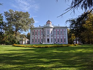
Petrovskoye-Alabino (Петровское-Алабино) is a ruined country house near the village of Alabino, in the Naro-Fominsky District of the Moscow Oblast. It is sited near the Desna River, about 50 kilometres (31 mi) southwest of Moscow, beside the route towards Kyiv. The classical house was built in the late 18th century, probably designed by Matvey Kazakov, or perhaps his mentor Vasili Bazhenov, for the Demidov family.
Zhavoronki
Village in Moscow Oblast, Russia
Distance: Approx. 5993 meters
Latitude and longitude: 55.642,37.0969
Zhavoronki is a village (before 2004, a settlement) in Odintsovsky District in Moscow Oblast, Russia. It is the administrative center of the Zhavoronkovskoye Rural Settlement. There is a railway station in the village.

Kalininets
Town in Moscow Oblast, Russia
Distance: Approx. 6069 meters
Latitude and longitude: 55.55846855,36.974891
Kalininets (Russian: Кали́нинец) is an urban locality (a work settlement) in the Naro-Fominsky District in Moscow Oblast, Russia. The town's name is a derivative form an unofficial name for a soldier of Taman Division, which is in turn named after Mikhail Ivanovich Kalinin (Russian: Михаи́л Ива́нович Кали́нин).

Bolshiye Vyazyomy
Urban-type settlement in Moscow Oblast, Russia
Distance: Approx. 3843 meters
Latitude and longitude: 55.6312,37.0148
Bolshiye Vyazyomy (Russian: Большие Вязёмы) is an urban locality (an urban-type settlement) in Odintsovsky District of Moscow Oblast, Russia. The population is 12,650 (2010 Census); 5,667 (2002 Census); Vyazyomy is the location of Vyazyomy Manor owned by members of the Golitsyn family. Both Kutuzov and Napoleon Bonaparte slept in the main manor house (on the same sofa in the library) only one day apart; Napoleon left the day before the French entered Moscow.

Kokoshkino
Urban-type settlement in Moscow, Russia
Distance: Approx. 8231 meters
Latitude and longitude: 55.59777778,37.16944444
Kokoshkino is an urban locality (an urban-type settlement) in Novomoskovsky Administrative Okrug of the federal city of Moscow, Russia. Population: 11,600 (2010 Census); 9,900 (2002 Census); 10,694 (1989 Soviet census). Kokoshkino is named after Fyodor Kokoshkin, founder of the Constitutional Democratic Party, who owned a house nearby.

Pobeda railway station
Railway station in Moscow, Russia
Distance: Approx. 5029 meters
Latitude and longitude: 55.5662,37.0928
Pobeda (Russian: Победа, lit. Victory) is a railway station of Kiyevsky suburban railway line in Naro-Fominsky District of Moscow Oblast. It was opened in 1951 and rebuilt in 2020.

Golitsyno Border Institute of the FSB of the Russian Federation
Military school of the Russian Border Guards
Distance: Approx. 4980 meters
Latitude and longitude: 55.62882277,36.97894069
Golitsyno Border Institute of the FSB of the Russian Federation (Russian: Голицынский пограничный институт ФСБ России) is a federal state educational institution of higher professional education for the training of officers for the Border Service of the Federal Security Service of Russia. It traces its history and traditions from the border school of the OGPU of the USSR, which existed between 1930 and 1953). It has existed in its current form since 1967.
Weather in this IP's area
few clouds
1 Celsius
-5 Celsius
1 Celsius
1 Celsius
1008 hPa
86 %
1008 hPa
985 hPa
10000 meters
8 m/s
230 degree
20 %