Country:
 Switzerland
Region:
City:
Latitude and Longitude:
Time Zone:
Postal Code:
IP information under different IP Channel
ip-api
Country
Region
City
ASN
Time Zone
ISP
Blacklist
Proxy
Latitude
Longitude
Postal
Route
IPinfo
Country
Region
City
ASN
Time Zone
ISP
Blacklist
Proxy
Latitude
Longitude
Postal
Route
MaxMind
Country
Region
City
ASN
Time Zone
ISP
Blacklist
Proxy
Latitude
Longitude
Postal
Route
Luminati
Country
CHRegion
ag
City
oberwillieli
ASN
Time Zone
Europe/Zurich
ISP
Bluewin
Latitude
Longitude
Postal
db-ip
Country
Region
City
ASN
Time Zone
ISP
Blacklist
Proxy
Latitude
Longitude
Postal
Route
ipdata
Country
Region
City
ASN
Time Zone
ISP
Blacklist
Proxy
Latitude
Longitude
Postal
Route
Popular places and events near this IP address

Berikon
Municipality in Aargau, Switzerland
Distance: Approx. 2994 meters
Latitude and longitude: 47.35,8.36666667
Berikon is a municipality in the district of Bremgarten in the canton of Aargau in Switzerland. The village lies on a hill above and to the east of the Reuss Valley, covering part of the Mutschellen Pass. This municipality is bounded by Rudolfstetten-Friedlisberg, Widen, Zufikon, and Oberwil-Lieli, all in canton Aargau, and shares a boundary with the canton of Zürich (district of Dietikon) to the east.
Arni, Aargau
Municipality in Aargau, Switzerland
Distance: Approx. 2417 meters
Latitude and longitude: 47.319445,8.42222167
Arni is a municipality in the district of Bremgarten in the Swiss canton of Aargau.

Islisberg
Municipality in Aargau, Switzerland
Distance: Approx. 3257 meters
Latitude and longitude: 47.31666667,8.43333333
Islisberg is a municipality in the district of Bremgarten in the canton of Aargau in Switzerland.

Zufikon
Municipality in Aargau, Switzerland
Distance: Approx. 2994 meters
Latitude and longitude: 47.35,8.36666667
Zufikon is a municipality in the district of Bremgarten in the canton of Aargau in Switzerland.
Rottenschwil
Municipality in Aargau, Switzerland
Distance: Approx. 3138 meters
Latitude and longitude: 47.31666667,8.36666667
Rottenschwil is a municipality in the district of Muri in the canton of Aargau in Switzerland.

Oberlunkhofen
Municipality in Aargau, Switzerland
Distance: Approx. 2301 meters
Latitude and longitude: 47.31666667,8.38333333
Oberlunkhofen is a municipality in the district of Bremgarten, in the canton of Aargau in Switzerland.

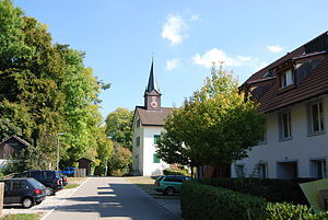
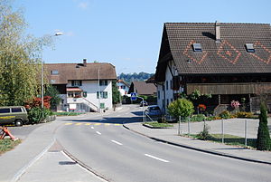
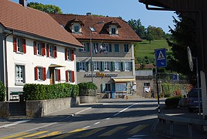
Oberwil-Lieli
Municipality in Aargau, Switzerland
Distance: Approx. 141 meters
Latitude and longitude: 47.33333333,8.4
Oberwil-Lieli is a municipality in the district of Bremgarten in the canton of Aargau in Switzerland.
Unterlunkhofen
Municipality in Aargau, Switzerland
Distance: Approx. 2301 meters
Latitude and longitude: 47.31666667,8.38333333
Unterlunkhofen is a municipality in the district of Bremgarten in the canton of Aargau in Switzerland.

Aesch, Zürich
Municipality in Zurich, Switzerland
Distance: Approx. 2593 meters
Latitude and longitude: 47.33333333,8.43333333
Aesch is a municipality in the district of Dietikon in the canton of Zürich in Switzerland. Until 2001 it was known as Aesch bei Birmensdorf.

Birmensdorf
Municipality in Zurich, Switzerland
Distance: Approx. 3118 meters
Latitude and longitude: 47.35,8.43333333
Birmensdorf is a municipality in the district of Dietikon in the canton of Zürich in Switzerland.

Flachsee
Lake on the Reuss at Rottenschwil, Switzerland
Distance: Approx. 2339 meters
Latitude and longitude: 47.32805556,8.36944444
Flachsee is an artificial lake on the Reuss at Rottenschwil, south of Bremgarten in the Aargau region of Switzerland. The reservoir was formed after the construction of the dam in 1975 at Bremgarten-Zufikon. The lake's surface area is 72 ha (180 acres).

Arni-Islisberg
Former municipality of Aargau, Switzerland
Distance: Approx. 2364 meters
Latitude and longitude: 47.31822778,8.41930278
Arni-Islisberg is a former municipality in the district of Bremgarten in the canton of Aargau, Switzerland. It was created in 1803. It ceased to exist in 1983, when it was split into the two new municipalities Arni and Islisberg.
Weather in this IP's area
clear sky
18 Celsius
18 Celsius
18 Celsius
19 Celsius
1011 hPa
74 %
1011 hPa
944 hPa
10000 meters
1.54 m/s
06:53:45
19:55:18