Country:
Region:
City:
Latitude and Longitude:
Time Zone:
Postal Code:
IP information under different IP Channel
ip-api
Country
Region
City
ASN
Time Zone
ISP
Blacklist
Proxy
Latitude
Longitude
Postal
Route
Luminati
Country
Region
l
City
dublin
ASN
Time Zone
Europe/Dublin
ISP
Three Ireland (Hutchison) limited
Latitude
Longitude
Postal
IPinfo
Country
Region
City
ASN
Time Zone
ISP
Blacklist
Proxy
Latitude
Longitude
Postal
Route
db-ip
Country
Region
City
ASN
Time Zone
ISP
Blacklist
Proxy
Latitude
Longitude
Postal
Route
ipdata
Country
Region
City
ASN
Time Zone
ISP
Blacklist
Proxy
Latitude
Longitude
Postal
Route
Popular places and events near this IP address

Ballybough
Northern inner city district of Dublin, Ireland
Distance: Approx. 287 meters
Latitude and longitude: 53.3565,-6.2508
Ballybough (Irish: An Baile Bocht, meaning 'the poor town') is an inner city district of northeast Dublin city, Ireland. Adjacent areas include the North Strand and Clonliffe.

Hill 16
Terrace at Croke Park, Dublin, Ireland
Distance: Approx. 345 meters
Latitude and longitude: 53.36146,-6.250288
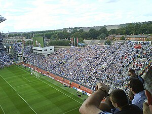
Hill 16 – officially called Dineen Hill 16 and sometimes referred to as The Hill – is a terrace at the Railway End of Croke Park, the principal stadium and headquarters of the Gaelic Athletic Association (GAA). It is located on the Northside of the Irish capital city, Dublin.

North Strand Road
Street in Dublin, Ireland
Distance: Approx. 465 meters
Latitude and longitude: 53.358525,-6.241297
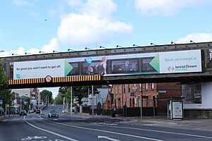
North Strand Road (Irish: Bóthar na Trá Thuaidh) is a street in the Northside of Dublin, Ireland. It links the city centre from Connolly Station to Fairview by road.
O'Connell School
School in Ireland
Distance: Approx. 226 meters
Latitude and longitude: 53.3593,-6.2515
The O’Connell School is a secondary and primary school for boys located on North Richmond Street in Dublin, Ireland. The school, named in honour of the leader of Catholic Emancipation, Daniel O’Connell, has the distinction of being the oldest surviving Christian Brothers school in Dublin, having been first established in 1829. It is now under the trusteeship of the Edmund Rice Schools Trust.
2009 All-Ireland Senior Football Championship final
Football match
Distance: Approx. 306 meters
Latitude and longitude: 53.36072222,-6.25122222
The 2009 All-Ireland Football Championship final was the 122nd event of its kind. Played between Cork and Kerry on 20 September 2009 in Croke Park, Dublin, it was the last football match of the 2009 All-Ireland Senior Football Championship. Kerry won by a score of 0–16 to 1–09.

North Strand FET Campus
Distance: Approx. 420 meters
Latitude and longitude: 53.35514,-6.24579
GAA Hall of Fame
Distance: Approx. 249 meters
Latitude and longitude: 53.3607,-6.2496
The GAA Hall of Fame is the hall of fame for Gaelic games in Ireland. The hall opened in the Cusack Stand, Croke Park, Dublin, on 11 February 2013, with 32 inaugural inductees.

Aldborough House
Georgian mansion in Dublin 1, Ireland
Distance: Approx. 383 meters
Latitude and longitude: 53.35515944,-6.24804806
Aldborough House (sometimes Aldboro House) is a large Georgian house in Dublin, Ireland. Built as a private residence by 1795, the original structure included a chapel (since lost) and a theatre wing. The house has been used for periods as a school, barracks and post office depot, before becoming vacant in the early 21st century.
Murder of Michael Barr
Distance: Approx. 192 meters
Latitude and longitude: 53.357,-6.24939
Michael Barr (died 25 April 2016) was a 35-year-old Irishman who was shot dead in a pub in Dublin as part of the Hutch–Kinahan feud. Four people have been convicted of his murder.

Free Church, Great Charles Street, Dublin
Former free, then Church of Ireland, church
Distance: Approx. 425 meters
Latitude and longitude: 53.357351,-6.254349
Free Church, Great Charles Street, Dublin was a proprietary episcopal chapel in Summerhill, off Mountjoy Square in Dublin. Built by Methodists, in 1800, designed by architect Edward Robbins, and initially known as the Wesley Chapel. Following a schism in the congregation in 1816, a group called the Primitive Wesleyan Methodists split from the Methodist Church, it became known as the free church.

North Strand Church (Church of Ireland)
Church in Dublin
Distance: Approx. 390 meters
Latitude and longitude: 53.3584946,-6.2424395
North Strand Church, is a Church of Ireland church on North Strand and Waterloo Avenue, in Dublin. The original church was established in 1786. It is now part of the United Parish of Drumcondra, North Strand, and Saint Barnabas.

Buckingham Street
Street in central Dublin, Ireland
Distance: Approx. 471 meters
Latitude and longitude: 53.35448239,-6.24995157
Buckingham Street is a street in Dublin running from Summerhill to Amiens Street. It is divided into Buckingham Street Lower (south end) and Buckingham Street Upper (north end).
Weather in this IP's area
broken clouds
13 Celsius
13 Celsius
13 Celsius
14 Celsius
1026 hPa
85 %
1026 hPa
1024 hPa
10000 meters
2.06 m/s
150 degree
75 %
07:28:03
16:48:59