Country:
 Netherlands
Region:
City:
Latitude and Longitude:
Time Zone:
Postal Code:
IP information under different IP Channel
ip-api
Country
Region
City
ASN
Time Zone
ISP
Blacklist
Proxy
Latitude
Longitude
Postal
Route
IPinfo
Country
Region
City
ASN
Time Zone
ISP
Blacklist
Proxy
Latitude
Longitude
Postal
Route
MaxMind
Country
Region
City
ASN
Time Zone
ISP
Blacklist
Proxy
Latitude
Longitude
Postal
Route
Luminati
Country
NLRegion
zh
City
bergschenhoek
ASN
Time Zone
Europe/Amsterdam
ISP
LeaseWeb Netherlands B.V.
Latitude
Longitude
Postal
db-ip
Country
Region
City
ASN
Time Zone
ISP
Blacklist
Proxy
Latitude
Longitude
Postal
Route
ipdata
Country
Region
City
ASN
Time Zone
ISP
Blacklist
Proxy
Latitude
Longitude
Postal
Route
Popular places and events near this IP address

Urk
Municipality in Flevoland, Netherlands
Distance: Approx. 337 meters
Latitude and longitude: 52.66666667,5.6
Urk (Dutch: [ˈʏr(ə)k] ; Urkers: Urrek; Dutch Low Saxon: Ürrek) is a municipality and a town in the Flevoland province in the central Netherlands. Urk is first mentioned in historical records dating to the 10th century, when it was still an island in the Almere, an inland sea that would become part of the Zuiderzee in the 13th century after a series of incursions by the North Sea. In 1939, a dike from the mainland to Urk ended the town's island status, just as the Afsluitdijk project was changing the salt water Zuiderzee surrounding Urk to the less saline IJsselmeer.

Tollebeek
Village in Flevoland, Netherlands
Distance: Approx. 5040 meters
Latitude and longitude: 52.67777778,5.67527778
Tollebeek is a village in the Dutch province of Flevoland. It is a part of the municipality of Noordoostpolder, and is approximately 90 kilometres north east of Amsterdam. Tollebeek is one of ten villages in the Noordoostpolder (literally: North East Polder) which was reclaimed from the Zuiderzee (now: IJsselmeer) in the 1930s and 1940s as part of a huge project known as the 'Zuiderzeewerken' ('Zuiderzee works') to create new land to accommodate growing need for farmland and new urban areas in the already densely populated country.

Espel
Village in Flevoland, Netherlands
Distance: Approx. 7158 meters
Latitude and longitude: 52.72416667,5.64416667
Espel is one of the so-called green villages (Dutch: groendorpen) in the Dutch province of Flevoland. It lies in the municipality of Noordoostpolder next to a crossroads where provincial road N712 from Urk to Lemmer intersects with road N714 to Emmeloord, roughly 6 km (3.7 mi) to the east.

Nagele
Village in Flevoland, Netherlands
Distance: Approx. 8398 meters
Latitude and longitude: 52.64388889,5.72333333
Nagele is a village in the Dutch province of Flevoland. It is a part of the municipality of Noordoostpolder, and lies about 10 km south of Emmeloord.

Ketelbrug
Distance: Approx. 6491 meters
Latitude and longitude: 52.61194444,5.64472222
The Ketelbrug is bridge spanning the Ketel-lake between the Noordoostpolder and the Eastern Flevopolder in the Dutch province of Flevoland. The motorway A6 runs over it. A part of it is a Bascule bridge.

Urk Lighthouse
Lighthouse
Distance: Approx. 897 meters
Latitude and longitude: 52.66105556,5.59194444
Urk Lighthouse is a lighthouse in Urk at the eastern banks of the IJsselmeer. From 1617 a coal fire was used for the local fishermen as well as for the ships sailing from Amsterdam to the North Sea. The current lighthouse station was established in 1837.
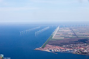
Windpark Noordoostpolder
Onshore and near-shore wind farm in Flevoland, the Netherlands
Distance: Approx. 6422 meters
Latitude and longitude: 52.721,5.583
Windpark Noordoostpolder is an onshore and near-shore wind farm in Flevoland, the Netherlands. Upon completion in 2017, it was the largest wind farm in the Netherlands, and as of 2019 it is still one of the largest.
Weather in this IP's area
overcast clouds
14 Celsius
14 Celsius
13 Celsius
15 Celsius
1017 hPa
89 %
1017 hPa
1017 hPa
10000 meters
9 m/s
15.32 m/s
229 degree
100 %
08:14:25
18:29:35