178.16.126.141 - IP Lookup: Free IP Address Lookup, Postal Code Lookup, IP Location Lookup, IP ASN, Public IP
Country:
Region:
City:
Location:
Time Zone:
Postal Code:
ISP:
ASN:
language:
User-Agent:
Proxy IP:
Blacklist:
IP information under different IP Channel
ip-api
Country
Region
City
ASN
Time Zone
ISP
Blacklist
Proxy
Latitude
Longitude
Postal
Route
db-ip
Country
Region
City
ASN
Time Zone
ISP
Blacklist
Proxy
Latitude
Longitude
Postal
Route
IPinfo
Country
Region
City
ASN
Time Zone
ISP
Blacklist
Proxy
Latitude
Longitude
Postal
Route
IP2Location
178.16.126.141Country
Region
mazowieckie
City
radzymin
Time Zone
Europe/Warsaw
ISP
Language
User-Agent
Latitude
Longitude
Postal
ipdata
Country
Region
City
ASN
Time Zone
ISP
Blacklist
Proxy
Latitude
Longitude
Postal
Route
Popular places and events near this IP address

Radzymin
Place in Masovian Voivodeship, Poland
Distance: Approx. 100 meters
Latitude and longitude: 52.41666667,21.18333333
Radzymin [raˈd͡zɨmʲin] is a town in Poland and is one of the distant suburbs of the city of Warsaw. It is located in the powiat of Wołomin of the Masovian Voivodeship. The town has 8,818 inhabitants (as of 2008, but the surrounding commune is heavily populated and has an additional 11,000 inhabitants).
Gmina Radzymin
Gmina in Masovian Voivodeship, Poland
Distance: Approx. 100 meters
Latitude and longitude: 52.41666667,21.18333333
Gmina Radzymin is an urban-rural gmina (administrative district) in Wołomin County, Masovian Voivodeship, in east-central Poland. Its seat is the town of Radzymin, which lies approximately 9 kilometres (6 mi) north-west of Wołomin and 26 km (16 mi) north-east of Warsaw. The gmina covers an area of 130.93 square kilometres (50.6 sq mi), and as of 2006 its total population is 19,129 (out of which the population of Radzymin amounts to 7,864, and the population of the rural part of the gmina is 11,265).
Cegielnia, Wołomin County
Village in Masovian Voivodeship, Poland
Distance: Approx. 2385 meters
Latitude and longitude: 52.4,21.16055556
Cegielnia [t͡sɛˈɡʲɛlɲa] is a village in the administrative district of Gmina Radzymin, within Wołomin County, Masovian Voivodeship, in east-central Poland. It lies approximately 3 kilometres (2 mi) south-west of Radzymin, 8 km (5 mi) north-west of Wołomin, and 24 km (15 mi) north-east of Warsaw.
Ciemne, Masovian Voivodeship
Village in Masovian Voivodeship, Poland
Distance: Approx. 2469 meters
Latitude and longitude: 52.39388889,21.18861111
Ciemne [ˈt͡ɕɛmnɛ] is a village in the administrative district of Gmina Radzymin, within Wołomin County, Masovian Voivodeship, in east-central Poland. It lies approximately 3 kilometres (2 mi) south of Radzymin, 6 km (4 mi) north-west of Wołomin, and 24 km (15 mi) north-east of Warsaw.
Dybów-Folwark
Village in Masovian Voivodeship, Poland
Distance: Approx. 2449 meters
Latitude and longitude: 52.425,21.21694444
Dybów-Folwark [ˈdɨbuf ˈfɔlvark] is a village in the administrative district of Gmina Radzymin, within Wołomin County, Masovian Voivodeship, in east-central Poland. It lies approximately 3 kilometres (2 mi) east of Radzymin, 9 km (6 mi) north of Wołomin, and 28 km (17 mi) north-east of Warsaw.
Dybów-Górki
Village in Masovian Voivodeship, Poland
Distance: Approx. 2758 meters
Latitude and longitude: 52.43361111,21.2125
Dybów-Górki [ˈdɨbuf ˈɡurki] is a village in the administrative district of Gmina Radzymin, within Wołomin County, Masovian Voivodeship, in east-central Poland. It lies approximately 3 kilometres (2 mi) north-east of Radzymin, 10 km (6 mi) north of Wołomin, and 29 km (18 mi) north-east of Warsaw.
Dybów-Kolonia
Village in Masovian Voivodeship, Poland
Distance: Approx. 2082 meters
Latitude and longitude: 52.40444444,21.20833333
Dybów-Kolonia [ˈdɨbuf kɔˈlɔɲa] is a village in the administrative district of Gmina Radzymin, within Wołomin County, Masovian Voivodeship, in east-central Poland. It lies approximately 3 kilometres (2 mi) south-east of Radzymin, 7 km (4 mi) north of Wołomin, and 26 km (16 mi) north-east of Warsaw.
Stary Dybów
Village in Masovian Voivodeship, Poland
Distance: Approx. 2786 meters
Latitude and longitude: 52.42861111,21.21944444
Stary Dybów [ˈstarɨ ˈdɨbuf] is a village in the administrative district of Gmina Radzymin, within Wołomin County, Masovian Voivodeship, in east-central Poland. It lies approximately 3 kilometres (2 mi) north-east of Radzymin, 9 km (6 mi) north of Wołomin, and 28 km (17 mi) north-east of Warsaw.
Wiktorów, Wołomin County
Village in Masovian Voivodeship, Poland
Distance: Approx. 2953 meters
Latitude and longitude: 52.41416667,21.2275
Wiktorów [vikˈtɔruf] is a village in the administrative district of Gmina Radzymin, within Wołomin County, Masovian Voivodeship, in east-central Poland. It lies approximately 4 kilometres (2 mi) east of Radzymin, 8 km (5 mi) north of Wołomin, and 27 km (17 mi) north-east of Warsaw.

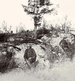
Battle of Radzymin (1920)
Battle during the Polish–Soviet War
Distance: Approx. 1967 meters
Latitude and longitude: 52.40055556,21.16972222
The Battle of Radzymin (Polish: Bitwa pod Radzyminem) took place during the Polish–Soviet War (1919–21). The battle occurred near the town of Radzymin, some 20 kilometres (12 mi) north-east of Warsaw, between August 13 and 16, 1920. Along with the Battle of Ossów and the Polish counteroffensive from the Wieprz River area, this engagement was a key part of what later became known as the Battle of Warsaw.

Battle of Radzymin (1809)
1809 battle during the War of the Fifth Coalition
Distance: Approx. 100 meters
Latitude and longitude: 52.41666667,21.18333333
The Battle of Radzymin took place on 25 April 1809, during the brief Polish–Austrian War. The battle occurred at Radzymin, some 20 kilometres (12 mi) north-east of Warsaw.

Radzymin railway station
Railway station in Radzymin, Poland
Distance: Approx. 1068 meters
Latitude and longitude: 52.42416667,21.17611111
Radzymin railway station is a railway station in Radzymin, Wołomin, Poland. It is served by Koleje Mazowieckie.
Weather in this IP's area
broken clouds
5 Celsius
4 Celsius
5 Celsius
7 Celsius
1016 hPa
84 %
1016 hPa
1005 hPa
10000 meters
1.88 m/s
2.58 m/s
241 degree
51 %
