Country:
Region:
City:
Latitude and Longitude:
Time Zone:
Postal Code:
IP information under different IP Channel
ip-api
Country
Region
City
ASN
Time Zone
ISP
Blacklist
Proxy
Latitude
Longitude
Postal
Route
Luminati
Country
City
douglas
ASN
Time Zone
Europe/Isle_of_Man
ISP
Manx Telecom Trading Ltd
Latitude
Longitude
Postal
IPinfo
Country
Region
City
ASN
Time Zone
ISP
Blacklist
Proxy
Latitude
Longitude
Postal
Route
db-ip
Country
Region
City
ASN
Time Zone
ISP
Blacklist
Proxy
Latitude
Longitude
Postal
Route
ipdata
Country
Region
City
ASN
Time Zone
ISP
Blacklist
Proxy
Latitude
Longitude
Postal
Route
Popular places and events near this IP address
Peel, Isle of Man
Town on the Isle of Man
Distance: Approx. 122 meters
Latitude and longitude: 54.221,-4.691
Peel (Manx: Purt ny h-Inshey 'port of the Island') is a seaside town and small fishing port in the Isle of Man, in the historic parish of German but administered separately. Peel is the third largest town in the Island after Douglas and Ramsey but the fourth largest settlement, as Onchan has the second largest population but is classified as a village. Until 2016 (when it was merged with Glenfaba) Peel was also a House of Keys constituency, electing one Member of the House of Keys (MHK), who, from September 2015, was Ray Harmer.

Peel Castle
Ancient castle on Isle of Man
Distance: Approx. 716 meters
Latitude and longitude: 54.22645,-4.6991
Peel Castle (Cashtal Phurt ny h-Inshey in Manx Gaelic) is a castle in Peel in the Isle of Man, originally constructed by Norwegians. The castle stands on St Patrick's Isle, which is connected to the town by a causeway. It is now owned by Manx National Heritage and is open to visitors during the summer.

Peel Cathedral
Church in Peel, Isle of Man
Distance: Approx. 49 meters
Latitude and longitude: 54.22166667,-4.69111111
The Cathedral Church of Saint German or Peel Cathedral, renamed Cathedral Isle of Man, is located in Peel, Isle of Man. The cathedral is also one of the parish churches in the parish of the West Coast, which includes the town of Peel. Built in 1879–84, it was made the cathedral by Act of Tynwald in 1980.
Peel A.F.C.
Association football club on the Isle of Man
Distance: Approx. 614 meters
Latitude and longitude: 54.217111,-4.68696
Peel Association Football Club is a football club from Peel on the Isle of Man. The team competes in the Isle of Man Football League and the players wear red, white and black kits. The Peel A.F.C. plays its home games at the Peel A.F.C. Football Ground, on Douglas Road in Peel.

River Neb
River on the Isle of Man
Distance: Approx. 472 meters
Latitude and longitude: 54.221,-4.698
The River Neb (Manx: Awin Neb) is one of the principal rivers on the Isle of Man. It rises in the Michael hills, flows SW through Glen Helen (where it is joined by the Blaber River) to St John's, where it is joined by its principal tributary, the Foxdale River, and then flows NW to the Irish Sea at the town of Peel on the western coast. The river gets a fine run of seatrout in the autumn.
Queen Elizabeth II High School
Comprehensive school in Peel, Isle of Man
Distance: Approx. 673 meters
Latitude and longitude: 54.2173,-4.6847
Queen Elizabeth II High School (commonly referred to as simply QE2) is a mixed comprehensive school in Peel, Isle of Man. The school teaches the years 7-11 as well as a sixth form for years 12–13. Queen Elizabeth II High School follows the Manx National Curriculum.

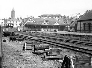
Peel railway station
Former railway station in Isle of Man
Distance: Approx. 418 meters
Latitude and longitude: 54.2219,-4.6974
Peel Railway Station (Manx: Stashoon Raad Yiarn Phurt ny h-Inshey) was a terminus on the Isle of Man Railway; it served the town of Peel in the Isle of Man and was the final stopping place on a line that ran between the city of Douglas and the town. It was part of the Island's first railway line.

Diocese of the Isles
Diocese in Scotland (c. 11 century-1689)
Distance: Approx. 650 meters
Latitude and longitude: 54.2262,-4.6981
The Diocese of the Isles, also known as the Diocese of Suðreyar, or the Diocese of Sodor, was one of the dioceses of medieval Norway. After the mid-13th-century Treaty of Perth, the diocese was accounted as one of the 13 dioceses of Scotland. The original seat of the bishopric appears to have been at Peel, on St Patrick's Isle, where indeed it continued to be under English overlordship; the Bishopric of the Isles as it was after the split was relocated to the north, firstly to Snizort and then Iona.

Peel Marina
Marina in the Isle of Man
Distance: Approx. 498 meters
Latitude and longitude: 54.2225,-4.69861111
Peel Marina is a marina at Peel Harbour in the town of Peel, Isle of Man. It was constructed in 2009 as an expansion of Peel Harbour. Since construction, the site has had continuous issues with silt buildup and toxic materials contamination.
Leece Museum
Local museum in Peel, Isle of Man
Distance: Approx. 468 meters
Latitude and longitude: 54.224,-4.6974
The Leece Museum is a museum in Peel, Isle of Man established in 1984. It is dedicated to the local history of Peel.

House of Manannan
Distance: Approx. 431 meters
Latitude and longitude: 54.2218,-4.6976
The House of Manannan is a museum in Peel in the Isle of Man. It is named after the "great mythological sea god" Manannan and covers the island's Celtic, Viking, and Maritime history.

Peel Lifeboat Station
RNLI lifeboat station on the Isle of Man
Distance: Approx. 703 meters
Latitude and longitude: 54.22694444,-4.69791667
Peel Lifeboat Station is located in the shadow of Peel Castle on St Patrick's Isle, in the town of Peel, in the Isle of Man, a British Crown Dependency. A lifeboat was first stationed here by the Royal National Institute for the Preservation of Life from Shipwreck (RNIPLS) in 1828. Re-established by the Royal National Lifeboat Institution (RNLI) in 1884, the station currently operates an Shannon-class All-weather lifeboat, 13-35 Frank and Brenda Winter (ON 1342), on station since 2021.
Weather in this IP's area
broken clouds
13 Celsius
12 Celsius
13 Celsius
13 Celsius
1027 hPa
82 %
1027 hPa
1024 hPa
10000 meters
6.17 m/s
140 degree
75 %
07:24:33
16:40:02
