Country:
 Germany
Region:
City:
Latitude and Longitude:
Time Zone:
Postal Code:
IP information under different IP Channel
ip-api
Country
Region
City
ASN
Time Zone
ISP
Blacklist
Proxy
Latitude
Longitude
Postal
Route
IPinfo
Country
Region
City
ASN
Time Zone
ISP
Blacklist
Proxy
Latitude
Longitude
Postal
Route
MaxMind
Country
Region
City
ASN
Time Zone
ISP
Blacklist
Proxy
Latitude
Longitude
Postal
Route
Luminati
Country
DERegion
bw
City
schorndorf
ASN
Time Zone
Europe/Berlin
ISP
TeleData GmbH
Latitude
Longitude
Postal
db-ip
Country
Region
City
ASN
Time Zone
ISP
Blacklist
Proxy
Latitude
Longitude
Postal
Route
ipdata
Country
Region
City
ASN
Time Zone
ISP
Blacklist
Proxy
Latitude
Longitude
Postal
Route
Popular places and events near this IP address
Adelberg
Municipality in Baden-Württemberg, Germany
Distance: Approx. 6729 meters
Latitude and longitude: 48.76194444,9.59972222
Adelberg is a municipality in the district of Göppingen in Baden-Württemberg in southern Germany.
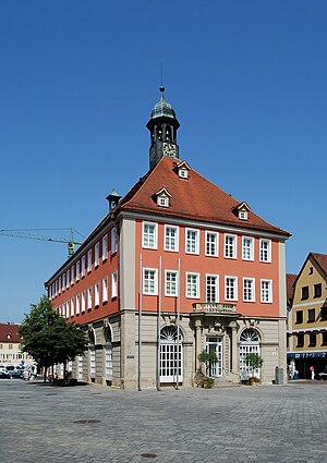
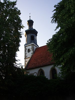
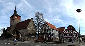
Schorndorf
Town in Baden-Württemberg, Germany
Distance: Approx. 303 meters
Latitude and longitude: 48.8,9.53333333
Schorndorf is a town in Baden-Württemberg, Germany, located approximately 26 km east of Stuttgart. Its train station is the terminus of the S2 line of the Stuttgart S-Bahn. The town is also sometimes referred to as Die Daimlerstadt (The Daimler Town in English), as it is the town in which Gottlieb Daimler (1834–1900) was born.
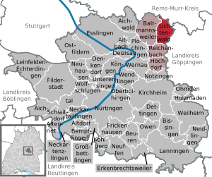
Lichtenwald
Municipality in Baden-Württemberg, Germany
Distance: Approx. 6649 meters
Latitude and longitude: 48.75222222,9.48277778
Lichtenwald is a municipality located in the Schurwald forest in the district of Esslingen in Baden-Württemberg in southern Germany. Situated on the state road L1151 between Reichenbach an der Fils (4 km) and Schorndorf (7 km). It belongs to the Stuttgart Region (until 1992 the Central Neckar Region) and the European metropolitan region of Stuttgart.

Berglen
Municipality in Baden-Württemberg, Germany
Distance: Approx. 7987 meters
Latitude and longitude: 48.86138889,9.46944444
Berglen is a municipality in the district of Rems-Murr in Baden-Württemberg in Germany.

Plüderhausen
Municipality in Baden-Württemberg, Germany
Distance: Approx. 5158 meters
Latitude and longitude: 48.795,9.60111111
Plüderhausen is a municipality east of Schorndorf in the Rems-Murr district in Baden-Württemberg, Germany. It belongs to the Stuttgart Metropolitan Region.
Winterbach, Baden-Württemberg
Municipality in Baden-Württemberg, Germany
Distance: Approx. 3809 meters
Latitude and longitude: 48.79916667,9.48
Winterbach is a municipality in the district of Rems-Murr in Baden-Württemberg in Germany.

Urbach, Baden-Württemberg
Municipality in Baden-Württemberg, Germany
Distance: Approx. 3664 meters
Latitude and longitude: 48.81333333,9.57888889
Urbach is a municipality in the district of Rems-Murr in Baden-Württemberg, Germany. It is east of Stuttgart. It belongs to the metropolitan region of Stuttgart.

Schurwald
Distance: Approx. 4617 meters
Latitude and longitude: 48.76666667,9.5
The Schurwald is a wooded mountain range in Baden-Württemberg, southern Germany, which at its highest point is 513.2 m above sea level. It is one of the most important Recreation areas for the Stuttgart area. Over the centuries, the vast forests of the mountain range supplied the surrounding towns and villages with wood for fuel and building material, and thus acquired the name "Schurwald", which comes from the German word, Schur, which can mean a shearing or clearcutting.
Wieslauf
River in Germany
Distance: Approx. 1202 meters
Latitude and longitude: 48.8133,9.532
Wieslauf is a river of Baden-Württemberg, Germany. It flows into the Rems in Schorndorf.
Urbach (b Schorndorf) station
Railway station in the municipality of Urbach, Baden-Württemberg
Distance: Approx. 3146 meters
Latitude and longitude: 48.805,9.57444444
Urbach (b Schorndorf) station is a railway stop in the municipality of Urbach, located in the Rems-Murr-Kreis district in Baden-Württemberg, Germany. The station lies on the Stuttgart-Bad Cannstatt–Nördlingen railway. The train services are operated by Go-Ahead Baden-Württemberg.
Plüderhausen station
Railway station in the municipality of Plüderhausen
Distance: Approx. 4767 meters
Latitude and longitude: 48.79666667,9.59611111
Plüderhausen station is a railway station in the municipality of Plüderhausen, located in the Rems-Murr-Kreis district in Baden-Württemberg, Germany. The station lies on the Stuttgart-Bad Cannstatt–Nördlingen railway. The train services are operated by Go-Ahead Baden-Württemberg.
Waldhausen (b Schorndorf) station
Railway station in the municipality of Plüderhausen
Distance: Approx. 7939 meters
Latitude and longitude: 48.78916667,9.63805556
Waldhausen (b Schorndorf) station is a railway stop in the municipality of Lorch, located in the Ostalbkreis district in Baden-Württemberg, Germany. The station lies on the Stuttgart-Bad Cannstatt–Nördlingen railway. The train services are operated by Go-Ahead Baden-Württemberg.
Weather in this IP's area
overcast clouds
11 Celsius
10 Celsius
10 Celsius
12 Celsius
1023 hPa
92 %
1023 hPa
991 hPa
10000 meters
1.4 m/s
2.88 m/s
259 degree
100 %
07:00:19
19:33:10