178.156.98.106 - IP Lookup: Free IP Address Lookup, Postal Code Lookup, IP Location Lookup, IP ASN, Public IP
Country:
Region:
City:
Location:
Time Zone:
Postal Code:
IP information under different IP Channel
ip-api
Country
Region
City
ASN
Time Zone
ISP
Blacklist
Proxy
Latitude
Longitude
Postal
Route
Luminati
Country
Region
cm
City
castellardesantiago
ASN
Time Zone
Europe/Madrid
ISP
Aire Networks Del Mediterraneo Sl Unipersonal
Latitude
Longitude
Postal
IPinfo
Country
Region
City
ASN
Time Zone
ISP
Blacklist
Proxy
Latitude
Longitude
Postal
Route
IP2Location
178.156.98.106Country
Region
castilla-la mancha
City
pozuelo de calatrava
Time Zone
Europe/Madrid
ISP
Language
User-Agent
Latitude
Longitude
Postal
db-ip
Country
Region
City
ASN
Time Zone
ISP
Blacklist
Proxy
Latitude
Longitude
Postal
Route
ipdata
Country
Region
City
ASN
Time Zone
ISP
Blacklist
Proxy
Latitude
Longitude
Postal
Route
Popular places and events near this IP address

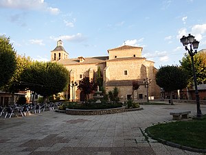
Pozuelo de Calatrava
Distance: Approx. 5 meters
Latitude and longitude: 38.58333333,-3.83333333
Pozuelo de Calatrava is a municipality in Ciudad Real, Castile-La Mancha, Spain. It has a population of 2,602.

Calatrava la Nueva
Castle in Calzada de Calatrava, Spain
Distance: Approx. 9297 meters
Latitude and longitude: 38.6663,-3.8452
Calatrava la Nueva (Sacro convento-castillo de Calatrava la Nueva) is a medieval castle and convent found on the peak of Alacranejo, within the municipality of Aldea del Rey, near Almagro, in the province of Ciudad Real, Spain. Its name is a reference to the Order of Calatrava, which was originally situated in Calatrava la Vieja, 60 km to the north. In 1217, the Order of Calatrava moved to Calatrava la Nueva.

Salvatierra Castle
Distance: Approx. 9626 meters
Latitude and longitude: 38.6693,-3.8218
Salvatierra Castle is a fortification near Calzada de Calatrava in the south of the province of Ciudad Real, Castilla-La Mancha, Spain. It is located on a small hillock at the foot of the volcanic Mount Atalaya, about 5 kilometres (3.1 mi) from Calzada de Calatrava.
Weather in this IP's area
clear sky
5 Celsius
4 Celsius
5 Celsius
5 Celsius
1030 hPa
63 %
1030 hPa
940 hPa
10000 meters
1.82 m/s
2.73 m/s
6 degree
3 %