178.114.93.76 - IP Lookup: Free IP Address Lookup, Postal Code Lookup, IP Location Lookup, IP ASN, Public IP
Country:
Region:
City:
Location:
Time Zone:
Postal Code:
ISP:
ASN:
language:
User-Agent:
Proxy IP:
Blacklist:
IP information under different IP Channel
ip-api
Country
Region
City
ASN
Time Zone
ISP
Blacklist
Proxy
Latitude
Longitude
Postal
Route
db-ip
Country
Region
City
ASN
Time Zone
ISP
Blacklist
Proxy
Latitude
Longitude
Postal
Route
IPinfo
Country
Region
City
ASN
Time Zone
ISP
Blacklist
Proxy
Latitude
Longitude
Postal
Route
IP2Location
178.114.93.76Country
Region
karnten
City
sankt peter
Time Zone
Europe/Vienna
ISP
Language
User-Agent
Latitude
Longitude
Postal
ipdata
Country
Region
City
ASN
Time Zone
ISP
Blacklist
Proxy
Latitude
Longitude
Postal
Route
Popular places and events near this IP address

Klagenfurt Airport
Airport in Austria
Distance: Approx. 1462 meters
Latitude and longitude: 46.64277778,14.33722222
Klagenfurt Airport (German: Flughafen Klagenfurt IATA: KLU, ICAO: LOWK) is a primary international airport near Klagenfurt, the sixth-largest city in Austria. It is located in the borough of Annabichl, 1.5 NM (2.8 km; 1.7 mi) north-north-east of the city centre.

Glanfurt
River in Carinthia, Austria
Distance: Approx. 2469 meters
Latitude and longitude: 46.6105,14.3561
Glanfurt is a river of Carinthia, Austria. Its drainage basin is 230 km2 (89 sq mi). The Glanfurt is also called Sattnitz by the Carinthian people.

Ebenthal in Kärnten
Municipality in Carinthia, Austria
Distance: Approx. 2552 meters
Latitude and longitude: 46.60944444,14.35555556
Ebenthal in Kärnten (Slovene: Žrelec) is a town in the district of Klagenfurt-Land in the Austrian state of Carinthia.

Sportzentrum Fischl
Distance: Approx. 1015 meters
Latitude and longitude: 46.62072222,14.33902778
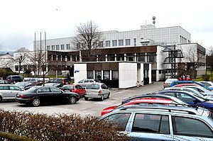
The Sportzentrum Fischl is a soccer stadium in Klagenfurt. It has a capacity of 3,000 people. Currently the Red-Zac team FC Kärnten plays its home games in the stadium.

Roman Catholic Diocese of Gurk
Catholic ecclesiastical territory
Distance: Approx. 2506 meters
Latitude and longitude: 46.6221,14.3094
The Diocese of Gurk-Klagenfurt (German: Diözese Gurk-Klagenfurt, Slovene: Krška škofija) is a Latin Church diocese of the Catholic Church covering the Austrian state of Carinthia. It is part of the ecclesiastical province of Salzburg. Though named after Gurk Cathedral, the bishop's see since 1787 has been in Klagenfurt.

Klagenfurt Hauptbahnhof
Railway station in Carinthia, Austria
Distance: Approx. 2576 meters
Latitude and longitude: 46.61583333,14.31333333
Klagenfurt Hauptbahnhof (German for Klagenfurt Main station; occasionally translated as Klagenfurt Central Station) is the main railway station in Klagenfurt, capital of the Austrian state of Carinthia. It is an important railway junction in southern Austria.

Stadttheater Klagenfurt
Theatre in Klagenfurt, Carinthia, Austria
Distance: Approx. 2689 meters
Latitude and longitude: 46.62694444,14.30527778
Stadttheater Klagenfurt is the municipal theatre in Klagenfurt, the capital of Carinthia in Austria. Its present house was designed by the Viennese architecture office Fellner & Helmer, and completed in 1910.

Klagenfurt Cathedral
Church building in Klagenfurt, Austria
Distance: Approx. 2236 meters
Latitude and longitude: 46.623991,14.312207
Klagenfurt Cathedral (German: Klagenfurter Dom; Dom- und Stadtpfarrkirche Hll. Petrus und Paulus) is the cathedral of the Roman Catholic Diocese of Gurk-Klagenfurt and also the main parish church of Klagenfurt. It was built by Protestants and dedicated to the Holy Trinity in 1581, and was the largest Protestant church in Austria at that time.

HTL1 Lastenstrasse
Technical secondary school in Carinthia, Austria
Distance: Approx. 2128 meters
Latitude and longitude: 46.62,14.3163
HTL 1 Lastenstrasse is a technical secondary school located in Carinthia, Austria. Established in 1861, the school focuses on mechanical engineering, electrical engineering and mechatronics. The school additionally emphasises environmental technology including e-mobility and green energy.
City-Arkaden
Shopping centre in Carinthia, Austria
Distance: Approx. 2365 meters
Latitude and longitude: 46.6275,14.30944444
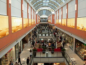
City-Arkaden is a shopping centre in Klagenfurt, Carinthia, Austria. In terms of area, the centre is the second largest shopping centre in Carinthia, after Atrio in Villach, and is located at the northern edge of the centre of Klagenfurt. After a year and half of construction, City-Arkaden was opened on St.

State Museum for Carinthia
Distance: Approx. 2334 meters
Latitude and longitude: 46.62106,14.31245
The kärnten.museum (formerly the Carinthian State Museum or Kärntner Landesmuseum) is a cultural and natural science museum in Klagenfurt am Wörthersee, Carinthia, Austria.

Federal Gymnasium for Slovenes
Public school in Klagenfurt, Carinthia, Austria
Distance: Approx. 1448 meters
Latitude and longitude: 46.62388889,14.32333333
The Federal Gymnasium for Slovenes (Slovene: Zvezna gimnazija za Slovence, German: Bundesgymnasium für Slowenen) in Klagenfurt, the capital of Carinthia in Austria, is a public coeducational high school (gymnasium, similar to preparatory school) serving primarily community of Carinthian Slovenes.
Weather in this IP's area
clear sky
-3 Celsius
-3 Celsius
-3 Celsius
-3 Celsius
1039 hPa
68 %
1039 hPa
944 hPa
10000 meters
1.03 m/s
6 %
