178.114.132.89 - IP Lookup: Free IP Address Lookup, Postal Code Lookup, IP Location Lookup, IP ASN, Public IP
Country:
Region:
City:
Location:
Time Zone:
Postal Code:
IP information under different IP Channel
ip-api
Country
Region
City
ASN
Time Zone
ISP
Blacklist
Proxy
Latitude
Longitude
Postal
Route
Luminati
Country
Region
9
City
vienna
ASN
Time Zone
Europe/Vienna
ISP
Hutchison Drei Austria GmbH
Latitude
Longitude
Postal
IPinfo
Country
Region
City
ASN
Time Zone
ISP
Blacklist
Proxy
Latitude
Longitude
Postal
Route
IP2Location
178.114.132.89Country
Region
niederosterreich
City
ternitz
Time Zone
Europe/Vienna
ISP
Language
User-Agent
Latitude
Longitude
Postal
db-ip
Country
Region
City
ASN
Time Zone
ISP
Blacklist
Proxy
Latitude
Longitude
Postal
Route
ipdata
Country
Region
City
ASN
Time Zone
ISP
Blacklist
Proxy
Latitude
Longitude
Postal
Route
Popular places and events near this IP address
Neunkirchen District, Austria
District in Lower Austria, Austria
Distance: Approx. 3667 meters
Latitude and longitude: 47.7269,16.0817
Bezirk Neunkirchen (German: [ˈnɔʏnˌkɪʁçn̩] ) is a district of the state of Lower Austria in Austria. It is located at the south of the state.

Altendorf, Austria
Municipality in Lower Austria, Austria
Distance: Approx. 7441 meters
Latitude and longitude: 47.65,16.01666667
Altendorf is a town in the district of Neunkirchen in the Austrian state of Lower Austria.

Buchbach, Austria
Municipality in Lower Austria, Austria
Distance: Approx. 5319 meters
Latitude and longitude: 47.68333333,15.98333333
Buchbach is a village in the district of Neunkirchen in the Austrian state of Lower Austria.

Bürg-Vöstenhof
Municipality in Lower Austria, Austria
Distance: Approx. 5172 meters
Latitude and longitude: 47.71666667,15.96666667
Bürg-Vöstenhof is a town in the district of Neunkirchen in the Austrian state of Lower Austria.
Grafenbach-Sankt Valentin
Municipality in Lower Austria, Austria
Distance: Approx. 4478 meters
Latitude and longitude: 47.68333333,16
Grafenbach-Sankt Valentin is a town in the district of Neunkirchen in the Austrian state of Lower Austria.
Natschbach-Loipersbach
Municipality in Lower Austria, Austria
Distance: Approx. 5120 meters
Latitude and longitude: 47.7,16.1
Natschbach-Loipersbach is a town in the district of Neunkirchen in the Austrian state of Lower Austria.
Neunkirchen, Austria
City in Lower Austria, Austria
Distance: Approx. 4077 meters
Latitude and longitude: 47.73333333,16.08333333
Neunkirchen (German: [ˈnɔʏnˌkɪʁçn̩] ) is the capital of the district of Neunkirchen in the Austrian state of Lower Austria. As of 2020 it has a population of 12,721.
Sankt Egyden am Steinfeld
Municipality in Lower Austria, Austria
Distance: Approx. 7449 meters
Latitude and longitude: 47.76666667,16.1
Sankt Egyden am Steinfeld is a town in the district of Neunkirchen in the Austrian state of Lower Austria.
Ternitz
Municipality in Lower Austria, Austria
Distance: Approx. 213 meters
Latitude and longitude: 47.71666667,16.03333333
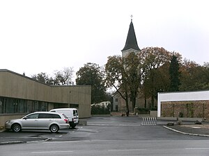
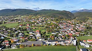
Ternitz is a town and municipality (14,823 inhabitants end 2014) in the district of Neunkirchen in the Austrian state of Lower Austria, situated at the confluence of the Sierning stream and the River Schwarza, at the western end of the Steinfeld plain. It is divided in the following parts, called Katastralgemeinden: Dunkelstein, Flatz, Holzweg, Mahrersdorf, Pottschach, Putzmannsdorf, Raglitz, Rohrbach am Steinfelde, St. Johann am Steinfelde and Sieding.

Wartmannstetten
Municipality in Lower Austria, Austria
Distance: Approx. 4276 meters
Latitude and longitude: 47.68333333,16.06666667
Wartmannstetten is a town in the district of Neunkirchen in the Austrian state of Lower Austria.
Wimpassing im Schwarzatale
Municipality in Lower Austria, Austria
Distance: Approx. 2247 meters
Latitude and longitude: 47.7,16.01666667
Wimpassing im Schwarzatale is a town in the district of Neunkirchen in the Austrian state of Lower Austria. It lies on the main route to Vienna.
Würflach
Municipality in Lower Austria, Austria
Distance: Approx. 7616 meters
Latitude and longitude: 47.78333333,16.05
Würflach is a town in the district of Neunkirchen in the Austrian state of Lower Austria.
Weather in this IP's area
scattered clouds
-1 Celsius
-4 Celsius
-2 Celsius
-1 Celsius
1041 hPa
82 %
1041 hPa
958 hPa
10000 meters
2.07 m/s
2.65 m/s
296 degree
41 %


