Country:
Region:
City:
Latitude and Longitude:
Time Zone:
Postal Code:
IP information under different IP Channel
ip-api
Country
Region
City
ASN
Time Zone
ISP
Blacklist
Proxy
Latitude
Longitude
Postal
Route
Luminati
Country
Region
dc
City
bogota
ASN
Time Zone
America/Bogota
ISP
TV AZTECA SUCURSAL COLOMBIA
Latitude
Longitude
Postal
IPinfo
Country
Region
City
ASN
Time Zone
ISP
Blacklist
Proxy
Latitude
Longitude
Postal
Route
db-ip
Country
Region
City
ASN
Time Zone
ISP
Blacklist
Proxy
Latitude
Longitude
Postal
Route
ipdata
Country
Region
City
ASN
Time Zone
ISP
Blacklist
Proxy
Latitude
Longitude
Postal
Route
Popular places and events near this IP address

Berbeo
Municipality and town in Boyacá Department, Colombia
Distance: Approx. 3965 meters
Latitude and longitude: 5.22666667,-73.12666667
Berbeo is a town and municipality in the Lengupá Province, part of the Colombian department of Boyacá. The urban centre of Berbeo is located at an altitude of 1,350 metres (4,430 ft) in the Eastern Ranges of the Colombian Andes. Berbeo borders San Eduardo in the east, Zetaquirá and Miraflores in the west, Zetaquirá in the north and Miraflores and Páez in the south.

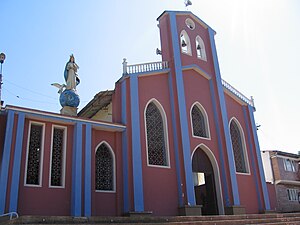
Miraflores, Boyacá
Municipality and town in Boyacá Department, Colombia
Distance: Approx. 71 meters
Latitude and longitude: 5.19638889,-73.14444444
Miraflores is a town and municipality in the Colombian Department of Boyacá, part of the subregion of the Lengupá Province.

San Eduardo, Boyacá
Municipality and town in Boyacá Department, Colombia
Distance: Approx. 8098 meters
Latitude and longitude: 5.2225,-73.07694444
San Eduardo (Spanish pronunciation: [san eðuˈaɾðo]) is a town and municipality in the Colombian Department of Boyacá, part of the subregion of the Lengupá Province.
Lengupá Province
Province in Boyacá, Colombia
Distance: Approx. 71 meters
Latitude and longitude: 5.19638889,-73.14444444
The Lengupá Province is a province of Boyacá Department, Colombia. The province is formed by 6 municipalities.
Weather in this IP's area
overcast clouds
15 Celsius
15 Celsius
15 Celsius
15 Celsius
1014 hPa
96 %
1014 hPa
851 hPa
10000 meters
1.73 m/s
1.37 m/s
340 degree
99 %
05:41:49
17:34:13
