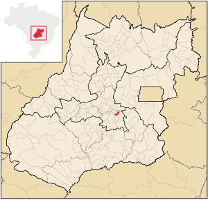
Country:
Region:
City:
Latitude and Longitude:
Time Zone:
Postal Code:
IP information under different IP Channel
ip-api
Country
Region
City
ASN
Time Zone
ISP
Blacklist
Proxy
Latitude
Longitude
Postal
Route
Luminati
Country
Region
go
City
petrolinadegoias
ASN
Time Zone
America/Sao_Paulo
ISP
Une Telecom Ltda
Latitude
Longitude
Postal
IPinfo
Country
Region
City
ASN
Time Zone
ISP
Blacklist
Proxy
Latitude
Longitude
Postal
Route
db-ip
Country
Region
City
ASN
Time Zone
ISP
Blacklist
Proxy
Latitude
Longitude
Postal
Route
ipdata
Country
Region
City
ASN
Time Zone
ISP
Blacklist
Proxy
Latitude
Longitude
Postal
Route
Popular places and events near this IP address

Goianápolis
Municipality in Central-West, Brazil
Distance: Approx. 679 meters
Latitude and longitude: -16.505,-49.02138889
Goianápolis is a municipality in central Goiás state, Brazil. It had a population of 11,224 (IBGE 2020 estimate) in a total area of 162.38 km2 (2007). The town is famous for its tomato production and as the birthplace of Leandro and Leonardo, one of the most famous country and western duos in recent Brazilian music.

Terezópolis de Goiás
Municipality in Central-West, Brazil
Distance: Approx. 8224 meters
Latitude and longitude: -16.48277778,-49.09527778
Terezópolis de Goiás is a municipality in central Goiás state, Brazil.
Weather in this IP's area
light rain
20 Celsius
20 Celsius
20 Celsius
20 Celsius
1010 hPa
93 %
1010 hPa
905 hPa
10000 meters
1.76 m/s
1.79 m/s
345 degree
92 %
05:36:07
18:23:31