177.66.99.131 - IP Lookup: Free IP Address Lookup, Postal Code Lookup, IP Location Lookup, IP ASN, Public IP
Country:
Region:
City:
Location:
Time Zone:
Postal Code:
ISP:
ASN:
language:
User-Agent:
Proxy IP:
Blacklist:
IP information under different IP Channel
ip-api
Country
Region
City
ASN
Time Zone
ISP
Blacklist
Proxy
Latitude
Longitude
Postal
Route
db-ip
Country
Region
City
ASN
Time Zone
ISP
Blacklist
Proxy
Latitude
Longitude
Postal
Route
IPinfo
Country
Region
City
ASN
Time Zone
ISP
Blacklist
Proxy
Latitude
Longitude
Postal
Route
IP2Location
177.66.99.131Country
Region
paraiba
City
inga
Time Zone
America/Fortaleza
ISP
Language
User-Agent
Latitude
Longitude
Postal
ipdata
Country
Region
City
ASN
Time Zone
ISP
Blacklist
Proxy
Latitude
Longitude
Postal
Route
Popular places and events near this IP address
Ingá
District of Niterói, Rio de Janeiro, Brazil
Distance: Approx. 1720 meters
Latitude and longitude: -7.26777778,-35.61277778
Ingá is one of the 48 administrative districts into which the city of Niterói, Rio de Janeiro in Brazil, is divided. It lies in the southern zone of the city, on the coast of the Guanabara Bay. It is named after ingá, a Brazilian native tree whose name is of Tupi origin.

Ingá Stone
Rock formation and archaeological site in Brazil
Distance: Approx. 5367 meters
Latitude and longitude: -7.3253,-35.5857
The Ingá Stone (Pedra do Ingá in Portuguese) is located in the middle of the Ingá River near the small city of Ingá, 96 kilometres (60 mi) from João Pessoa, in Paraíba State in the northeast of Brazil. The Ingá Stone is also called Itacoatiara do Ingá. The word Ita means "stone" in the Tupi language of the natives that lived in that area.

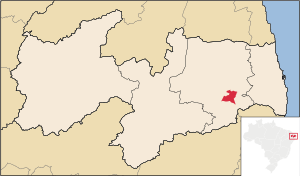
Ingá, Paraíba
Municipality in Northeast, Brazil
Distance: Approx. 1720 meters
Latitude and longitude: -7.26777778,-35.61277778
Ingá is a municipality in the state of Paraíba in the Northeast Region of Brazil. A notable landmark of Ingá is the Ingá Stone, a rock with huge pre-Columbian inscriptions which are still undeciphered.
Riachão do Bacamarte
Municipality in Northeast, Brazil
Distance: Approx. 9366 meters
Latitude and longitude: -7.25,-35.68333333
Riachão do Bacamarte is a municipality in the state of Paraíba in the Northeast Region of Brazil.
Weather in this IP's area
clear sky
24 Celsius
25 Celsius
24 Celsius
24 Celsius
1014 hPa
74 %
1014 hPa
987 hPa
10000 meters
2.86 m/s
6.96 m/s
108 degree
9 %