177.36.14.41 - IP Lookup: Free IP Address Lookup, Postal Code Lookup, IP Location Lookup, IP ASN, Public IP
Country:
Region:
City:
Location:
Time Zone:
Postal Code:
IP information under different IP Channel
ip-api
Country
Region
City
ASN
Time Zone
ISP
Blacklist
Proxy
Latitude
Longitude
Postal
Route
Luminati
Country
Region
pe
City
recife
ASN
Time Zone
America/Recife
ISP
1TELECOM SERVICOS DE TECNOLOGIA EM INTERNET LTDA
Latitude
Longitude
Postal
IPinfo
Country
Region
City
ASN
Time Zone
ISP
Blacklist
Proxy
Latitude
Longitude
Postal
Route
IP2Location
177.36.14.41Country
Region
pernambuco
City
abreu e lima
Time Zone
America/Recife
ISP
Language
User-Agent
Latitude
Longitude
Postal
db-ip
Country
Region
City
ASN
Time Zone
ISP
Blacklist
Proxy
Latitude
Longitude
Postal
Route
ipdata
Country
Region
City
ASN
Time Zone
ISP
Blacklist
Proxy
Latitude
Longitude
Postal
Route
Popular places and events near this IP address

Paulista
Municipality in Northeast, Brazil
Distance: Approx. 4634 meters
Latitude and longitude: -7.94083333,-34.87277778
Paulista is a municipality in Pernambuco, Brazil, with a population of 334,376 as of 2020. It has the highest Human Development Index (HDI) of the Recife metropolitan area. It is the birthplace of footballer Rivaldo and is also famous for its beaches, including Maria Farinha with the giant Veneza water park.

Igarassu, Pernambuco
Municipality in Northeastern Brazil
Distance: Approx. 8640 meters
Latitude and longitude: -7.83416667,-34.90638889
Igarassu (or IgaraçuA) is a city in the Brazilian state of Pernambuco. It is the second oldest city of the country and is situated on the north coast of the metropolitan region of Recife, approximately 32 kilometres (20 mi). It stands as one of the earliest European settlements in Brazil and is the site of the oldest church in the country, the Church of Saints Cosme and Damião, built in 1535.

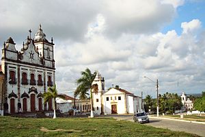
Abreu e Lima, Pernambuco
Municipality in Northeast, Brazil
Distance: Approx. 4 meters
Latitude and longitude: -7.91166667,-34.90277778
Abreu e Lima is a Brazilian municipality in the state of Pernambuco. It is located in the Metropolitan Region of Recife, also known as Greater Recife. Abreu e Lima covers 126.193 km2 (48.723 sq mi), and has a population of 100,346 with a population density of 780 inhabitants per square kilometer.
Maria Farinha Formation
Geological formation in northeastern Brazil
Distance: Approx. 1339 meters
Latitude and longitude: -7.9,-34.9
The Maria Farinha Formation is a geological formation of the Parnaíba Basin in Pernambuco, northeastern Brazil whose strata date back to the Danian stage of the Paleocene, or Tiupampan in the SALMA classification. The formation comprising limestones, dolomites, marly and sandy limestones has been deposited in a shallow marine platform environment. The formation has provided fossils of reptiles and fish.
Weather in this IP's area
broken clouds
28 Celsius
30 Celsius
28 Celsius
28 Celsius
1013 hPa
73 %
1013 hPa
1008 hPa
10000 meters
4.56 m/s
5.69 m/s
78 degree
57 %