Country:
Region:
City:
Latitude and Longitude:
Time Zone:
Postal Code:
IP information under different IP Channel
ip-api
Country
Region
City
ASN
Time Zone
ISP
Blacklist
Proxy
Latitude
Longitude
Postal
Route
Luminati
Country
ASN
Time Zone
America/Mexico_City
Latitude
Longitude
Postal
IPinfo
Country
Region
City
ASN
Time Zone
ISP
Blacklist
Proxy
Latitude
Longitude
Postal
Route
db-ip
Country
Region
City
ASN
Time Zone
ISP
Blacklist
Proxy
Latitude
Longitude
Postal
Route
ipdata
Country
Region
City
ASN
Time Zone
ISP
Blacklist
Proxy
Latitude
Longitude
Postal
Route
Popular places and events near this IP address

Álvaro Obregón, Mexico City
Borough in Mexico City, Mexico
Distance: Approx. 2770 meters
Latitude and longitude: 19.35638889,-99.23611111
Álvaro Obregón (Spanish pronunciation: [ˈalβaɾo oβɾeˈɣon]) is a borough (demarcación territorial) in Mexico City. It contains a large portion of the south-west part of Mexico City. It had a 2020 census population of 759,137 inhabitants and lies at an elevation of 2,319 m.

Universidad Iberoamericana
Jesuit college in Mexico
Distance: Approx. 1821 meters
Latitude and longitude: 19.36972222,-99.26388889
The Ibero-American University (Spanish: Universidad Iberoamericana), also referred to by its acronym UIA but commonly known as Ibero or La Ibero, is a private, Catholic, Mexican higher education institution, sponsored by the Mexican province of the Society of Jesus (Jesuit). In 2009, the UIA received the SEP-ANUIES Prize as the best private university in Mexico. The Ibero's flagship campus is located in the Santa Fe district of Mexico City.

Arcos Bosques
Office and shopping complex in Bosques de las Lomas, Mexico City, Mexico
Distance: Approx. 1025 meters
Latitude and longitude: 19.3860963,-99.2538414
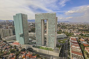
Arcos Bosques is an office and shopping complex in Bosques de las Lomas, Cuajimalpa borough, Mexico City, Mexico, very close to the Santa Fe business district. There are two office towers, Torre I and Torre II, and a shopping center, Paseo Arcos Bosques.
Torre Altus
Residential condominiums in Mexico
Distance: Approx. 1949 meters
Latitude and longitude: 19.38020278,-99.267425
Torre Altus is one of the tallest skyscrapers in Mexico City, Mexico. It is a residential condominium tower located on Paseo de los Laureles y Alcanfores in the Bosques de las Lomas district of the Miguel Hidalgo borough in the city. Bosques de las Lomas is one of the more exclusive residential and commercial districts in Latin America.

Jilotzingo
Municipality in Mexico, Mexico
Distance: Approx. 2941 meters
Latitude and longitude: 19.4,-99.23333333
Jilotzingo is one of 125 municipalities in the State of Mexico in Mexico. The municipal seat is the town of Santa Ana Jilotzingo, which is the 4th largest town in the municipality. The municipality covers an area of 143.66 km².
Universidad Iberoamericana Puebla
Distance: Approx. 1715 meters
Latitude and longitude: 19.37111111,-99.26355556
The Ibero-American University Puebla (in Spanish: Universidad Iberoamericana Puebla, abbreviated UIA but commonly known as Ibero) is a Mexican private institution of higher education sponsored by the Society of Jesus. A spin-off from the main campus located in Mexico City, the Puebla campus was built in response to interest in a Jesuit institution in Puebla State. The university has grown to become an important university for the students in the Southern region of Mexico.

Bosques de las Lomas
Neighborhood of Mexico City
Distance: Approx. 2440 meters
Latitude and longitude: 19.4,-99.25
Bosques de las Lomas is a colonia, or officially recognised neighbourhood, located in western Mexico City. It falls partly in Cuajimalpa borough and partly in Miguel Hidalgo borough. It was the masterpiece of Carleton F. Boyle, who previously was the CEO of Lock Joint Company.
Colegio Hebreo Monte Sinaí
Jewish private school in Cuajimalpa, Mexico City
Distance: Approx. 2760 meters
Latitude and longitude: 19.3837,-99.2746
Colegio Hebreo Monte Sinaí A.C. (CHMS; Hebrew: בית הספר העברי הר סיני) is a Jewish private school in Colonia Vista Hermosa, Cuajimalpa, Mexico City. It serves preschool through senior high school.
Colegio del Bosque México
Catholic private school in Mexico City
Distance: Approx. 1549 meters
Latitude and longitude: 19.3894,-99.2576
Colegio del Bosque México is a private school in Bosques de las Lomas, Cuajimalpa, Mexico City, affiliated with the Legion of Christ. It enrolls girls from preschool to the 12th grade. Boys and girls are educated in separate classes.

Cielito Querido Café
Mexican coffee shop chain
Distance: Approx. 531 meters
Latitude and longitude: 19.37763611,-99.25402778
Cielito Querido Café is a Mexican coffee shop chain inspired by Latin American history that sells typical Mexican beverages and foods. Brenda Montero is the current CEO of the company. The brand vends typical Mexican products including chamoyadas, hot horchata, café de olla, ponche, and sweet bread.
Patio Santa Fe
Distance: Approx. 580 meters
Latitude and longitude: 19.37722222,-99.25444444
Patio Santa Fe, original name Gran Patio Santa Fe, is a 2,100,000-square-foot (200,000 m2) vertical power center in Santa Fe, Mexico City. It is nine stories tall anchored by Walmart, Sam's Club, The Home Depot, Office Depot, Petco, a Sportium gym, Cinépolis 16-screen multicinema, and a 7,000-square-metre (75,000 sq ft) glass-covered rooftop park. It has approximately 130 retail shops, 25 restaurants including Red Lobster, Toks, and IHOP, and 2,800 parking spaces.

Santa Fe railway station (Mexico City)
Commuter rail station in Mexico City
Distance: Approx. 2523 meters
Latitude and longitude: 19.364475,-99.2682
The Santa Fe railway station is a commuter railway station serving the El Insurgente commuter rail system which will connect Greater Toluca, State of Mexico, with Mexico City. The station is located next to the shopping mall Centro Santa Fe, in Santa Fe, Cuajimalpa, Mexico City. Santa Fe station was inaugurated on 31 August 2024 and it opened incomplete the next day, serving as a provisional terminal station with westward service towards Zinacantepec railway station.
Weather in this IP's area
clear sky
21 Celsius
20 Celsius
20 Celsius
21 Celsius
1013 hPa
22 %
1013 hPa
763 hPa
10000 meters
3.6 m/s
60 degree
06:43:39
17:58:58
