177.223.231.161 - IP Lookup: Free IP Address Lookup, Postal Code Lookup, IP Location Lookup, IP ASN, Public IP
Country:
Region:
City:
Location:
Time Zone:
Postal Code:
ISP:
ASN:
language:
User-Agent:
Proxy IP:
Blacklist:
IP information under different IP Channel
ip-api
Country
Region
City
ASN
Time Zone
ISP
Blacklist
Proxy
Latitude
Longitude
Postal
Route
db-ip
Country
Region
City
ASN
Time Zone
ISP
Blacklist
Proxy
Latitude
Longitude
Postal
Route
IPinfo
Country
Region
City
ASN
Time Zone
ISP
Blacklist
Proxy
Latitude
Longitude
Postal
Route
IP2Location
177.223.231.161Country
Region
minas gerais
City
santana do manhuacu
Time Zone
America/Sao_Paulo
ISP
Language
User-Agent
Latitude
Longitude
Postal
ipdata
Country
Region
City
ASN
Time Zone
ISP
Blacklist
Proxy
Latitude
Longitude
Postal
Route
Popular places and events near this IP address

Natividade, Rio de Janeiro
Municipality in Rio de Janeiro, Brazil
Distance: Approx. 8826 meters
Latitude and longitude: -20.04194444,-41.97277778
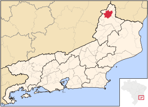
Natividade (Portuguese pronunciation: [nɐtʃiviˈdadʒi], Nativity) is a municipality located in the Brazilian state of Rio de Janeiro. Its population was 15,311 (2020) and its area is 387 km².

Simonésia
Municipality of Minas Gerais, Brazil
Distance: Approx. 8103 meters
Latitude and longitude: -20.12388889,-42.00083333
Simonésia is a Brazilian municipality located in the state of Minas Gerais. Its discovery is generally credited to the explorers Luciano Galo Nunes and Manuel Antônio Meira. The name of the city is derived from Simon the Zealot, the saint of the city.

Santana do Manhuaçu
Brazilian municipality located in the state of Minas Gerais
Distance: Approx. 44 meters
Latitude and longitude: -20.10777778,-41.925
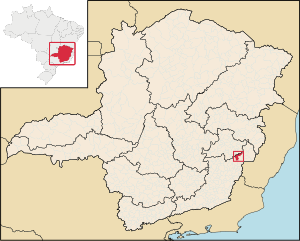
Santana do Manhuaçu is a Brazilian municipality located in the state of Minas Gerais. The city belongs to the mesoregion of Zona da Mata and to the microregion of Manhuaçu. As of 2020, the estimated population was 8,667.
Sossego Forest Biological Station
Distance: Approx. 7503 meters
Latitude and longitude: -20.123611,-41.995
The Sossego Forest Biological Station (Portuguese: Reserva Particular do Patrimônio Natural Estação Biológica da Mata do Sossego) is a private natural heritage reserve in the state of Minas Gerais, Brazil. It holds a population of the critically endangered northern muriqui, a primate.
Weather in this IP's area
moderate rain
21 Celsius
22 Celsius
21 Celsius
21 Celsius
1014 hPa
97 %
1014 hPa
927 hPa
10000 meters
0.47 m/s
0.3 m/s
110 degree
100 %