177.221.35.132 - IP Lookup: Free IP Address Lookup, Postal Code Lookup, IP Location Lookup, IP ASN, Public IP
Country:
Region:
City:
Location:
Time Zone:
Postal Code:
IP information under different IP Channel
ip-api
Country
Region
City
ASN
Time Zone
ISP
Blacklist
Proxy
Latitude
Longitude
Postal
Route
Luminati
Country
Region
pe
City
recife
ASN
Time Zone
America/Recife
ISP
1TELECOM SERVICOS DE TECNOLOGIA EM INTERNET LTDA
Latitude
Longitude
Postal
IPinfo
Country
Region
City
ASN
Time Zone
ISP
Blacklist
Proxy
Latitude
Longitude
Postal
Route
IP2Location
177.221.35.132Country
Region
pernambuco
City
olinda
Time Zone
America/Recife
ISP
Language
User-Agent
Latitude
Longitude
Postal
db-ip
Country
Region
City
ASN
Time Zone
ISP
Blacklist
Proxy
Latitude
Longitude
Postal
Route
ipdata
Country
Region
City
ASN
Time Zone
ISP
Blacklist
Proxy
Latitude
Longitude
Postal
Route
Popular places and events near this IP address

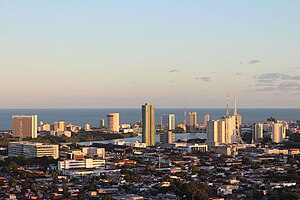
Olinda
Municipality in Pernambuco, Brazil
Distance: Approx. 3245 meters
Latitude and longitude: -8,-34.88333333
Olinda (Portuguese pronunciation: [ɔˈlĩdɐ]) is a historic city in Pernambuco, Brazil, in the Northeast Region. It is located on the country's northeastern Atlantic Ocean coast, in the Metropolitan Region of Recife, the state capital. It has a population of 349.976 people, covers 41.681 square kilometres (16.093 sq mi), and has a population density of 9,437 inhabitants per square kilometre (24,440/sq mi).
Estádio do Arruda
Distance: Approx. 4424 meters
Latitude and longitude: -8.02671111,-34.891175
Estádio José do Rego Maciel, also known as Estádio do Arruda, is a multi-purpose stadium in Recife, Brazil. It is currently used mostly for football matches. The stadium was built in 1972 and is able to hold 60,044 spectators.

University of Pernambuco
Public state university located in Recife, Pernambuco, Brazil
Distance: Approx. 5183 meters
Latitude and longitude: -8.04406,-34.88612
The University of Pernambuco (Portuguese: Universidade de Pernambuco, UPE; formerly Fundação de Ensino Superior de Pernambuco, FESP) is a public state university located in Recife, Pernambuco, Brazil. Every year almost 4,000 seats of UPE are offered in Brazilian's universities entry exam, the National High School Exam (ENEM). The competition rate is over 12 applicants for each seat, in general.

Boa Viagem, Recife
Neighborhood in Pernambuco, Northeast, Brazil
Distance: Approx. 5743 meters
Latitude and longitude: -8.05389,-34.8808
Boa Viagem is a neighborhood in Recife, Pernambuco in the wealthy southern zone of the municipality. The neighborhood has one of the most visited beaches in Northeastern Brazil, Boa Viagem beach. The neighborhood has a population as of 2010 of 122,922 inhabitants, and an area of 753 hectares (2.91 sq mi).

Roman Catholic Archdiocese of Olinda e Recife
Catholic ecclesiastical territory
Distance: Approx. 881 meters
Latitude and longitude: -8.0139,-34.8491
The Metropolitan Archdiocese of Olinda and Recife (Latin: Archidioecesis Metropolitae Olindensis et Recifensis) is a Latin metropolitan archdiocese in northeast Brazil's Pernambuco state.

Beberibe River
River in Pernambuco, Brazil
Distance: Approx. 3685 meters
Latitude and longitude: -8.03972222,-34.8675
The Beberibe River is a river located in Pernambuco, Brazil. The river rises in the city of Camaragibe from the confluence of the rivers Araçá and Pacas, and is 23.7 km long. Its drainage basin measures 81 square kilometers and includes the following cities: Recife (65%), Olinda (21%) and Camaragibe (14%).
Mirabilandia (Olinda, Brazil)
Amusement park in Olinda, Brazil
Distance: Approx. 3375 meters
Latitude and longitude: -8.032921,-34.87398
Mirabilandia is the only fixed amusement park in Northeastern Brazil. It is located between Recife and Olinda, and it occupies 57,000 m2 of land. Mirabilandia operates three traveling parks in Brazil, called Universal Park, Fiesta Park and American Park.

Cemitério dos Ingleses, Recife
Protestant cemetery in Brazil
Distance: Approx. 4858 meters
Latitude and longitude: -8.04722222,-34.87638889
The Cemitério dos Ingleses is a cemetery in Recife, the capital of Pernambuco in Brazil. It was built in 1814, and at the time was named British Cemetery.

Santo Amaro, Recife
Place in Northeast, Brazil
Distance: Approx. 4887 meters
Latitude and longitude: -8.046227,-34.8786306
Santo Amaro is a neighborhood of Recife in the state of Pernambuco in Brazil, was founded in 1681 and incorporated in 1814. In 1814, the Cemitério dos Ingleses was built in the neighborhood, the first of the city, on a land donated by the Provincial Government to the English Consul in March 1869.

Limoeiro Bridge
Bridge in Recife, Pernambuco, Brazil
Distance: Approx. 5040 meters
Latitude and longitude: -8.0506,-34.8731
Ponte do Limoeiro (Limoeiro Bridge) is a bridge in the city of Recife, Pernambuco, Brazil. It connects Avenida Norte Miguel de Alencar to the Apolo pier, in the Recife neighborhood. Dating back to 1881, it was built from iron for the passage of trains destined for the city of Limoeiro.
TV Jornal
Television station in Recife, Pernambuco
Distance: Approx. 5528 meters
Latitude and longitude: -8.05297222,-34.87841667
TV Jornal (channel 2) is a television station licensed to Recife, capital of the state of Pernambuco, Brazil and is affiliated with SBT. It is part of the Sistema Jornal do Commercio de Comunicação, a subsidiary of the JCPM Group, owned by businessman João Carlos Paes Mendonça. Founded on June 18, 1960, it is the oldest TV station still in operation in the Northeast Region of Brazil.
TV Universitária (Recife)
Television station in Pernambuco, Brazil
Distance: Approx. 5003 meters
Latitude and longitude: -8.04941667,-34.87494444
TV Universitária is a Brazilian television station based in Recife, capital of the state of Pernambuco. It operates on channel 11 (UHF digital 40) and is affiliated to TV Brasil. It belongs to the University Radio and TV Center of the Federal University of Pernambuco, which also includes radio stations Paulo Freire and Universitária FM. It was opened in 1968, being the first educational TV station created in the country.
Weather in this IP's area
scattered clouds
28 Celsius
31 Celsius
28 Celsius
28 Celsius
1014 hPa
74 %
1014 hPa
1012 hPa
10000 meters
5.66 m/s
140 degree
40 %
