177.22.94.251 - IP Lookup: Free IP Address Lookup, Postal Code Lookup, IP Location Lookup, IP ASN, Public IP
Country:
Region:
City:
Location:
Time Zone:
Postal Code:
ISP:
ASN:
language:
User-Agent:
Proxy IP:
Blacklist:
IP information under different IP Channel
ip-api
Country
Region
City
ASN
Time Zone
ISP
Blacklist
Proxy
Latitude
Longitude
Postal
Route
db-ip
Country
Region
City
ASN
Time Zone
ISP
Blacklist
Proxy
Latitude
Longitude
Postal
Route
IPinfo
Country
Region
City
ASN
Time Zone
ISP
Blacklist
Proxy
Latitude
Longitude
Postal
Route
IP2Location
177.22.94.251Country
Region
rio grande do sul
City
tapera
Time Zone
America/Sao_Paulo
ISP
Language
User-Agent
Latitude
Longitude
Postal
ipdata
Country
Region
City
ASN
Time Zone
ISP
Blacklist
Proxy
Latitude
Longitude
Postal
Route
Popular places and events near this IP address

Federal University of Santa Catarina
University in Florianópolis, Brazil
Distance: Approx. 9864 meters
Latitude and longitude: -27.60111111,-48.52
The Federal University of Santa Catarina (Portuguese: Universidade Federal de Santa Catarina, UFSC) is a public university in Florianópolis, the capital city of Santa Catarina in southern Brazil. Considered one of the leading universities in Brazil, UFSC is the 6th best university in Latin America in the ranking of Times Higher Education; the 23rd by QS World University Rankings, and was ranked as the 10th best institution of higher education in Latin America by the Webometrics Ranking of World Universities. In the annual ranking of the Brazilian newspaper Folha de São Paulo, it is the 6th best Brazilian university, with courses being among the ten best in the country.

Avaí FC
Football club
Distance: Approx. 2830 meters
Latitude and longitude: -27.66666667,-48.53166667
Avaí Futebol Clube (Portuguese pronunciation: [avaˈi]) is a Brazilian football team from Florianópolis in Santa Catarina, founded on 1 September 1923. Their home stadium is Estádio Aderbal Ramos da Silva, also known as Ressacada, with a capacity of 17,800. They play in blue and white shirts, shorts and socks.

Estádio da Ressacada
Distance: Approx. 2853 meters
Latitude and longitude: -27.66638889,-48.53166667
Estádio Aderbal Ramos da Silva, usually called Estádio da Ressacada or just Ressacada, is a football stadium inaugurated on November 15, 1983 in Carianos neighborhood, Florianópolis, Santa Catarina, with a maximum capacity of approximately 19,000 people. The stadium is owned by Avaí. Its formal name honors Aderbal Ramos da Silva (1911–1985), who was president of the Santa Catarina Football Federation and was also governor of the state.

Hercílio Luz International Airport
International airport serving Florianópolis, Brazil
Distance: Approx. 1677 meters
Latitude and longitude: -27.67027778,-48.5525
Florianópolis–Hercílio Luz International Airport (IATA: FLN, ICAO: SBFL), branded Floripa Airport, is the airport serving Florianópolis, Brazil. It is named after Hercílio Pedro da Luz (1860–1924), three times governor of the state of Santa Catarina and senator. It is operated by Zurich Airport Brasil.
Estádio Adolfo Konder
Distance: Approx. 2850 meters
Latitude and longitude: -27.6664,-48.5317
The Estádio Adolfo Konder (Adolfo Konder Stadium), also known as Campo da Liga, was a soccer stadium located in Florianópolis, Santa Catarina state, Brazil, with a maximum capacity of approximately 14,000 people. The stadium was owned by Avaí Futebol Clube.

Campeche, Florianópolis
Beach in Santa Catarina, Brazil
Distance: Approx. 5874 meters
Latitude and longitude: -27.68305556,-48.49166667
Campeche is a beach located on the south of the city of Florianópolis, on the south of Brazil. There used to be a proper airport which was inaugurated in 1927 by the French Compagnie générale aéropostale. Aéropostale's planes used to land on it.
Tavares River
River in Brazil
Distance: Approx. 5511 meters
Latitude and longitude: -27.655,-48.507
The Tavares River or Rio Tavares is a river of Florianópolis, capital of Santa Catarina state in southeastern Brazil. Rio Tavares is also the name of a neighborhood in the city which is cut by the river.

Cubatão River (south Santa Catarina)
River in Brazil
Distance: Approx. 8573 meters
Latitude and longitude: -27.698296,-48.636924
The Cubatão River is a river of Santa Catarina state in southeastern Brazil. The sources of the river are in the 84,130 hectares (207,900 acres) Serra do Tabuleiro State Park, a mountainous region to the south west of Florianópolis covered in lush rain forest. The river supplies water to the greater Florianópolis region.
Florianópolis Air Force Base
Air base of the Brazilian Air Force
Distance: Approx. 1677 meters
Latitude and longitude: -27.67027778,-48.5525
Florianópolis Air Force Base – BAFL (IATA: FLN, ICAO: SBFL) is a base of the Brazilian Air Force, located in Florianópolis, Brazil. It shares some facilities with Hercílio Luz International Airport.

Legislative Assembly of Santa Catarina
Legislative assembly of the state of Santa Catarina, Brazil
Distance: Approx. 9162 meters
Latitude and longitude: -27.60305556,-48.54777778
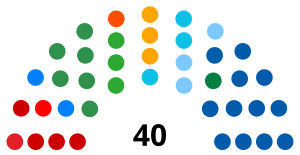
The Legislative Assembly of Santa Catarina (Portuguese: Assembleia Legislativa de Santa Catarina) is the unicameral legislature of Santa Catarina state in Brazil. It has 40 state deputies elected by proportional representation. The Assembly was created on August 12, 1834, the first legislature had 20 deputies, until 1881 when it was increased to 22.
Campeche Island
Island off the coast of Florianópolis, Brazil
Distance: Approx. 8433 meters
Latitude and longitude: -27.69527778,-48.46638889
Campeche Island (Portuguese: Ilha do Campeche) is an island located some 1250 m southeast of the coast of Florianópolis, Brazil. It is located in front of the homonymous beach. It is considered a site of archaeological interest due to paintings found throughout the island.

Pirajubaé Marine Extractive Reserve
Distance: Approx. 4397 meters
Latitude and longitude: -27.65136,-48.52839
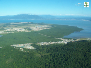
Pirajubaé Marine Extractive Reserve (Portuguese: Reserva Extrativista Marinha do Pirajubaé) is an extractive reserve in the state of Santa Catarina, Brazil, created in 1993. The purpose was to support sustainable harvesting of shellfish from a shoal in the south bay of the Santa Caterina Island. In recent years, due to various natural and human causes including dredging and over-fishing, the catch has declined steeply.
Weather in this IP's area
clear sky
27 Celsius
28 Celsius
26 Celsius
27 Celsius
1016 hPa
58 %
1016 hPa
1010 hPa
10000 meters
0.22 m/s
0.52 m/s
77 degree
1 %

