Country:
Region:
City:
Latitude and Longitude:
Time Zone:
Postal Code:
IP information under different IP Channel
ip-api
Country
Region
City
ASN
Time Zone
ISP
Blacklist
Proxy
Latitude
Longitude
Postal
Route
Luminati
Country
Region
rs
City
alvorada
ASN
Time Zone
America/Sao_Paulo
ISP
V tal
Latitude
Longitude
Postal
IPinfo
Country
Region
City
ASN
Time Zone
ISP
Blacklist
Proxy
Latitude
Longitude
Postal
Route
db-ip
Country
Region
City
ASN
Time Zone
ISP
Blacklist
Proxy
Latitude
Longitude
Postal
Route
ipdata
Country
Region
City
ASN
Time Zone
ISP
Blacklist
Proxy
Latitude
Longitude
Postal
Route
Popular places and events near this IP address

Gravataí
Municipality in South, Brazil
Distance: Approx. 7732 meters
Latitude and longitude: -29.93333333,-50.98333333
Gravataí (Tupi–Guarani: gravatá, a kind of flower common in the region; y, river.) is a Brazilian municipality near Porto Alegre at the Rio Grande do Sul State. Its population is approximately 280,000 people, making it the sixth most populous city in the state.

Alvorada
Place in South, Brazil
Distance: Approx. 4551 meters
Latitude and longitude: -29.98972222,-51.08333333
Alvorada (Portuguese: [aw.voˈɾa.dɐ] , lit. 'dawn') is a municipality in the state of Rio Grande do Sul, in the south of Brazil, adjacent to the capital of the state, Porto Alegre. The city is also known as "The Capital of Solidarity." Alvorada is primarily a bedroom community with most workers commuting to adjacent cities such as Porto Alegre to work. Its name means "the awakening" or "the sunrise".

Autódromo Internacional de Tarumã
Distance: Approx. 7230 meters
Latitude and longitude: -30.04861111,-51.01916667
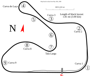
Autódromo Internacional de Tarumã is a motorsports circuit located in Viamão, Rio Grande do Sul, Brazil. It hosts national championships such as Stock Car Pro Series and Copa Truck. Previously it hosted the Brazilian Formula Renault, Formula 3 Sudamericana and Brazilian Formula Three Championship.
Mário Quintana, Rio Grande do Sul
Neighbourhood in Porto Alegre, Brazil
Distance: Approx. 8476 meters
Latitude and longitude: -30.03333333,-51.10472222
Mário Quintana is a neighbourhood (bairro) in the city of Porto Alegre, the state capital of Rio Grande do Sul, in Brazil. Created by Law 8258 from December 22, 1998, it was named in honour of poet Mário Quintana, who had died four years before. The occupation of Mario Quintana dates from 1896, but there were few dwellers until the 1960s, when the City Hall started to transfer masses of poor people from shantytowns in Porto Alegre to this neighbourhood.
Rubem Berta, Porto Alegre
Neighbourhood in Porto Alegre, Brazil
Distance: Approx. 6494 meters
Latitude and longitude: -30.01194444,-51.09638889
Rubem Berta is a neighbourhood (bairro) in the city of Porto Alegre, the state capital of Rio Grande do Sul, in Brazil. It was created by Law 3159 from July 9, 1968. The neighbourhood was named after Ruben Berta, considered the first Varig employee and one of its former presidents.
Weather in this IP's area
light rain
23 Celsius
23 Celsius
21 Celsius
23 Celsius
1016 hPa
75 %
1016 hPa
1014 hPa
10000 meters
6.69 m/s
110 degree
75 %
05:18:14
19:01:22