Country:
Region:
City:
Latitude and Longitude:
Time Zone:
Postal Code:
IP information under different IP Channel
ip-api
Country
Region
City
ASN
Time Zone
ISP
Blacklist
Proxy
Latitude
Longitude
Postal
Route
Luminati
Country
ASN
Time Zone
America/Sao_Paulo
ISP
HOJE SISTEMAS DE INFORMATICA LTDA
Latitude
Longitude
Postal
IPinfo
Country
Region
City
ASN
Time Zone
ISP
Blacklist
Proxy
Latitude
Longitude
Postal
Route
db-ip
Country
Region
City
ASN
Time Zone
ISP
Blacklist
Proxy
Latitude
Longitude
Postal
Route
ipdata
Country
Region
City
ASN
Time Zone
ISP
Blacklist
Proxy
Latitude
Longitude
Postal
Route
Popular places and events near this IP address
Tucuruvi
District of São Paulo, Brazil
Distance: Approx. 4531 meters
Latitude and longitude: -23.48111112,-46.4313889
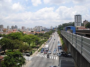
Tucuruvi is a district located in the North Zone of the municipality of São Paulo, Brazil.
Corinthians-Itaquera (São Paulo Metro)
São Paulo Metro station
Distance: Approx. 4129 meters
Latitude and longitude: -23.5423747,-46.4710683
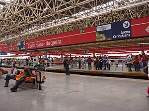
Corinthians-Itaquera, or just Itaquera, is a station which is part of the metropolitan train system of CPTM and São Paulo Metro. Corinthians-Itaquera station has this name for being located in the district of Itaquera, in São Paulo, close to Arena Corinthians. There is, also, connection with Poupatempo in Itaquera and Shopping Metrô Itaquera in its surroundings.
Subprefecture of Guaianases
Subprefecture in Southeast, Brazil
Distance: Approx. 3840 meters
Latitude and longitude: -23.55,-46.41666667
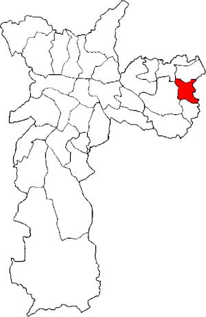
The Subprefecture of Guaianases is one of 32 subprefectures of the city of São Paulo, Brazil. It comprises two districts: Guaianases and Lajeado.
Subprefecture of Itaquera
Subprefecture in Southeast, Brazil
Distance: Approx. 1847 meters
Latitude and longitude: -23.53333333,-46.45027778
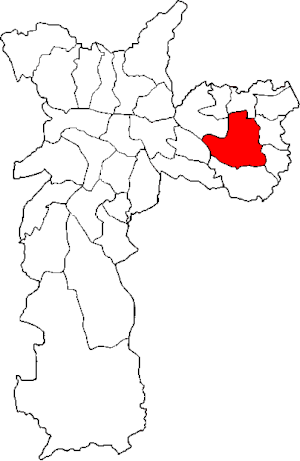
The Subprefecture of Itaquera is one of 32 subprefectures of the city of São Paulo, Brazil. It comprises four districts: Itaquera, Parque do Carmo, José Bonifácio, and Cidade Líder. The name in Tupi means "hard stone" or "insensitive stone".
Subprefecture of São Miguel Paulista
Subprefecture in Southeast, Brazil
Distance: Approx. 4375 meters
Latitude and longitude: -23.48222222,-46.44111111
The Subprefecture of São Miguel Paulista is one of 32 subprefectures of the city of São Paulo, Brazil. It comprises three districts: São Miguel Paulista, Jardim Helena, and Vila Jacuí.

Vila Jacuí
District of São Paulo, Brazil
Distance: Approx. 3329 meters
Latitude and longitude: -23.5002,-46.4607
Vila Jacuí is a district in the subprefecture of São Miguel Paulista in the city of São Paulo, Brazil.

Ponte Rasa
District of São Paulo, Brazil
Distance: Approx. 4177 meters
Latitude and longitude: -23.5077,-46.4758
Ponte Rasa is one of 96 districts in the city of São Paulo, Brazil.

São Miguel Paulista (CPTM)
Train station in the city of São Paulo
Distance: Approx. 3449 meters
Latitude and longitude: -23.490633,-46.441644
São Miguel Paulista is a train station belonging to CPTM Line 12-Sapphire, located in the city of São Paulo.
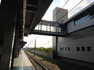
Jardim Helena-Vila Mara (CPTM)
Railway station in São Paulo, Brazil
Distance: Approx. 3613 meters
Latitude and longitude: -23.492719,-46.4211309
Jardim Helena-Vila Mara is a train station on CPTM Line 12-Sapphire, located in the district of Vila Curuçá, a few meters of the district of Jardim Helena (north side), being built to facilitate the access of passengers of both neighbourhoods, located in the city of São Paulo.

Dom Bosco (CPTM)
Railway station in São Paulo, Brazil
Distance: Approx. 2519 meters
Latitude and longitude: -23.541873,-46.448216
Dom Bosco is a train station on CPTM Line 11–Coral, located in the city of São Paulo. It was named for its proximity to the acting area of Dom Bosco Social Work.

José Bonifácio (CPTM)
Railway station in São Paulo, Brazil
Distance: Approx. 3243 meters
Latitude and longitude: -23.542316,-46.415584
José Bonifácio is a train station on CPTM Line 11-Coral, located in the district of José Bonifácio, East Side of São Paulo. The station also has an integrated urban bus terminal with lines that attend Areas 3 (yellow) and 4 (red).
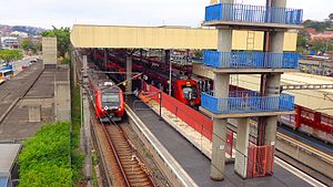
Guaianases (CPTM)
Railway station in São Paulo, Brazil
Distance: Approx. 3243 meters
Latitude and longitude: -23.542316,-46.415584
Guaianases is a train station on CPTM Line 11-Coral, located in the limits between Lajeado and Guaianases districts, both in the East Side São Paulo.
Weather in this IP's area
clear sky
26 Celsius
26 Celsius
26 Celsius
27 Celsius
1013 hPa
65 %
1013 hPa
929 hPa
10000 meters
2.06 m/s
60 degree
05:11:40
18:31:39
