177.181.176.67 - IP Lookup: Free IP Address Lookup, Postal Code Lookup, IP Location Lookup, IP ASN, Public IP
Country:
Region:
City:
Location:
Time Zone:
Postal Code:
ISP:
ASN:
language:
User-Agent:
Proxy IP:
Blacklist:
IP information under different IP Channel
ip-api
Country
Region
City
ASN
Time Zone
ISP
Blacklist
Proxy
Latitude
Longitude
Postal
Route
db-ip
Country
Region
City
ASN
Time Zone
ISP
Blacklist
Proxy
Latitude
Longitude
Postal
Route
IPinfo
Country
Region
City
ASN
Time Zone
ISP
Blacklist
Proxy
Latitude
Longitude
Postal
Route
IP2Location
177.181.176.67Country
Region
rio grande do norte
City
serraria
Time Zone
America/Fortaleza
ISP
Language
User-Agent
Latitude
Longitude
Postal
ipdata
Country
Region
City
ASN
Time Zone
ISP
Blacklist
Proxy
Latitude
Longitude
Postal
Route
Popular places and events near this IP address

Natal, Rio Grande do Norte
Capital city of Rio Grande do Norte, Brazil
Distance: Approx. 4402 meters
Latitude and longitude: -5.78333333,-35.2
Natal (Brazilian Portuguese: [naˈtaw], literally Christmas or natal (something related to "birth")) is the capital and largest city of the state of Rio Grande do Norte, located in northeastern Brazil. According to IBGE's 2022 estimate, the city had a total population of 751,300, making it the 24th largest city in the country. Natal is a major tourist destination and an exporting hub of crustaceans, carnauba wax and fruits, mostly melon, sugar apple, cashew and papaya.

Potenji River
River in Rio Grande do Norte, Brazil
Distance: Approx. 3211 meters
Latitude and longitude: -5.75833333,-35.20416667
The Potenji River (Portuguese: Rio Potenji), meaning "river of the shrimps" in Tupi, is the principal river in the state of Rio Grande do Norte (Brazil). Its delta, that discharges in the coastline of Natal, was soon discovered by the first colonists that used to penetrate into the territory with their vessels. They named the river Rio Grande (which means "Big River" in English) because of its large channel and extension, being the origin of the name of the "capitania hereditária" (administrative division of Brazil during the colonial period whose possession was inherited by the descendants) of Rio Grande do Norte of that time.

Roman Catholic Archdiocese of Natal
Catholic ecclesiastical territory
Distance: Approx. 4400 meters
Latitude and longitude: -5.7881,-35.2038
The Roman Catholic Metropolitan Archdiocese of Natal (Latin: Archidioecesis Metropolitae Natalensis) is an archdiocese located in the city of Natal in Brazil.

Newton Navarro Bridge
Bridge in Natal, Brazil
Distance: Approx. 3422 meters
Latitude and longitude: -5.75638889,-35.2025
The Newton Navarro Bridge is a cable-stayed bridge located in Natal, the capital of the Brazilian state of Rio Grande do Norte. It connects the North Zone and the cities of the north coast to the South Zone and the other regions of the city across the Potengi River. It is one of the largest cable-stayed bridges in Brazil, and was built off a project by the Italian engineer Mario de Miranda.

Redinha beach
Beach in Natal, Rio Grande do Norte, Brazil
Distance: Approx. 3754 meters
Latitude and longitude: -5.745,-35.20333333
Redinha beach (Portuguese: Praia da Redinha) is a beach located in the Brazilian city of Natal in the State of Rio Grande do Norte.
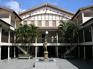
Alberto Maranhão Theatre
Theatre in Natal, Brazil
Distance: Approx. 3735 meters
Latitude and longitude: -5.77954,-35.2047
The Alberto Maranhão Theatre is a theatre located in the city of Natal, state of Rio Grande do Norte, Brazil.

Forte dos Reis Magos
Distance: Approx. 4275 meters
Latitude and longitude: -5.75638889,-35.19472222
The Forte dos Reis Magos or Fortaleza dos Reis Magos (Fortress of the Three Wise Men) is a fortress located in the city of Natal in the Brazilian state of Rio Grande do Norte. The fortress was the first milestone of the city – founded on 25 December 1599 – on the right side of the bar of the Potengi River (today near the Newton Navarro bridge). It received its name based on the date of commencement of its construction, 6 January 1598, at Epiphany Catholic calendar.

Greater Natal
Distance: Approx. 4605 meters
Latitude and longitude: -5.795,-35.20888889
The Greater Natal (lit. Grande Natal, officially Natal Metropolitan Region, lit. Região Metropolitana de Natal) is a metropolitan area located in Rio Grande do Norte state in Brazil.
Ginásio Nélio Dias
Distance: Approx. 3879 meters
Latitude and longitude: -5.73329444,-35.25383889
Ginásio Nélio Dias is an indoor sporting arena located in Natal, Brazil. The capacity of the arena is 10,000 spectators and opened in 2008. It hosts indoor sporting events such as basketball and volleyball, and also hosts concerts.

Microregion of Natal
Microregion in Rio Grande do Norte, Brazil
Distance: Approx. 4605 meters
Latitude and longitude: -5.795,-35.20888889
Natal was a microregion in the Brazilian state of Rio Grande do Norte.

Our Lady of the Presentation Cathedral, Natal
Church in Natal, Brazil
Distance: Approx. 4541 meters
Latitude and longitude: -5.792,-35.206
The Our Lady of the Presentation Cathedral (Portuguese: Catedral Metropolitana Nossa Senhora da Apresentação) Also Natal Cathedral It is a religious building of the Catholic Church dedicated to Our Lady of the Presentation, in Natal, Brazil. It was inaugurated on November 21, 1988, and is located in the district of Cidade Alta in Natal, capital of the Brazilian state of Rio Grande do Norte. It has a style of construction with ascending lines in trapezoidal form quite peculiar.

André de Albuquerque Square
Square in Natal, Rio Grande do Norte, Brazil
Distance: Approx. 3743 meters
Latitude and longitude: -5.78499444,-35.20902222
André de Albuquerque Square, also popularly known as Red Square (Portuguese: Praça Vermelha), is located in the Cidade Alta neighborhood, in Natal, capital of the state of Rio Grande do Norte. The square, named after the revolutionary André de Albuquerque Maranhão, who fought on the side of the Pernambuco rebels, marks the geodesic point of the city and also its zero milestone. It was created in 1888 by the City Council of Natal, when it renamed the famous Rua Grande, giving the square its current name.
Weather in this IP's area
scattered clouds
24 Celsius
25 Celsius
24 Celsius
25 Celsius
1013 hPa
94 %
1013 hPa
1010 hPa
10000 meters
2.57 m/s
180 degree
40 %

