Country:
Region:
City:
Latitude and Longitude:
Time Zone:
Postal Code:
IP information under different IP Channel
ip-api
Country
Region
City
ASN
Time Zone
ISP
Blacklist
Proxy
Latitude
Longitude
Postal
Route
Luminati
Country
Region
go
City
goiania
ASN
Time Zone
America/Sao_Paulo
ISP
TELEFONICA BRASIL S.A
Latitude
Longitude
Postal
IPinfo
Country
Region
City
ASN
Time Zone
ISP
Blacklist
Proxy
Latitude
Longitude
Postal
Route
db-ip
Country
Region
City
ASN
Time Zone
ISP
Blacklist
Proxy
Latitude
Longitude
Postal
Route
ipdata
Country
Region
City
ASN
Time Zone
ISP
Blacklist
Proxy
Latitude
Longitude
Postal
Route
Popular places and events near this IP address

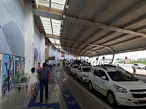
Goiânia International Airport
Airport in Brazil
Distance: Approx. 8115 meters
Latitude and longitude: -16.6325,-49.22111111
Goiânia/Santa Genoveva International Airport (IATA: GYN, ICAO: SBGO) is the airport serving Goiânia, Brazil. It is operated by CCR (Companhia de Concessoes Rodoviarias), a Brazilian toll road operator.
Altamiro de Moura Pacheco State Park
Distance: Approx. 7559 meters
Latitude and longitude: -16.534458,-49.141101
The Altamiro de Moura Pacheco State Park (Portuguese: Parque Estadual Altamiro de Moura Pacheco) is a state park in the state of Goiás, Brazil. It protects an area of dry forest beside a major reservoir that supplies water to the state capital.
Weather in this IP's area
thunderstorm
22 Celsius
23 Celsius
22 Celsius
23 Celsius
1011 hPa
88 %
1011 hPa
929 hPa
10000 meters
3.6 m/s
120 degree
100 %
05:37:48
18:22:58
