Country:
 Brazil
Region:
City:
Latitude and Longitude:
Time Zone:
Postal Code:
IP information under different IP Channel
ip-api
Country
Region
City
ASN
Time Zone
ISP
Blacklist
Proxy
Latitude
Longitude
Postal
Route
IPinfo
Country
Region
City
ASN
Time Zone
ISP
Blacklist
Proxy
Latitude
Longitude
Postal
Route
MaxMind
Country
Region
City
ASN
Time Zone
ISP
Blacklist
Proxy
Latitude
Longitude
Postal
Route
Luminati
Country
BRRegion
sp
City
araraquara
ASN
Time Zone
America/Sao_Paulo
ISP
TELEFONICA BRASIL S.A
Latitude
Longitude
Postal
db-ip
Country
Region
City
ASN
Time Zone
ISP
Blacklist
Proxy
Latitude
Longitude
Postal
Route
ipdata
Country
Region
City
ASN
Time Zone
ISP
Blacklist
Proxy
Latitude
Longitude
Postal
Route
Popular places and events near this IP address

Araraquara
Municipality in Southeast, Brazil
Distance: Approx. 5992 meters
Latitude and longitude: -21.79388889,-48.17583333
Araraquara (Portuguese pronunciation: [ɐɾaɾɐˈkwaɾɐ] or [aˌɾaɾɐˈkwaɾɐ]) is a city in the state of São Paulo in Brazil. The population is 250,314 (2022 est.) in an area of 1,004 km2 (388 sq mi). It is also known as "the abode of the sun," because of its impressive sunset and because of its hot atmosphere, especially in summer.

Fonte Luminosa
Distance: Approx. 8156 meters
Latitude and longitude: -21.774446,-48.170071
Estádio Dr. Adhemar de Barros, usually known as Estádio Fonte Luminosa, or just Fonte Luminosa, is a football (soccer) stadium in Araraquara, Brazil. The stadium has a maximum capacity of 25,000.
Chibarro River
River in Brazil
Distance: Approx. 6828 meters
Latitude and longitude: -21.86666667,-48.26666667
The Chibarro River is a river of São Paulo state in southeastern Brazil.
Araraquara Airport
Airport
Distance: Approx. 8282 meters
Latitude and longitude: -21.81194444,-48.13305556
Bartholomeu de Gusmão State Airport (IATA: AQA, ICAO: SBAQ) is the airport serving Araraquara, Brazil. It is named after Bartolomeu Lourenço de Gusmão (1685-1724), a Portuguese priest born in Brazil, who did research about transportation with balloons. It is operated by Rede Voa.
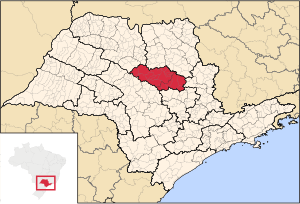
Mesoregion of Araraquara
Mesoregion in Southeast, Brazil
Distance: Approx. 5992 meters
Latitude and longitude: -21.79388889,-48.17583333
The Mesoregion of Araraquara is one of the 15 mesoregions of the São Paulo state, Brazil. It is located on the center of the state, and has an area of 9,451.2 km2. The population of the mesoregion is 810,926 inhabitants (IBGE/2010), spread over 21 municipalities.
Weather in this IP's area
few clouds
27 Celsius
27 Celsius
27 Celsius
27 Celsius
1015 hPa
44 %
1015 hPa
946 hPa
10000 meters
2.12 m/s
2.87 m/s
225 degree
22 %
06:07:57
18:07:20