Country:
 Brazil
Region:
City:
Latitude and Longitude:
Time Zone:
Postal Code:
IP information under different IP Channel
ip-api
Country
Region
City
ASN
Time Zone
ISP
Blacklist
Proxy
Latitude
Longitude
Postal
Route
IPinfo
Country
Region
City
ASN
Time Zone
ISP
Blacklist
Proxy
Latitude
Longitude
Postal
Route
MaxMind
Country
Region
City
ASN
Time Zone
ISP
Blacklist
Proxy
Latitude
Longitude
Postal
Route
Luminati
Country
BRRegion
sp
City
saopaulo
ASN
Time Zone
America/Sao_Paulo
ISP
TIM SA
Latitude
Longitude
Postal
db-ip
Country
Region
City
ASN
Time Zone
ISP
Blacklist
Proxy
Latitude
Longitude
Postal
Route
ipdata
Country
Region
City
ASN
Time Zone
ISP
Blacklist
Proxy
Latitude
Longitude
Postal
Route
Popular places and events near this IP address

São Paulo–Congonhas Airport
Domestic airport in São Paulo, Brazil
Distance: Approx. 1598 meters
Latitude and longitude: -23.62611111,-46.65638889
São Paulo/Congonhas–Deputado Freitas Nobre Airport (IATA: CGH, ICAO: SBSP) Portuguese pronunciation: [kõˈɡõɲɐs] is one of the four commercial airports serving São Paulo, Brazil. The airport is named after the neighborhood where it is located, called Vila Congonhas, property of the descendants of Lucas Antônio Monteiro de Barros (1767–1851), Viscount of Congonhas do Campo, first president of the province of São Paulo after the independence of Brazil in 1822, during the Empire. In turn, the Viscount's domain was named after the plural of a shrub known in Brazil as congonha-do-campo (Luxemburgia polyandra, of the Ochnaceae family).
TAM Transportes Aéreos Regionais Flight 402
1996 aviation accident
Distance: Approx. 2094 meters
Latitude and longitude: -23.64611111,-46.6475
TAM Transportes Aéreos Regionais Flight 402 was a scheduled domestic flight from Caxias do Sul, Brazil, to Recife International Airport in Recife, via São Paulo–Congonhas International Airport and Santos Dumont Airport in Rio de Janeiro. On 31 October 1996, at 8:27 (UTC-2), the starboard engine of the Fokker 100 operating the route reversed thrust while the aircraft was climbing away from the runway at Congonhas. The aircraft stalled and rolled beyond control to the right, then struck two buildings and crashed into several houses in a heavily populated area only 25 seconds after takeoff.
Saúde (district of São Paulo)
District of São Paulo, Brazil
Distance: Approx. 2077 meters
Latitude and longitude: -23.61,-46.63694444
Saúde is a district in the city of São Paulo, Brazil. Saúde is a district in the South Zone of the city of São Paulo, included in the area of the Vila Mariana Subprefecture. The district is served by Line 1-Blue of the São Paulo Metro, with the stations Praça da Árvore, Saúde-Ultrafarma and São Judas.

Praça da Árvore (São Paulo Metro)
São Paulo Metro station
Distance: Approx. 1997 meters
Latitude and longitude: -23.610576,-46.637861
Praça da Árvore is a station on Line 1 (Blue) of the São Paulo Metro.
Saúde-Ultrafarma (São Paulo Metro)
São Paulo Metro station
Distance: Approx. 1033 meters
Latitude and longitude: -23.619133,-46.639345
Saúde-Ultrafarma, or simply Saúde, is a station on Line 1 (Blue) of the São Paulo Metro.
São Judas (São Paulo Metro)
São Paulo Metro station
Distance: Approx. 300 meters
Latitude and longitude: -23.625609,-46.64075
São Judas is a station on Line 1 (Blue) of the São Paulo Metro. It will be integrated with the planned Line 20 (Pink).

Conceição (São Paulo Metro)
São Paulo Metro station
Distance: Approx. 881 meters
Latitude and longitude: -23.636209,-46.641142
Conceição is a station on Line 1 (Blue) of the São Paulo Metro.

Jabaquara (São Paulo Metro)
São Paulo Metro station
Distance: Approx. 2098 meters
Latitude and longitude: -23.647134,-46.640112
Jabaquara is a station on Line 1 (Blue) of the São Paulo Metro and is the current terminus. It will be integrated with the planned Line 17 (Gold). The station integrates with the Jabaquara Intermunicipal Terminal, allowing passengers to transfer to SPTrans and EMTU bus lines with their Bilhete Único card.

Jabaquara Intermunicipal Terminal
Distance: Approx. 1922 meters
Latitude and longitude: -23.64555556,-46.64166667
Jabaquara Intermunicipal Terminal is an intermunicipal bus terminal in São Paulo, Brazil. Along with the Tietê Bus Terminal and the Palmeiras-Barra Funda Intermodal Terminal, it is one of the most important bus terminals in the State of São Paulo. tel.11 5060-4275 of ambulatory.

Paróquia Nossa Senhora de Lourdes (São Paulo)
Church in São Paulo, Brazil
Distance: Approx. 1465 meters
Latitude and longitude: -23.61833333,-46.65027778
Paróquia Nossa Senhora de Lourdes is a church located in São Paulo, Brazil. The church was created on 8 December 1939.

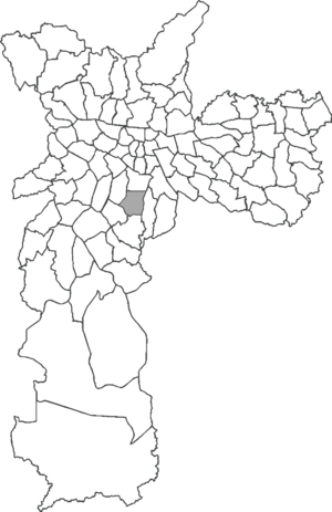
Jabaquara (district of São Paulo)
District of São Paulo, Brazil
Distance: Approx. 1036 meters
Latitude and longitude: -23.6364,-46.6459
Jabaquara is one of 96 districts in the city of São Paulo, Brazil. The name Jabaquara comes from tupi-guarani YAB-A-QUAR-A, which means rock or hole.

Aeroporto de Congonhas (São Paulo Metro)
Future railway station in São Paulo, Brazil
Distance: Approx. 2133 meters
Latitude and longitude: -23.626944,-46.661764
Aeroporto de Congonhas will be a monorail station of Line 17-Gold of ViaMobilidade, which is currently under construction, and will connect Line 9-Emerald to Congonhas Airport. Aeroporto de Congonhas station will be located in the crossing of Avenida Washington Luís with Rua Rafael Lório. The station will have a tunnel across Av.
Weather in this IP's area
clear sky
22 Celsius
22 Celsius
20 Celsius
22 Celsius
1020 hPa
80 %
1020 hPa
931 hPa
6000 meters
2.06 m/s
70 degree
1 %
06:10:16
17:58:18