177.143.219.237 - IP Lookup: Free IP Address Lookup, Postal Code Lookup, IP Location Lookup, IP ASN, Public IP
Country:
Region:
City:
Location:
Time Zone:
Postal Code:
IP information under different IP Channel
ip-api
Country
Region
City
ASN
Time Zone
ISP
Blacklist
Proxy
Latitude
Longitude
Postal
Route
Luminati
Country
Region
rs
City
santamaria
ASN
Time Zone
America/Sao_Paulo
ISP
Claro NXT Telecomunicacoes Ltda
Latitude
Longitude
Postal
IPinfo
Country
Region
City
ASN
Time Zone
ISP
Blacklist
Proxy
Latitude
Longitude
Postal
Route
IP2Location
177.143.219.237Country
Region
rio grande do sul
City
santa maria
Time Zone
America/Sao_Paulo
ISP
Language
User-Agent
Latitude
Longitude
Postal
db-ip
Country
Region
City
ASN
Time Zone
ISP
Blacklist
Proxy
Latitude
Longitude
Postal
Route
ipdata
Country
Region
City
ASN
Time Zone
ISP
Blacklist
Proxy
Latitude
Longitude
Postal
Route
Popular places and events near this IP address

Santa Maria, Rio Grande do Sul
Municipality in the state of Rio Grande do Sul, Brazil
Distance: Approx. 674 meters
Latitude and longitude: -29.68333333,-53.8
Santa Maria is a municipality (município) in the central region of Rio Grande do Sul, the southernmost state of Brazil. In 2020, its population was 283,677 inhabitants in a total area of 1,823 square kilometres (704 sq mi). Santa Maria is the 5th biggest municipality in the state, and the largest in its micro-region.
Caturrita Formation
Rock formation in Rio Grande do Sul, Brazil
Distance: Approx. 1641 meters
Latitude and longitude: -29.695042,-53.795403
The Caturrita Formation is a rock formation found in Rio Grande do Sul, Brazil. Its sediments were deposited in the Paraná Basin. The formation is from the Upper Triassic and forms part of the Santa Maria Supersequence in the upper section of the Rosário do Sul Group.

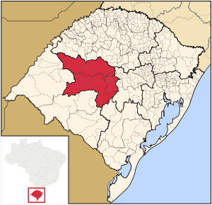
Centro Ocidental Rio-Grandense
Mesoregion in Rio Grande do Sul, Brazil
Distance: Approx. 35 meters
Latitude and longitude: -29.68388889,-53.80694444
The Centro Ocidental Rio-Grandense (Brazilian Portuguese: Western Center of Rio Grande) is one of the seven mesoregions of the state of Rio Grande do Sul in Brazil.

Roman Catholic Archdiocese of Santa Maria
Catholic ecclesiastical territory
Distance: Approx. 132 meters
Latitude and longitude: -29.6849,-53.808
The Roman Catholic Archdiocese of Santa Maria (Latin: Archdioecesis Sanctae Mariae) is an archdiocese located in the city of Santa Maria. Before being elevated to an archdiocese itself in 2011 it was part of the ecclesiastical province of Porto Alegre in Brazil.

Kiss nightclub fire
2013 fire in Santa Maria, Brazil
Distance: Approx. 13 meters
Latitude and longitude: -29.68430556,-53.80694444
The Kiss nightclub fire started between 2:00 and 2:30 a.m. (BRST) on 27 January 2013 in Santa Maria, Rio Grande do Sul, Brazil, killing 242 people and injuring at least 630 others. The acoustic foam in the ceiling was ignited.

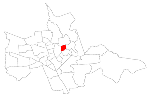
Centro, Santa Maria
Bairro in Rio Grande do Sul, Brazil
Distance: Approx. 264 meters
Latitude and longitude: -29.68645,-53.80605
Centro ("downtown") is a bairro in the District of Sede in the municipality of Santa Maria, in the Brazilian state of Rio Grande do Sul. It is the economical heart of Santa Maria.

Carolina, Santa Maria
Bairro in Rio Grande do Sul, Brazil
Distance: Approx. 1443 meters
Latitude and longitude: -29.67738611,-53.81958889
Carolina is a bairro in the District of Sede in the municipality of Santa Maria, in the Brazilian state of Rio Grande do Sul. It is located in north Santa Maria.

Menino Jesus
Bairro in Rio Grande do Sul, Brazil
Distance: Approx. 1016 meters
Latitude and longitude: -29.68429444,-53.79639167
Menino Jesus ("child Jesus") is a bairro in the District of Sede in the municipality of Santa Maria, in the Brazilian state of Rio Grande do Sul. It is located in northeast Santa Maria.

Bonfim, Santa Maria
Bairro in Rio Grande do Sul, Brazil
Distance: Approx. 1047 meters
Latitude and longitude: -29.68783056,-53.81689167
Bonfim ("good end") is a bairro in the District of Sede in the municipality of Santa Maria, in the Brazilian state of Rio Grande do Sul. It is located in central Santa Maria.

Nossa Senhora de Fátima, Santa Maria
Bairro in Rio Grande do Sul, Brazil
Distance: Approx. 1538 meters
Latitude and longitude: -29.69520556,-53.81651667
Nossa Senhora de Fátima ("Our Lady of Fátima") is a bairro in the District of Sede in the municipality of Santa Maria, in the Brazilian state of Rio Grande do Sul. It is located in central Santa Maria.

Nossa Senhora do Rosário, Santa Maria
Bairro in Rio Grande do Sul, Brazil
Distance: Approx. 1011 meters
Latitude and longitude: -29.68285833,-53.81724167
Nossa Senhora do Rosário ("Our Lady of the Rosary") is a bairro in the District of Sede in the municipality of Santa Maria, in the Brazilian state of Rio Grande do Sul. It is located in Central Santa Maria.

Itararé, Santa Maria
Bairro in Rio Grande do Sul, Brazil
Distance: Approx. 1515 meters
Latitude and longitude: -29.67435,-53.79608889
Itararé (Portuguese pronunciation: [????], "indian word for excavated stone") is a bairro in the District of Sede in the municipality of Santa Maria, in the Brazilian state of Rio Grande do Sul. It is located in northeast Santa Maria.
Weather in this IP's area
clear sky
20 Celsius
20 Celsius
20 Celsius
20 Celsius
1013 hPa
70 %
1013 hPa
990 hPa
10000 meters
5.22 m/s
12.54 m/s
101 degree
