Country:
Region:
City:
Latitude and Longitude:
Time Zone:
Postal Code:
IP information under different IP Channel
ip-api
Country
Region
City
ASN
Time Zone
ISP
Blacklist
Proxy
Latitude
Longitude
Postal
Route
Luminati
Country
Region
mg
City
divinopolis
ASN
Time Zone
America/Sao_Paulo
ISP
TELEFONICA BRASIL S.A
Latitude
Longitude
Postal
IPinfo
Country
Region
City
ASN
Time Zone
ISP
Blacklist
Proxy
Latitude
Longitude
Postal
Route
db-ip
Country
Region
City
ASN
Time Zone
ISP
Blacklist
Proxy
Latitude
Longitude
Postal
Route
ipdata
Country
Region
City
ASN
Time Zone
ISP
Blacklist
Proxy
Latitude
Longitude
Postal
Route
Popular places and events near this IP address

Divinópolis
Municipality in Southeast, Brazil
Distance: Approx. 4448 meters
Latitude and longitude: -20.13888889,-44.88388889
Divinópolis is a municipality in the centre-west of Minas Gerais state, Brazil. The estimated population in 2020 was 240,408 inhabitants. The total area of the municipality is 709 km2 and the elevation is 712 metres.

Roman Catholic Diocese of Divinópolis
Catholic ecclesiastical territory
Distance: Approx. 4446 meters
Latitude and longitude: -20.139,-44.884
The Roman Catholic Diocese of Divinópolis (Latin: Dioecesis Divinopolitanus) is a diocese located in the city of Divinópolis in the ecclesiastical province of Belo Horizonte in Brazil.
Itapecerica River
River in Brazil
Distance: Approx. 6421 meters
Latitude and longitude: -20.08333333,-44.86666667
The Itapecerica River is a river of Minas Gerais state in southeastern Brazil.

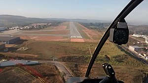
Divinópolis Airport
Airport
Distance: Approx. 8983 meters
Latitude and longitude: -20.18194444,-44.87
Brigadeiro Cabral Airport (IATA: DIQ, ICAO: SNDV) is the airport serving Divinópolis, Brazil. It is managed by contract by Infraero.
Weather in this IP's area
few clouds
20 Celsius
20 Celsius
20 Celsius
20 Celsius
1008 hPa
88 %
1008 hPa
928 hPa
10000 meters
0.96 m/s
0.99 m/s
36 degree
24 %
05:12:51
18:15:23