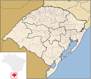
Country:
 Brazil
Region:
City:
Latitude and Longitude:
Time Zone:
Postal Code:
IP information under different IP Channel
ip-api
Country
Region
City
ASN
Time Zone
ISP
Blacklist
Proxy
Latitude
Longitude
Postal
Route
IPinfo
Country
Region
City
ASN
Time Zone
ISP
Blacklist
Proxy
Latitude
Longitude
Postal
Route
MaxMind
Country
Region
City
ASN
Time Zone
ISP
Blacklist
Proxy
Latitude
Longitude
Postal
Route
Luminati
Country
BRRegion
rs
City
canoas
ASN
Time Zone
America/Sao_Paulo
ISP
TELEFONICA BRASIL S.A
Latitude
Longitude
Postal
db-ip
Country
Region
City
ASN
Time Zone
ISP
Blacklist
Proxy
Latitude
Longitude
Postal
Route
ipdata
Country
Region
City
ASN
Time Zone
ISP
Blacklist
Proxy
Latitude
Longitude
Postal
Route
Popular places and events near this IP address

Salgado Filho Porto Alegre International Airport
Brazilian airport
Distance: Approx. 8013 meters
Latitude and longitude: -29.99472222,-51.17111111
Porto Alegre–Salgado Filho International Airport (IATA: POA, ICAO: SBPA) is the airport serving Porto Alegre and the region of Greater Porto Alegre, Brazil. Since October 12, 1951, it is named after the Senator and first Minister of the Brazilian Air Force Joaquim Pedro Salgado Filho (1888–1950). It is operated by Fraport Brasil.
Canoas
Municipality in South, Brazil
Distance: Approx. 624 meters
Latitude and longitude: -29.92,-51.18
Canoas (Portuguese pronunciation: [kaˈnoɐs]) is a municipality in the state of Rio Grande do Sul, Brazil, forming part of the Greater Porto Alegre area. It is the largest municipality of the metropolitan region of Porto Alegre and the third largest municipality of Rio Grande do Sul. Officially declared a city on June 27, 1939, after its separation from São Sebastião do Caí and Gravataí, Canoas derives its name from the historical crafting of canoes in the area.

Lutheran University of Brazil
Distance: Approx. 4115 meters
Latitude and longitude: -29.8872,-51.1629
The Lutheran University of Brazil (Portuguese: Universidade Luterana do Brasil or ULBRA) is a university which covers several states throughout Brazil.
Esteio
Place in Sul, Brazil
Distance: Approx. 6912 meters
Latitude and longitude: -29.86083333,-51.17888889
Esteio is a municipality situated in the Brazilian state of Rio Grande do Sul, in the metropolitan region of Porto Alegre, the state capital. About 9.3 miles from Porto Alegre, and neighboring Canoas and Sapucaia do Sul, it has about 83,000 inhabitants. Esteio is known for being the city where the Expointer takes place.

Arena do Grêmio
Stadium in Rio Grande do Sul, Brazil
Distance: Approx. 5959 meters
Latitude and longitude: -29.97344444,-51.19440278
Arena do Grêmio is a multi-use stadium in Porto Alegre, Rio Grande do Sul. It was inaugurated on December 8, 2012. It is used mostly for football matches and as the home stadium of Grêmio Foot-Ball Porto Alegrense, replacing the Estádio Olímpico Monumental.

Gravataí River
River in Brazil
Distance: Approx. 5472 meters
Latitude and longitude: -29.96666667,-51.2
Gravataí River (Portuguese pronunciation: [ɡɾavataˈi]) is a river that runs along Gravataí (a city located in the metropolitan area of Porto Alegre city).

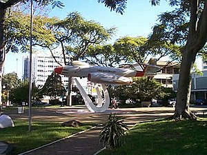
Canoas Air Force Base
Air base of the Brazilian Air Force
Distance: Approx. 3904 meters
Latitude and longitude: -29.94555556,-51.14361111
Canoas Air Force Base – ALA3 (IATA: QNS, ICAO: SBCO) is a base of the Brazilian Air Force, located in Canoas, near Porto Alegre, Brazil.
Anchieta, Porto Alegre
Neighbourhood in Porto Alegre, Brazil
Distance: Approx. 6904 meters
Latitude and longitude: -29.98465758,-51.16929056
Anchieta is a neighbourhood (bairro) in the city of Porto Alegre, the state capital of Rio Grande do Sul, in Brazil. Created by Law 2022 from December 7, 1959, it was named after José de Anchieta. The neighbourhood is close to the municipality of Canoas.
Farrapos, Rio Grande do Sul
Distance: Approx. 6729 meters
Latitude and longitude: -29.98,-51.19694444
Farrapos (meaning Ragamuffins in English, in allusion to the Ragamuffin War) is a neighbourhood (bairro) in the city of Porto Alegre, the state capital of Rio Grande do Sul, in Brazil. It was created by Law 6218 from November 17, 1988.

Pepsi on Stage
Distance: Approx. 7206 meters
Latitude and longitude: -29.9875,-51.17666667
Pepsi on Stage is a music venue in the city of Porto Alegre, Brazil. It is located in the neighborhood of São João, near the Salgado Filho International Airport.

Rio dos Sinos
River in Brazil
Distance: Approx. 6067 meters
Latitude and longitude: -29.934444,-51.235833
Rio dos Sinos is a river in the state of Rio Grande do Sul, southern Brazil. It rises in the hills east of Caraá (130 kilometres (81 mi) away from Porto Alegre) at elevations above 600 metres (2,000 ft) and covers a distance of about 190 kilometres (120 mi), flowing into the delta Jacuí in Canoas, at an elevation of only 5 metres (16 ft). The river basin contains the São Francisco de Paula National Forest, a 1,616-hectare (3,990-acre) sustainable use conservation area created in 1968.

Nossa Senhora de Fátima Aerodrome
Brazilian airport
Distance: Approx. 3904 meters
Latitude and longitude: -29.94555556,-51.14361111
Campo Nossa Senhora de Fátima (IATA: QNS, ICAO: SBCO) is a temporary aerodrome located in Canoas, serving Porto Alegre and the region of Greater Porto Alegre, Brazil. It started operations on May 27, 2024, as a contingency measure after the indefinite closure of Salgado Filho Airport as a result of 2024 Rio Grande do Sul floods that caused critical damage to the latter. It operates using the facilities (runways, taxiways and apron) of Canoas Air Force Base.
Weather in this IP's area
broken clouds
21 Celsius
21 Celsius
21 Celsius
22 Celsius
1023 hPa
70 %
1023 hPa
1020 hPa
10000 meters
4.12 m/s
160 degree
75 %
06:21:15
18:17:45