Country:
 Brazil
Region:
City:
Latitude and Longitude:
Time Zone:
Postal Code:
IP information under different IP Channel
ip-api
Country
Region
City
ASN
Time Zone
ISP
Blacklist
Proxy
Latitude
Longitude
Postal
Route
IPinfo
Country
Region
City
ASN
Time Zone
ISP
Blacklist
Proxy
Latitude
Longitude
Postal
Route
MaxMind
Country
Region
City
ASN
Time Zone
ISP
Blacklist
Proxy
Latitude
Longitude
Postal
Route
Luminati
Country
BRRegion
mg
City
parademinas
ASN
Time Zone
America/Sao_Paulo
ISP
SKY SERVICOS DE BANDA LARGA LTDA
Latitude
Longitude
Postal
db-ip
Country
Region
City
ASN
Time Zone
ISP
Blacklist
Proxy
Latitude
Longitude
Postal
Route
ipdata
Country
Region
City
ASN
Time Zone
ISP
Blacklist
Proxy
Latitude
Longitude
Postal
Route
Popular places and events near this IP address
Nova Lima
Municipality in Minas Gerais, Brazil
Distance: Approx. 4930 meters
Latitude and longitude: -19.98583333,-43.84694444
Nova Lima is a municipality of about 87,000 people, whose downtown is located about 20 kilometers south of Belo Horizonte, the capital of the south-eastern Brazilian state of Minas Gerais. Mining is one of the main economical activities of the city, including the extraction of Iron Ore and Gold. The most famous mine in the city is Morro Velho (Old Hill), a gold mine of 2,700 metres (8,900 ft) depth.
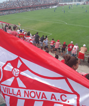
Estádio Castor Cifuentes
Distance: Approx. 4804 meters
Latitude and longitude: -19.9875,-43.84472222
Estádio Municipal Castor Cifuentes – named 1936 after a former president (1932–35) of the local Villa Nova AC, also known as Alçapão do Bonfim, the "Trap of Bonfim" after the neighbourhood just east of the city centre, or Penidão, nicknamed after the city's mayor Vitor Penido, who reformed the stadium in 1989 – is a football stadium located in Nova Lima, a city with a population of about 80,000 people located about 20 kilometres south-east of the centre of Belo Horizonte, the capital of the south-east Brazilian state of Minas Gerais. It is also known by the nickname Penidão, nicknamed after the city's mayor Vitor Penido, who reformed the stadium in 1989. It was built in 1930 and is owned by the Municipality of Nova Lima.

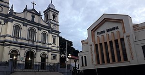
Sabará
Municipality in Southeast, Brazil
Distance: Approx. 9062 meters
Latitude and longitude: -19.88583333,-43.80694444
Sabará is a Brazilian municipality located in the state of Minas Gerais. The city belongs to the Belo Horizonte metropolitan region and to the associated microregion. It is a well preserved historic city and retains the characteristics of a baroque city, with its churches, buildings and museums.
Raposos
Municipality in Minas Gerais, Brazil
Distance: Approx. 43 meters
Latitude and longitude: -19.96694444,-43.80388889
Raposos is a Brazilian municipality located in the state of Minas Gerais. The city belongs to the mesoregion Metropolitana de Belo Horizonte and to the microregion of Belo Horizonte.
Saint John d'El Rey Mining Company
Distance: Approx. 4930 meters
Latitude and longitude: -19.985833,-43.846944
The Saint John d'El Rey Mining Company was a British mining company that operated in Brazil in the 19th and 20th centuries. The company employed skilled miners from Cornwall and elsewhere in Britain in its gold mines in the state of Minas Gerais, and also employed black slaves.
Honório Bicalho
Village in Minas Gerais, Brazil
Distance: Approx. 6468 meters
Latitude and longitude: -20.022102,-43.824432
Honório Bicalho is a community in the state of Minas Gerais, Brazil, in the municipality of Nova Lima. The Rio das Velhas runs through the community from south to north.
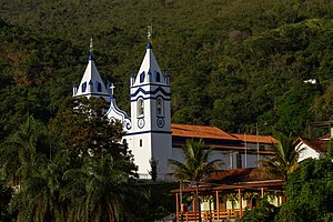
Church of Our Lady of the Rosary of Black Men (Sabará)
Monument in
Distance: Approx. 8656 meters
Latitude and longitude: -19.8897,-43.8109
The Church of Our Lady of the Rosary of Black Men (Brazilian Portuguese: Igreja de Nossa Senhora do Rosário dos Pretos), in Sabará, Minas Gerais, Brazil is a Roman Catholic church whose construction was initiated in the 18th century and interrupted towards the end of the 19th century. The building is listed by the National Institute of Historic and Artistic Heritage of Brazil (IPHAN) and is characterized mainly by having an internal chapel, made of earth and wood, inside of a larger and unfinished building made of stone.
Weather in this IP's area
clear sky
25 Celsius
25 Celsius
24 Celsius
26 Celsius
1020 hPa
52 %
1020 hPa
938 hPa
10000 meters
2.33 m/s
5.03 m/s
74 degree
8 %
05:58:17
17:48:18