177.128.144.28 - IP Lookup: Free IP Address Lookup, Postal Code Lookup, IP Location Lookup, IP ASN, Public IP
Country:
Region:
City:
Location:
Time Zone:
Postal Code:
ISP:
ASN:
language:
User-Agent:
Proxy IP:
Blacklist:
IP information under different IP Channel
ip-api
Country
Region
City
ASN
Time Zone
ISP
Blacklist
Proxy
Latitude
Longitude
Postal
Route
db-ip
Country
Region
City
ASN
Time Zone
ISP
Blacklist
Proxy
Latitude
Longitude
Postal
Route
IPinfo
Country
Region
City
ASN
Time Zone
ISP
Blacklist
Proxy
Latitude
Longitude
Postal
Route
IP2Location
177.128.144.28Country
Region
sao paulo
City
avare
Time Zone
America/Sao_Paulo
ISP
Language
User-Agent
Latitude
Longitude
Postal
ipdata
Country
Region
City
ASN
Time Zone
ISP
Blacklist
Proxy
Latitude
Longitude
Postal
Route
Popular places and events near this IP address

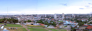
Avaré, São Paulo
Municipality in the state of São Paulo in Brazil
Distance: Approx. 32 meters
Latitude and longitude: -23.09888889,-48.92583333
Avaré is a city in the State of São Paulo, Brazil, located 270 km from the state capital, São Paulo. The population is 91,232 (2020 est.) in an area of 1213 km2. Established on 15 September 1861 by Major Vitoriano de Souza Rocha and Domiciano Santana, the city was developed around the chapel of Our Lady of the Good Death ("Nossa Senhora da Boa Morte").
Avaré-Arandu Airport
Airport
Distance: Approx. 6329 meters
Latitude and longitude: -23.09222222,-48.98722222
Comandante Luiz Gonzaga Lutti Regional Airport (IATA: QVP, ICAO: SDRR) is the airport serving Avaré and Arandu, Brazil. It is operated by Rede Voa.
Weather in this IP's area
clear sky
15 Celsius
15 Celsius
15 Celsius
15 Celsius
1011 hPa
97 %
1011 hPa
932 hPa
10000 meters
3.42 m/s
10.28 m/s
125 degree
7 %
