Country:
Region:
City:
Latitude and Longitude:
Time Zone:
Postal Code:
IP information under different IP Channel
ip-api
Country
Region
City
ASN
Time Zone
ISP
Blacklist
Proxy
Latitude
Longitude
Postal
Route
Luminati
Country
Region
se
City
ribeiropolis
ASN
Time Zone
America/Maceio
ISP
ALOO TELECOM - FSF TECNOLOGIA SA
Latitude
Longitude
Postal
IPinfo
Country
Region
City
ASN
Time Zone
ISP
Blacklist
Proxy
Latitude
Longitude
Postal
Route
db-ip
Country
Region
City
ASN
Time Zone
ISP
Blacklist
Proxy
Latitude
Longitude
Postal
Route
ipdata
Country
Region
City
ASN
Time Zone
ISP
Blacklist
Proxy
Latitude
Longitude
Postal
Route
Popular places and events near this IP address

Sergipe
State of Brazil
Distance: Approx. 5033 meters
Latitude and longitude: -10.56,-37.36
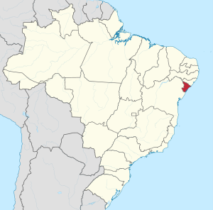
Sergipe (Brazilian Portuguese: [sɛʁˈʒipi] ), officially State of Sergipe, is a state of Brazil. Located in the Northeast Region along the Atlantic coast of the country, Sergipe is the smallest state in Brazil by geographical area at 21,910 square kilometres (8,460 sq mi), larger only than the Federal District. Sergipe borders Bahia to the south and west and Alagoas to the north.

Moita Bonita
Municipality in Northeast, Brazil
Distance: Approx. 7705 meters
Latitude and longitude: -10.57777778,-37.34277778
Moita Bonita is a municipality located in the Brazilian state of Sergipe. Its population was 11,348 (2020) and covers 96.53 km2 (37.27 sq mi). Moita Bonita has a population density of 120 inhabitants per square kilometer.
Ribeirópolis
Distance: Approx. 6273 meters
Latitude and longitude: -10.53888889,-37.43611111
Ribeirópolis is a municipality located in the Brazilian state of Sergipe. Its population was 18,773 (2020) and its area is 262 km2.
Weather in this IP's area
scattered clouds
30 Celsius
30 Celsius
30 Celsius
30 Celsius
1010 hPa
36 %
1010 hPa
983 hPa
10000 meters
8.32 m/s
7.6 m/s
123 degree
36 %
04:57:58
17:28:09