177.11.206.14 - IP Lookup: Free IP Address Lookup, Postal Code Lookup, IP Location Lookup, IP ASN, Public IP
Country:
Region:
City:
Location:
Time Zone:
Postal Code:
IP information under different IP Channel
ip-api
Country
Region
City
ASN
Time Zone
ISP
Blacklist
Proxy
Latitude
Longitude
Postal
Route
Luminati
Country
Region
rs
City
feliz
ASN
Time Zone
America/Sao_Paulo
ISP
BRASIL TECPAR | AMIGO | AVATO
Latitude
Longitude
Postal
IPinfo
Country
Region
City
ASN
Time Zone
ISP
Blacklist
Proxy
Latitude
Longitude
Postal
Route
IP2Location
177.11.206.14Country
Region
rio grande do sul
City
feliz
Time Zone
America/Sao_Paulo
ISP
Language
User-Agent
Latitude
Longitude
Postal
db-ip
Country
Region
City
ASN
Time Zone
ISP
Blacklist
Proxy
Latitude
Longitude
Postal
Route
ipdata
Country
Region
City
ASN
Time Zone
ISP
Blacklist
Proxy
Latitude
Longitude
Postal
Route
Popular places and events near this IP address

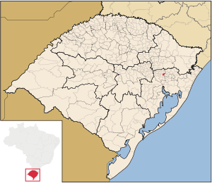
Feliz
Municipality in Sul, Brazil
Distance: Approx. 55 meters
Latitude and longitude: -29.45083334,-51.30583334
Feliz is a municipality in the Brazilian state of Rio Grande do Sul. (Municipalities, in this case, are sections of cities/villages in Brazil, which are like counties in the United States of America.) The population of Feliz was 13,640 as of 2020. Feliz was founded in February 1959.

Alto Feliz
Municipality in Rio Grande do Sul, Brazil
Distance: Approx. 7536 meters
Latitude and longitude: -29.38333333,-51.3
Alto Feliz is a municipality within the state of Rio Grande do Sul, Brazil. It was raised to municipality status in 1992, the area being taken out of the municipality of Feliz.

Bom Princípio
Municipality in Rio Grande do Sul, Brazil
Distance: Approx. 5563 meters
Latitude and longitude: -29.4833,-51.35
Bom Princípio is a municipality in the state of Rio Grande do Sul, Brazil. It is known in alla Brazil as Strawberry Land. It was raised to municipality status in 1992, the area being taken out of the municipalities of São Sebastião do Caí and Montenegro.

São José do Hortêncio
Municipality in Rio Grande do Sul, Brazil
Distance: Approx. 9962 meters
Latitude and longitude: -29.53333333,-51.26666667
São José do Hortêncio is a municipality in the state of Rio Grande do Sul, Brazil.

São Vendelino
Municipality in Rio Grande do Sul, Brazil
Distance: Approx. 7536 meters
Latitude and longitude: -29.38333333,-51.3
São Vendelino is a municipality in the state of Rio Grande do Sul, Brazil. It was raised to municipality status in 1988, the area being taken out of the municipality of Bom Princípio.

Vale Real
Municipality in Rio Grande do Sul, Brazil
Distance: Approx. 7795 meters
Latitude and longitude: -29.39777778,-51.25388889
Vale Real is a municipality in the state of Rio Grande do Sul, Brazil.
Jaguari River (Canastra River tributary)
River in Brazil
Distance: Approx. 8619 meters
Latitude and longitude: -29.38333333,-51.35
The Jaguari River (Canastra River) is a river in the state of Rio Grande do Sul in southern Brazil. It is a tributary of the Canastra River, and therefore indirectly of the Caí River.
Forromeco River
River in Brazil
Distance: Approx. 6917 meters
Latitude and longitude: -29.5,-51.35
The Forromeco River is a river of Rio Grande do Sul state in southern Brazil. It is a tributary of the Caí River.
Canastra River
River in Brazil
Distance: Approx. 7060 meters
Latitude and longitude: -29.4,-51.35
The Canastra River is a river of Rio Grande do Sul state in southern Brazil.
Weather in this IP's area
clear sky
27 Celsius
26 Celsius
26 Celsius
29 Celsius
1011 hPa
30 %
1011 hPa
1005 hPa
10000 meters
2.57 m/s
2.62 m/s
182 degree