176.94.230.62 - IP Lookup: Free IP Address Lookup, Postal Code Lookup, IP Location Lookup, IP ASN, Public IP
Country:
Region:
City:
Location:
Time Zone:
Postal Code:
IP information under different IP Channel
ip-api
Country
Region
City
ASN
Time Zone
ISP
Blacklist
Proxy
Latitude
Longitude
Postal
Route
Luminati
Country
Region
by
City
stockstadtammain
ASN
Time Zone
Europe/Berlin
ISP
Vodafone GmbH
Latitude
Longitude
Postal
IPinfo
Country
Region
City
ASN
Time Zone
ISP
Blacklist
Proxy
Latitude
Longitude
Postal
Route
IP2Location
176.94.230.62Country
Region
nordrhein-westfalen
City
moers
Time Zone
Europe/Berlin
ISP
Language
User-Agent
Latitude
Longitude
Postal
db-ip
Country
Region
City
ASN
Time Zone
ISP
Blacklist
Proxy
Latitude
Longitude
Postal
Route
ipdata
Country
Region
City
ASN
Time Zone
ISP
Blacklist
Proxy
Latitude
Longitude
Postal
Route
Popular places and events near this IP address

Düsseldorf (region)
Regierungsbezirk in North Rhine-Westphalia, Germany
Distance: Approx. 4534 meters
Latitude and longitude: 51.42,6.67
Düsseldorf is one of the five Regierungsbezirke of North Rhine-Westphalia, Germany, located in the north-west of the country. It covers the western part of the Ruhr Area, as well as the Niederrheinische Tiefebene, the lower Rhine area. It is the most populated of all German administrative areas of the kind.

Moers
City in North Rhine-Westphalia, Germany
Distance: Approx. 1100 meters
Latitude and longitude: 51.45916667,6.61972222
Moers (German pronunciation: [ˈmœʁs] ; older form: Mörs; Dutch: Murse, Murs or Meurs) is a German city on the western bank of the Rhine, close to Duisburg. Moers belongs to the district of Wesel.

Neukirchen-Vluyn
Town in North Rhine-Westphalia, Germany
Distance: Approx. 5315 meters
Latitude and longitude: 51.44166667,6.55833333
Neukirchen-Vluyn (German pronunciation: [nɔʏˈkɪʁçənˈflyːn]) is a town in the district of Wesel, in North Rhine-Westphalia, Germany. It is situated approximately 5 km west of Moers, and 15 km north of Krefeld.
Beeckerwerth
Distance: Approx. 5339 meters
Latitude and longitude: 51.47527778,6.70111111
Beeckerwerth is a part of the German city of Duisburg and located right of the Rhine. It has a population of 3,807 and an area of 7.62 km2.

PCC-Stadion
Distance: Approx. 4840 meters
Latitude and longitude: 51.462,6.701
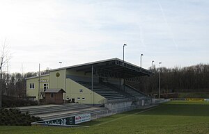
The PCC-Stadion is a football stadium in Homberg (Duisburg), North Rhine-Westphalia, Germany. It is the home ground of the women's Bundesliga side MSV Duisburg—continuing the tradition of the FCR 2001 Duisburg—and men's fourth division side VfB Homberg. The stadium has a capacity of 3,000.

Rhine Orange
Distance: Approx. 6253 meters
Latitude and longitude: 51.44953611,6.72253056
Rheinorange (Rhine Orange) is a sculpture erected in 1992 in Duisburg-Neuenkamp, Germany. It is located at the point where the Ruhr flows into the Rhine at 'Rheinkilometer 780', i.e. 780 km from the source of the Rhine.

Ruhrort–Homberg train ferry
German train ferry
Distance: Approx. 5852 meters
Latitude and longitude: 51.45444444,6.71694444
The Ruhrort–Homberg train ferry was a German train ferry on the Rhine between Ruhrort and Homberg, now districts of Duisburg.

Halde Rheinpreußen
Distance: Approx. 3052 meters
Latitude and longitude: 51.47852222,6.650225
The Halde Rheinpreußen is a spoil tip in the German city Moers which lies 70 metres (230 ft) above its ambit. It is part of the category Panoramas of the Ruhr Industrial Heritage Trail. In 1963, the spoil tip was heaped up with materials of the pit 5/9, i.e.
Schlosstheater Moers
Distance: Approx. 668 meters
Latitude and longitude: 51.44972222,6.625
Schlosstheater Moers is a theatre in Moers, North Rhine-Westphalia, Germany.

Moers station
Railway station in Moers, Germany
Distance: Approx. 681 meters
Latitude and longitude: 51.450986,6.641625
Moers station is located on the Lower Rhine Railway, which was built in 1904 by the Prussian state railways. It lies on the eastern edge of central Moers in the German state of North Rhine-Westphalia on the road to Duisburg-Homberg. The station is now a stop for Regional-Express service RE 44 and Regionalbahn service RB 31.
Haus-Knipp railway bridge
Bridge in North Rhine-Westphalia, Germany
Distance: Approx. 4352 meters
Latitude and longitude: 51.47861111,6.68055556
The Haus-Knipp railway bridge (German: Haus-Knipp-Eisenbahnbrücke) is a railway bridge over the Rhine north of the port of Duisburg-Ruhrort between Duisburg-Beeckerwerth and Duisburg-Baerl on the route of the Oberhausen–Moers railway in the German state of North Rhine-Westphalia.

Homberg/Ruhrort/Baerl
Stadtbezirk in Duisburg, Germany
Distance: Approx. 5323 meters
Latitude and longitude: 51.4506,6.7092
Homberg/Ruhrort/Baerl (German pronunciation: [ˌhɔmbɛʁkˌʁuːɐ̯ʔɔʁtˈbaːɐ̯l]) is a Stadtbezirk (borough/district) within the city of Duisburg, Germany. The population is 39 725 and the district has an area of 37.1 km2 (as of December 31, 2014). It consists of the districts of Alt-Homberg, Hochheide, Baerl and Ruhrort.
Weather in this IP's area
broken clouds
3 Celsius
1 Celsius
2 Celsius
4 Celsius
1024 hPa
96 %
1024 hPa
1021 hPa
10000 meters
2.11 m/s
4.39 m/s
243 degree
74 %