Country:
Region:
City:
Latitude and Longitude:
Time Zone:
Postal Code:
IP information under different IP Channel
ip-api
Country
Region
City
ASN
Time Zone
ISP
Blacklist
Proxy
Latitude
Longitude
Postal
Route
Luminati
Country
ASN
Time Zone
Europe/Berlin
ISP
Vodafone GmbH
Latitude
Longitude
Postal
IPinfo
Country
Region
City
ASN
Time Zone
ISP
Blacklist
Proxy
Latitude
Longitude
Postal
Route
db-ip
Country
Region
City
ASN
Time Zone
ISP
Blacklist
Proxy
Latitude
Longitude
Postal
Route
ipdata
Country
Region
City
ASN
Time Zone
ISP
Blacklist
Proxy
Latitude
Longitude
Postal
Route
Popular places and events near this IP address

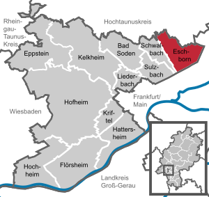
Eschborn
Town in Hesse, Germany
Distance: Approx. 279 meters
Latitude and longitude: 50.14361111,8.57
Eschborn (German pronunciation: [ˈɛʃbɔʁn] ) is a town in the Main-Taunus district, Hesse, Germany. It is part of the Frankfurt Rhein-Main urban area and has a population of 21,488 (2018). Eschborn is home to numerous corporations due to its proximity to Frankfurt and relatively low business tax rate.
1. FC Eschborn
German football club
Distance: Approx. 931 meters
Latitude and longitude: 50.14,8.56055556
1. FC Eschborn was a German association football club which played in Eschborn, a town close to Frankfurt, Hesse.

Schwalbach am Taunus
Town in Hesse, Germany
Distance: Approx. 2615 meters
Latitude and longitude: 50.15,8.53333333
Schwalbach am Taunus, a town in the Main-Taunus-Kreis district, in Hesse, Germany, population about 14,000, is a dormitory town to Frankfurt, situated some 11 km east of Schwalbach. There is evidence of human habitation dating back to Neolithic times, and recorded history going back to 781 AD. Until the end of the Second World War, it was a farming village, but in the post-war era it expanded rapidly and became economically linked to Frankfurt. Schwalbach was granted Gemeinde (municipal) status in 1970.

Steinbach (Taunus)
Town in Hesse, Germany
Distance: Approx. 2298 meters
Latitude and longitude: 50.16666667,8.56666667
Steinbach is a town in the Hochtaunuskreis that borders Frankfurt am Main to the east. Other neighbouring towns are Oberursel, Kronberg im Taunus and Eschborn. It is in the German state of Hesse.

Sulzbach, Hesse
Municipality in Hesse, Germany
Distance: Approx. 2945 meters
Latitude and longitude: 50.13333333,8.53333333
Sulzbach is a municipality in the Main-Taunus district, in Hesse, Germany and part of the Frankfurt Rhein-Main urban area.

Arboretum Main-Taunus
Distance: Approx. 2076 meters
Latitude and longitude: 50.135,8.54611111
The Arboretum Main-Taunus is an arboretum on an area of 76 hectares (190 acres) located southwest of Eschborn, Hesse, Germany. The arboretum lies close to Frankfurt am Main.
Sauerbornsbach
River in Germany
Distance: Approx. 2368 meters
Latitude and longitude: 50.1478,8.5364
Sauerbornsbach is a small river of Hesse, Germany. The upper course of the Sauerbornsbach is sometimes called Hollerbornbach, sometimes the Hollerbornbach is considered as the right and the Rentbach as the left headstream of the Sauerbornsbach. At the Sauerbornsbach's confluence with the Waldbach in Schwalbach am Taunus, the Schwalbach is formed.
Schwalbach (Sulzbach)
River in Germany
Distance: Approx. 2802 meters
Latitude and longitude: 50.12888889,8.54083333
Schwalbach is a river of Hesse, Germany. It is formed in Schwalbach am Taunus at the confluence of the rivers Sauerbornsbach and Waldbach. It is a left tributary of the Sulzbach, into which it flows near Sulzbach.
Waldbach (Schwalbach)
River in Hesse, Germany
Distance: Approx. 2368 meters
Latitude and longitude: 50.1478,8.5364
Waldbach is a river of Hesse, Germany. At its confluence with the Sauerbornsbach in Schwalbach am Taunus, the Schwalbach is formed.

Niederhöchstadt station
Railway station in Eschborn, Germany
Distance: Approx. 1789 meters
Latitude and longitude: 50.1538886,8.5475564
Niederhöchstadt station is a junction station in the Niederhöchstadt district of the town of Eschborn in the German state of Hesse. The stations of Eschborn and Eschborn Süd are nearby. Just north-west of the station the Limes Railway to Bad Soden separates from the Kronberg Railway to Kronberg.

St. Pankratius, Schwalbach
Church in Hesse, Germany
Distance: Approx. 2439 meters
Latitude and longitude: 50.14951,8.53572
The Church of St. Pankratius is a parish church of the Roman Catholic parish of Schwalbach am Taunus, Hesse, Germany. It is also used as a concert venue.

Nordwestkreuz Frankfurt
Road junction
Distance: Approx. 2036 meters
Latitude and longitude: 50.13416667,8.59111111
The Nordwestkreuz Frankfurt is a cloverleaf interchange in Frankfurt. Here, the Bundesautobahn 5 (Hattenbacher Dreieck - Frankfurt am Main - Basel) and the Bundesautobahn 66 (Wiesbaden - Fulda) intersect. Roadways and bridges to L3005 from Rödelheim to Eschborn are also integrated into the interchange.
Weather in this IP's area
overcast clouds
8 Celsius
7 Celsius
7 Celsius
10 Celsius
1025 hPa
86 %
1025 hPa
1009 hPa
10000 meters
2.57 m/s
80 degree
100 %
07:29:36
16:49:38


