Country:
Region:
City:
Latitude and Longitude:
Time Zone:
Postal Code:
IP information under different IP Channel
ip-api
Country
Region
City
ASN
Time Zone
ISP
Blacklist
Proxy
Latitude
Longitude
Postal
Route
Luminati
Country
Region
be
City
berlin
ASN
Time Zone
Europe/Berlin
ISP
Vodafone GmbH
Latitude
Longitude
Postal
IPinfo
Country
Region
City
ASN
Time Zone
ISP
Blacklist
Proxy
Latitude
Longitude
Postal
Route
db-ip
Country
Region
City
ASN
Time Zone
ISP
Blacklist
Proxy
Latitude
Longitude
Postal
Route
ipdata
Country
Region
City
ASN
Time Zone
ISP
Blacklist
Proxy
Latitude
Longitude
Postal
Route
Popular places and events near this IP address

Spandau
Borough of Berlin in Germany
Distance: Approx. 3504 meters
Latitude and longitude: 52.55,13.2
Spandau (German: [ˈʃpandaʊ̯] ) is the westernmost of the 12 boroughs (Bezirke) of Berlin, situated at the confluence of the Havel and Spree rivers and extending along the western bank of the Havel. It is the smallest borough by population, but the fourth largest by land area.

Spandau Citadel
Well-preserved Renaissance military structure in Berlin
Distance: Approx. 4672 meters
Latitude and longitude: 52.54138889,13.21222222
The Spandau Citadel (German: Zitadelle Spandau) is a fortress in Berlin, Germany, one of the best-preserved Renaissance military structures of Europe. Built from 1559–94 atop a medieval fort on an island near the meeting of the Havel and the Spree, it was designed to protect the town of Spandau, which is now part of Berlin. In recent years it has been used as a museum and has become a popular tourist spot.
Altstadt Spandau (Berlin U-Bahn)
Station of the Berlin U-Bahn
Distance: Approx. 4811 meters
Latitude and longitude: 52.53888889,13.20638889
Altstadt Spandau is a station in the Spandau district of Berlin, on that city's U-Bahn line U7. It takes its name from the Altstadt Spandau, the historic central area of the former independent city of Spandau. The station was opened on 1 October 1984 (architect R.G.Rümmler) with the line's extension from Rohrdamm to Rathaus Spandau.

Altstadt Spandau
Distance: Approx. 4811 meters
Latitude and longitude: 52.53888889,13.20638889
Altstadt Spandau is the historic centre (old town) of the Spandau borough in the western suburbs of Berlin, situated on the right bank of the Havel river by its confluence with the Spree tributary. It arose near the site of a former Slavic gord during the German eastward expansion (Ostsiedlung) in the early 13th century. A castle at Spandowe, erected on a Havel island to secure the eastern borderlands of the Margraviate of Brandenburg, was already documented in an 1197 deed issued by the Ascanian margrave Otto II. The city itself was first mentioned on 7 March 1232, when the Spandau citizens were vested with further privileges by the Brandenburg margraves John I and Otto III. A first church is documented in 1240; the present-day Saint Nicholas Church was built in the late 14th century.

Spandau (locality)
Quarter of Berlin in Germany
Distance: Approx. 5061 meters
Latitude and longitude: 52.53611111,13.20333333
Spandau (German: [ˈʃpandaʊ̯] ) is a locality (Ortsteil) of Berlin in the homonymous borough (Bezirk) of Spandau. The historic city is situated, for the most part, on the western banks of the Havel river. As of 2020 the estimated population of Spandau was 39,653.

Hakenfelde
Quarter of Berlin in Germany
Distance: Approx. 527 meters
Latitude and longitude: 52.57777778,13.18083333
Hakenfelde (German pronunciation: [ˈhaːkn̩ˌfɛldə] ) is a German locality (Ortsteil) of Berlin in the borough (Bezirk) of Spandau.

Falkenhagener Feld
Quarter of Berlin in Germany
Distance: Approx. 3789 meters
Latitude and longitude: 52.54694444,13.17777778
Falkenhagener Feld (German pronunciation: [ˈfalkŋ̍ˌhaːɡənɐ ˈfɛlt] ) is a German locality (Ortsteil) of Berlin in the borough (Bezirk) of Spandau.

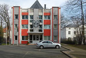
Embassy of Madagascar, Falkensee
Distance: Approx. 4553 meters
Latitude and longitude: 52.57277778,13.12111111
The Embassy of Madagascar in Falkensee is the diplomatic representation of Madagascar in Germany. They also represent Madagascan interests in Austria, the Czech Republic, Estonia, Denmark, Hungary, Lithuania, Poland, and Iceland. The chancery is located on the Seepromenade 92 on the banks of the Falkenhagener See in the town of Falkensee, Brandenburg, just outside of Berlin.

Hakenfelde Prison
Prison in Germany
Distance: Approx. 2066 meters
Latitude and longitude: 52.56916667,13.21138889
Hakenfelde Prison (German: Justizvollzugsanstalt Hakenfelde, JVA Hakenfelde) is a low-security prison in Hakenfelde in Berlin, operated by the State of Berlin Department of Corrections. It was opened on 1 March 1978 in what was then West Berlin, and was originally a branch of Düppel Prison. It became an independent correctional institution in 1991.

Spandau Synagogue
Destroyed Orthodox synagogue in Berlin, Germany
Distance: Approx. 5045 meters
Latitude and longitude: 52.53694444,13.20777778
The Spandau Synagogue (German: Synagoge Spandau) was a former Orthodox Jewish congregation and synagogue, located at 12 Lindenufer, in the Old Town area of Spandau, Berlin, Germany. Also known as Spandauer Vereinssynagoge (translated as Spandau private synagogue), the synagogue was built in 1894–95 and destroyed during Kristallnacht on 9 November 1938 when it was set on fire. The ruins were removed, probably in 1942.
Karlslust dance hall fire
Distance: Approx. 1641 meters
Latitude and longitude: 52.56711111,13.19733889
The Karlslust dance hall fire (also known as Loebel's Restaurant fire) occurred on 8 February 1947 in Hakenfelde, a locality of Spandau in what was then the British sector of Berlin. With its death toll of 80 to 88, it marks possibly the worst fire disaster in Germany since the Second World War. The death toll is today considered to be 81: 80 guests and the owner of the restaurant, Julius Loebel, who died while attempting to save a cashbox.

St. Marien am Behnitz
Catholic church in Spandau, Germany
Distance: Approx. 4817 meters
Latitude and longitude: 52.5391,13.2079
St. Marien am Behnitz is the second-oldest Catholic church in the area of Berlin, Germany, after St. Hedwig's Cathedral.
Weather in this IP's area
overcast clouds
5 Celsius
4 Celsius
4 Celsius
7 Celsius
1028 hPa
86 %
1028 hPa
1022 hPa
10000 meters
1.79 m/s
3.13 m/s
68 degree
100 %
07:18:58
16:23:19
