176.94.203.36 - IP Lookup: Free IP Address Lookup, Postal Code Lookup, IP Location Lookup, IP ASN, Public IP
Country:
Region:
City:
Location:
Time Zone:
Postal Code:
IP information under different IP Channel
ip-api
Country
Region
City
ASN
Time Zone
ISP
Blacklist
Proxy
Latitude
Longitude
Postal
Route
Luminati
Country
Region
he
City
fulda
ASN
Time Zone
Europe/Berlin
ISP
Vodafone GmbH
Latitude
Longitude
Postal
IPinfo
Country
Region
City
ASN
Time Zone
ISP
Blacklist
Proxy
Latitude
Longitude
Postal
Route
IP2Location
176.94.203.36Country
Region
bayern
City
herzogenaurach
Time Zone
Europe/Berlin
ISP
Language
User-Agent
Latitude
Longitude
Postal
db-ip
Country
Region
City
ASN
Time Zone
ISP
Blacklist
Proxy
Latitude
Longitude
Postal
Route
ipdata
Country
Region
City
ASN
Time Zone
ISP
Blacklist
Proxy
Latitude
Longitude
Postal
Route
Popular places and events near this IP address

Herzogenaurach
Town in Bavaria, Germany
Distance: Approx. 340 meters
Latitude and longitude: 49.57,10.88194444
Herzogenaurach (German: [hɛʁt͡soːɡn̩ˈʔaʊʁax] ; Mainfränkisch: Herziaura) is a town in the district of Erlangen-Höchstadt, in Bavaria, Germany. It is home to two major international sporting goods companies, Adidas and Puma, and Schaeffler Group, a car parts manufacturer.
Kosbach
Distance: Approx. 4961 meters
Latitude and longitude: 49.6,10.93333333
Kosbach is a village on the outskirts of Erlangen, Germany. The village is known locally for its own Kirchweih festival, the Kosbacher Karpfen Kirchweih, which is a fest or celebration at which carp is consumed en masse. The village is surrounded by carp ponds.
Vach
Distance: Approx. 7413 meters
Latitude and longitude: 49.52611111,10.96527778
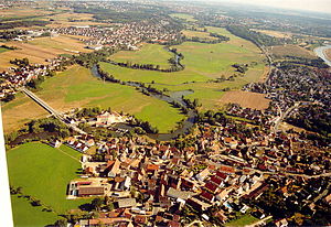
Vach is a district in the city of Fürth, Germany. Originally a separate town, it was incorporated into Fürth in 1972. It is first mentioned in documents concerning Gundekar II of Eichstätt in 1059.
Weisendorf
Municipality in Bavaria, Germany
Distance: Approx. 6597 meters
Latitude and longitude: 49.61666667,10.83333333
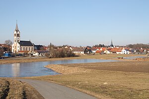
Weisendorf is a municipality in the district of Erlangen-Höchstadt, in Bavaria, Germany. It belongs to the administrative region of Middle Franconia.
Aurachtal
Municipality in Bavaria, Germany
Distance: Approx. 4134 meters
Latitude and longitude: 49.58333333,10.83333333
Aurachtal is a municipality in the district of Erlangen-Höchstadt, in Bavaria, Germany.

Großenseebach
Municipality in Bavaria, Germany
Distance: Approx. 7082 meters
Latitude and longitude: 49.63138889,10.87722222
Großenseebach is a village in the district of Erlangen-Höchstadt in Bavaria in Germany.

Obermichelbach
Municipality in Bavaria, Germany
Distance: Approx. 4468 meters
Latitude and longitude: 49.53333333,10.91666667
Obermichelbach is a municipality in the district of Fürth in Bavaria in Germany.

Tuchenbach
Municipality in Bavaria, Germany
Distance: Approx. 4092 meters
Latitude and longitude: 49.53333333,10.86666667
Tuchenbach is a municipality in the district of Fürth in Bavaria in Germany.
Veitsbronn
Municipality in Bavaria, Germany
Distance: Approx. 5874 meters
Latitude and longitude: 49.51666667,10.86666667
Veitsbronn is a municipality in the district of Fürth in Bavaria in Germany.
Aurach (Regnitz, Mittelfranken)
River in Germany
Distance: Approx. 7077 meters
Latitude and longitude: 49.5712,10.9834
There exists also another river named Aurach that is a tributary of the Regnitz, see Aurach (Regnitz, Oberfranken). For other uses, see Aurach (disambiguation). Aurach (German pronunciation: [ˈaʊ̯ʁax] ; also: Mittlere Aurach) is a river in Bavaria, Germany.
Gründlach
River in Germany
Distance: Approx. 7194 meters
Latitude and longitude: 49.5429,10.9773
Gründlach is a river of Bavaria, Germany. It flows into the Regnitz south of Erlangen.
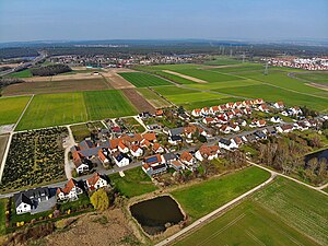
Häusling (Erlangen)
Village in Middle Franconia, Bavaria
Distance: Approx. 4163 meters
Latitude and longitude: 49.58888889,10.93333333
Häusling is a village in the city of Erlangen (Middle Franconia, Bavaria). Its resident population was 203 in 2020.
Weather in this IP's area
broken clouds
2 Celsius
-2 Celsius
2 Celsius
3 Celsius
1024 hPa
89 %
1024 hPa
987 hPa
10000 meters
4.63 m/s
290 degree
75 %

