Country:
Region:
City:
Latitude and Longitude:
Time Zone:
Postal Code:
IP information under different IP Channel
ip-api
Country
Region
City
ASN
Time Zone
ISP
Blacklist
Proxy
Latitude
Longitude
Postal
Route
Luminati
Country
Region
he
City
kelkheim
ASN
Time Zone
Europe/Berlin
ISP
Vodafone GmbH
Latitude
Longitude
Postal
IPinfo
Country
Region
City
ASN
Time Zone
ISP
Blacklist
Proxy
Latitude
Longitude
Postal
Route
db-ip
Country
Region
City
ASN
Time Zone
ISP
Blacklist
Proxy
Latitude
Longitude
Postal
Route
ipdata
Country
Region
City
ASN
Time Zone
ISP
Blacklist
Proxy
Latitude
Longitude
Postal
Route
Popular places and events near this IP address
Weser
River in Germany
Distance: Approx. 4492 meters
Latitude and longitude: 53.53555556,8.56555556
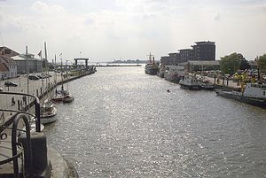
The Weser (pronounced [ˈveːzɐ] ) is a river of Lower Saxony in north-west Germany. It begins at Hannoversch Münden through the confluence of the Werra and Fulda. It passes through the Hanseatic city of Bremen.

Battle of Idistaviso
Battle between Roman legions and Germanic peoples in 16 AD
Distance: Approx. 4492 meters
Latitude and longitude: 53.53555556,8.56555556
The Battle of the Weser River, sometimes known as the First Battle of Minden or Battle of Idistaviso, was fought in 16 AD between Roman legions commanded by Roman Emperor Tiberius's heir and adopted son, Germanicus, and an alliance of Germanic peoples, commanded by Arminius. The battle marked the end of a three-year series of campaigns by Germanicus in Germania.

Bremerhaven Radar Tower
Distance: Approx. 4540 meters
Latitude and longitude: 53.53861111,8.58
The Bremerhaven Radar Tower is a 106-metre reinforced concrete tower located in Bremerhaven, Germany. The radar tower, which was constructed between 1962 and 1965, accommodates numerous transmitting plants for maritime radio purposes, in addition to its radar equipment. A viewing platform is situated at the 60 metre level, and is accessible to the public.

German Maritime Museum
Maritime museum in Bremerhaven, Germany
Distance: Approx. 4732 meters
Latitude and longitude: 53.54,8.57694444
The German Maritime Museum (German: Deutsches Schifffahrtsmuseum (DSM)) is a museum in Bremerhaven, Germany. It is part of the Gottfried Wilhelm Leibniz Scientific Community. The main museum building was opened on 5 September 1975 by then-president of Germany Walter Scheel, though scientific work already had started in 1971.

Bremerhaven Hauptbahnhof
Railway station in Geestemünde, Germany
Distance: Approx. 4086 meters
Latitude and longitude: 53.534958,8.599538
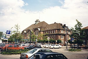
Bremerhaven Hauptbahnhof is a railway station in the city of Bremerhaven in northwestern Germany. It is the main railway hub for the city, offering regional connections to Bremen, Osnabrück, Cuxhaven, Bremervörde and Buxtehude. Museal services on the line to Bad Bederkesa also call at the station during weekends in summer.

Bremerhaven-Wulsdorf station
Railway station in Wulsdorf, Germany
Distance: Approx. 1718 meters
Latitude and longitude: 53.50854,8.612131
Bremerhaven-Wulsdorf is a railway station on the Bremen–Bremerhaven line in the Wulsdorf district of the city of Bremerhaven, Germany.

Bremen cog
Wreck of a cog in the German Maritime Museum in Bremerhaven
Distance: Approx. 4719 meters
Latitude and longitude: 53.5399,8.5771
The Bremen cog is a well-preserved wreck of a cog dated to 1380, found in 1962 in Bremen. Today, it is displayed at the German Maritime Museum in Bremerhaven as one of the main features. Three nearly identical replicas of this cog have been built: Ubena von Bremen, Hansekogge, and Roland von Bremen.

Carlsburg, Weser
Distance: Approx. 4659 meters
Latitude and longitude: 53.54,8.58333
Carlsburg (also Carolus-Stadt or Carolsburg) was a 17th-century fortified town in Swedish Bremen-Verden at the confluence of the Weser and Geeste rivers, at the site of modern Bremerhaven, Germany. Planned to compete with Bremen, the settlement did not prosper. After the Thirty Years' War, the Swedish Empire gained the Lower Saxon Prince-Archbishopric of Bremen as a Swedish dominion.
Geeste (river)
River in Germany
Distance: Approx. 4397 meters
Latitude and longitude: 53.5375,8.58194444
The Geeste is a river in Lower Saxony, Germany. It rises near the village of Hipstedt and falls into the Weser at Bremerhaven after a course of some 40 km (25 mi). It is the Weser's lowest tributary.
German submarine U-828
German World War II submarine
Distance: Approx. 3924 meters
Latitude and longitude: 53.53333333,8.58333333
German submarine U-828 was a Type VIIC/41 U-boat of Nazi Germany's Kriegsmarine during the Second World War. She saw no combat and was scuttled at the end of the war. U-828 was ordered on 8 June 1942 and laid down on 16 August 1943 at Schichau-Werke, Danzig, West Prussia.

Stadttheater Bremerhaven
Distance: Approx. 4755 meters
Latitude and longitude: 53.5407,8.5813
The Stadttheater Bremerhaven (Bremerhaven municipal theatre) is a theatre in Bremerhaven, Germany. Founded in 1867, it serves three genres: opera and other musical theatre, spoken plays, and dance. A theatre built on the present site in 1911 was largely destroyed in World War II; a new house was built in 1952 which incorporated the surviving Jugendstil facade.
German submarine U-1223
German World War II submarine
Distance: Approx. 3924 meters
Latitude and longitude: 53.53333333,8.58333333
German submarine U-1223 was a Type IXC/40 U-boat built for Nazi Germany's Kriegsmarine during World War II.
Weather in this IP's area
overcast clouds
6 Celsius
4 Celsius
6 Celsius
7 Celsius
1026 hPa
92 %
1026 hPa
1026 hPa
10000 meters
2.67 m/s
3.65 m/s
127 degree
100 %
07:40:35
16:38:28

