Country:
Region:
City:
Latitude and Longitude:
Time Zone:
Postal Code:
IP information under different IP Channel
ip-api
Country
Region
City
ASN
Time Zone
ISP
Blacklist
Proxy
Latitude
Longitude
Postal
Route
Luminati
Country
Region
he
City
kelkheim
ASN
Time Zone
Europe/Berlin
ISP
Vodafone GmbH
Latitude
Longitude
Postal
IPinfo
Country
Region
City
ASN
Time Zone
ISP
Blacklist
Proxy
Latitude
Longitude
Postal
Route
db-ip
Country
Region
City
ASN
Time Zone
ISP
Blacklist
Proxy
Latitude
Longitude
Postal
Route
ipdata
Country
Region
City
ASN
Time Zone
ISP
Blacklist
Proxy
Latitude
Longitude
Postal
Route
Popular places and events near this IP address

Burg bei Magdeburg
Town in Saxony-Anhalt, Germany
Distance: Approx. 466 meters
Latitude and longitude: 52.2725,11.855
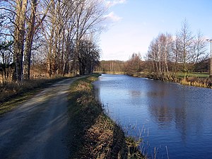
Burg (also known as Burg bei Magdeburg to distinguish from other places with the same name) is a town of about 22,400 inhabitants on the Elbe–Havel Canal in northeastern Germany, 25 km (16 mi) northeast of Magdeburg. It is the capital of the Jerichower Land district in the state of Saxony-Anhalt. The town is known for its mediaeval churches and towers.
Burg AM transmitter
Distance: Approx. 3646 meters
Latitude and longitude: 52.28583333,11.89805556
The AM transmitter in Burg, near Magdeburg, Germany, is a huge facility for longwave and mediumwave broadcasting. Its most dominant constructions are a 324-metre guyed radio mast and two 210 metre guyed steel tube masts. The 324-metre-high mast is a grounded construction with triangular cross section.
Ohre
River in Germany
Distance: Approx. 7033 meters
Latitude and longitude: 52.31111111,11.76527778
The Ohre is a river in northern Germany, left tributary to the Elbe. Its total length is 103 kilometres (64 mi). Its source is north of Wolfsburg, in Lower Saxony.
Biederitz-Möser
Distance: Approx. 7145 meters
Latitude and longitude: 52.21666667,11.8
Biederitz-Möser was a Verwaltungsgemeinschaft ("collective municipality") in the Jerichower Land district, in Saxony-Anhalt, Germany. It was situated east of Magdeburg. The seat of the Verwaltungsgemeinschaft was in Möser.

Rogätz
Municipality in Saxony-Anhalt, Germany
Distance: Approx. 7345 meters
Latitude and longitude: 52.31666667,11.76666667
Rogätz is a municipality in the Börde district in Saxony-Anhalt, Germany. It is located on the left bank of the river Elbe, and is linked to Schartau by the Rogätz Ferry.

Möser
Municipality in Saxony-Anhalt, Germany
Distance: Approx. 7145 meters
Latitude and longitude: 52.21666667,11.8
Möser is a municipality in the Jerichower Land district, in Saxony-Anhalt, Germany. On 1 January 2010, the municipality (Einheitsgemeinde) of Möser was formed by the merger of six former municipalities.

Pietzpuhl
Ortsteil of Möser in Saxony-Anhalt, Germany
Distance: Approx. 6339 meters
Latitude and longitude: 52.21666667,11.85
Pietzpuhl is a village and a former municipality in the Jerichower Land district, in Saxony-Anhalt, Germany. Since 1 January 2010, it is part of the municipality Möser.

Reesen
Stadtteil of Burg bei Magdeburg in Saxony-Anhalt, Germany
Distance: Approx. 5885 meters
Latitude and longitude: 52.28333333,11.93333333
Reesen is a village and a former municipality in the Jerichower Land district, in Saxony-Anhalt, Germany. Since 1 July 2009, it is part of the town Burg bei Magdeburg.
Schermen
Ortsteil of Möser in Saxony-Anhalt, Germany
Distance: Approx. 4977 meters
Latitude and longitude: 52.23333333,11.81666667
Schermen is a village and a former municipality in the Jerichower Land district, in Saxony-Anhalt, Germany. Since 1 January 2010, it is part of the municipality Möser.

Rogätz Ferry
Distance: Approx. 6910 meters
Latitude and longitude: 52.313457,11.770585
The Rogätz Ferry, also known as the Schartau Rogätz Ferry, is a ferry across the Elbe river between Schartau and Rogätz in Saxony-Anhalt, Germany.

Ihle
River in Germany
Distance: Approx. 2141 meters
Latitude and longitude: 52.29111111,11.86138889
The Ihle is a river of Saxony-Anhalt, Germany. A former tributary of the Elbe, it discharges into the Elbe–Havel Canal (and its predecessor Ihlekanal) since the 1860s.

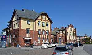
Burg (bei Magdeburg) station
Railway station in Burg, Germany
Distance: Approx. 530 meters
Latitude and longitude: 52.27446,11.84075
Burg (bei Magdeburg) station is a railway station in the municipality of Burg bei Magdeburg, located in the Jerichower Land district in Saxony-Anhalt, Germany.
Weather in this IP's area
overcast clouds
5 Celsius
3 Celsius
5 Celsius
6 Celsius
1027 hPa
72 %
1027 hPa
1022 hPa
10000 meters
2.21 m/s
2.53 m/s
111 degree
100 %
07:23:17
16:29:43

