Country:
Region:
City:
Latitude and Longitude:
Time Zone:
Postal Code:
IP information under different IP Channel
ip-api
Country
Region
City
ASN
Time Zone
ISP
Blacklist
Proxy
Latitude
Longitude
Postal
Route
Luminati
Country
ASN
Time Zone
Europe/Berlin
ISP
KAAL TECH CO., LIMITED
Latitude
Longitude
Postal
IPinfo
Country
Region
City
ASN
Time Zone
ISP
Blacklist
Proxy
Latitude
Longitude
Postal
Route
db-ip
Country
Region
City
ASN
Time Zone
ISP
Blacklist
Proxy
Latitude
Longitude
Postal
Route
ipdata
Country
Region
City
ASN
Time Zone
ISP
Blacklist
Proxy
Latitude
Longitude
Postal
Route
Popular places and events near this IP address

Oberschlettenbach
Municipality in Rhineland-Palatinate, Germany
Distance: Approx. 3978 meters
Latitude and longitude: 49.14583333,7.87305556
Oberschlettenbach is a municipality in Südliche Weinstraße district, in Rhineland-Palatinate, western Germany.
Vorderweidenthal
Municipality in Rhineland-Palatinate, Germany
Distance: Approx. 2537 meters
Latitude and longitude: 49.12805556,7.88305556
Vorderweidenthal is a municipality in Südliche Weinstraße district, in Rhineland-Palatinate, Western Germany.

Bruchweiler-Bärenbach
Municipality in Rhineland-Palatinate, Germany
Distance: Approx. 4229 meters
Latitude and longitude: 49.11333333,7.80166667
Bruchweiler-Bärenbach is a municipality in Südwestpfalz district, in Rhineland-Palatinate, western Germany.

Bundenthal
Municipality in Rhineland-Palatinate, Germany
Distance: Approx. 4105 meters
Latitude and longitude: 49.09555556,7.80861111
Bundenthal is a municipality in Südwestpfalz district, in Rhineland-Palatinate, western Germany.

Busenberg
Municipality in Rhineland-Palatinate, Germany
Distance: Approx. 3273 meters
Latitude and longitude: 49.13138889,7.82694444
Busenberg is a municipality in Südwestpfalz district, in Rhineland-Palatinate, western Germany.

Erlenbach bei Dahn
Municipality in Rhineland-Palatinate, Germany
Distance: Approx. 223 meters
Latitude and longitude: 49.1125,7.86194444
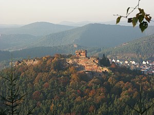
Erlenbach bei Dahn is a municipality in Südwestpfalz district, in Rhineland-Palatinate, western Germany. Above the village is Berwartstein Castle on one side of the Erlenbach stream and the outwork Little France on the other.

Niederschlettenbach
Municipality in Rhineland-Palatinate, Germany
Distance: Approx. 3000 meters
Latitude and longitude: 49.08598,7.84509
Niederschlettenbach is a municipality in Südwestpfalz district, in Rhineland-Palatinate, western Germany.

Drachenfels Castle (Wasgau)
Distance: Approx. 2598 meters
Latitude and longitude: 49.122,7.828
Drachenfels Castle is a ruined hill castle near the village of Busenberg in the state of Rhineland-Palatinate. It lies within the German half of the Wasgau region, the southern part of the Palatinate Forest.
Nestelberg (Wasgau)
Distance: Approx. 1254 meters
Latitude and longitude: 49.1,7.85778
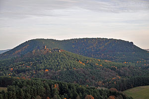
The Nestelberg is a 402-metre-high hill in the Dahner Felsenland in the Wasgau, a region that comprises the southern part of the Palatine Forest in the German state of Rhineland-Palatinate and the northern part of the French Vosges in the departments of Bas-Rhin and Moselle.
Little France (castle)
Distance: Approx. 728 meters
Latitude and longitude: 49.105,7.8628
Little France (German: Klein-Frankreich or Kleinfrankreich) is the ruin of a hillside fort in the German region of Dahner Felsenland. It lies above the village of Erlenbach bei Dahn in the county of Südwestpfalz in the state of Rhineland-Palatinate.

Heidenberg (Wasgau Felsenland)
Distance: Approx. 1799 meters
Latitude and longitude: 49.11555556,7.83583333
The Heidenberg is a 420-metre-high hill in the southeastern Wasgau, the region that covers the southern part of the Palatinate Forest in Germany and the northern Vosges in France. The Heidenberg's north flank is in the parish of Busenberg, its south flank in the parish of Erlenbach bei Dahn. On its western slopes is the Buchkammerfels, a striking rock formation in which, in a rock spur with vertical sides, there is what is suspected to be the site of a castle that consisted of inaccessible rock chambers (known as Buchkammern or Heidenkammern).
Reisbach (Palatinate)
River in Germany
Distance: Approx. 3899 meters
Latitude and longitude: 49.09127899,7.90361166
The Reisbach is a 5.6-kilometre (3.5 mi) left bank tributary of the Wieslauter in the eastern Wasgau, the southern part of the Palatine Forest in Germany and northern part of the Vosges in France.
Weather in this IP's area
overcast clouds
6 Celsius
6 Celsius
5 Celsius
8 Celsius
1029 hPa
97 %
1029 hPa
1000 hPa
10000 meters
0.77 m/s
1.04 m/s
345 degree
85 %
07:37:22
16:48:55

