Country:
Region:
City:
Latitude and Longitude:
Time Zone:
Postal Code:
IP information under different IP Channel
ip-api
Country
Region
City
ASN
Time Zone
ISP
Blacklist
Proxy
Latitude
Longitude
Postal
Route
Luminati
Country
Region
l
City
dublin
ASN
Time Zone
Europe/Dublin
ISP
Liberty Global B.V.
Latitude
Longitude
Postal
IPinfo
Country
Region
City
ASN
Time Zone
ISP
Blacklist
Proxy
Latitude
Longitude
Postal
Route
db-ip
Country
Region
City
ASN
Time Zone
ISP
Blacklist
Proxy
Latitude
Longitude
Postal
Route
ipdata
Country
Region
City
ASN
Time Zone
ISP
Blacklist
Proxy
Latitude
Longitude
Postal
Route
Popular places and events near this IP address

The Square Tallaght
Large suburban retail facility in Tallaght southwest of Dublin
Distance: Approx. 653 meters
Latitude and longitude: 53.28694444,-6.37166667
The Square Tallaght is a shopping centre located in Tallaght, Dublin, Ireland, opened in 1990. It is located 10 minutes from junction 11 of the M50 motorway on the Belgard Road (the R113 road) and the N81 road. The centre comprises 53,000 m2 of retail space, spread across three levels, and as of 2016 has up to 163 stores.

Tallaght Stadium
Association football stadium in Tallaght, Ireland
Distance: Approx. 281 meters
Latitude and longitude: 53.28352,-6.37371
Tallaght Stadium (Irish: Staid Thamhlachta) is an association football stadium in the Republic of Ireland based in Tallaght, South Dublin. The club Shamrock Rovers originally announced details of the stadium in July, 1996. The stadium is now owned and operated by South Dublin County Council with Shamrock Rovers as the anchor tenants.
Thomas Davis GAA
Sports club in County Dublin, Ireland
Distance: Approx. 1180 meters
Latitude and longitude: 53.272225,-6.3628
Thomas Davis (Irish: CLG Tomás Dáibhís) is a Gaelic Athletic Association club with extensive grounds and a clubhouse located on the Kiltipper Road in Tallaght, County Dublin, Ireland. Founded in 1888, Thomas Davis has a long association with Tallaght from the time when it was a small rural village in the countryside. The club motto is Nascann Dúshlán Daoine (A Challenge Unites People).

Tallaght University Hospital
Teaching hospital in Tallaght, Ireland
Distance: Approx. 1186 meters
Latitude and longitude: 53.29111111,-6.37861111
The Tallaght University Hospital (Irish: Ospidéal Ollscoile Thamhlachta) is a teaching hospital in County Dublin, Ireland. Its academic partner is the Trinity College Dublin. It is managed by Dublin Midlands Hospital Group.

Oldbawn
Suburban area within Tallaght, Dublin, Ireland
Distance: Approx. 461 meters
Latitude and longitude: 53.28333333,-6.36666667
Oldbawn (or Old Bawn, Irish: An Seanbhábhún) is a small suburban area now within Tallaght on Dublin's southside. Formerly a small village in its own right, it is situated between Sean Walsh Park and the River Dodder. A bawn is the defensive wall surrounding an Irish tower house.

Tallaght Castle
Former castle founded in the 14th century in Tallaght, Ireland
Distance: Approx. 1191 meters
Latitude and longitude: 53.2892,-6.3608
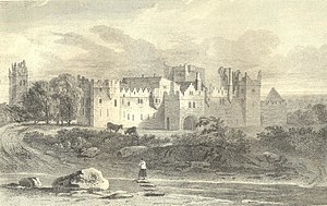
Tallaght Castle (also known as Tallaght House and formerly known as the Archiepiscopal Palace) was a castle in Kilnamanagh, Tallaght, County Dublin, Ireland. It dates from the 14th century. It became an official residence of the Church of Ireland Archbishop of Dublin until 1822.
Commission for Regulation of Utilities
Republic of Ireland's energy and water economic utility regulator
Distance: Approx. 949 meters
Latitude and longitude: 53.289538,-6.374483
The Commission for Regulation of Utilities (CRU, Irish: An Coimisiúin um Rialáil Fóntais), formerly known as the Commission for Energy Regulation (CER, Irish: An Coimisiún um Rialáil Fuinnimh), is Ireland's energy and water economic utility regulator.

County Hall, Tallaght
Municipal building in South Dublin, Ireland
Distance: Approx. 870 meters
Latitude and longitude: 53.2889,-6.3733
County Hall (Irish: Halla an Chontae, Tamhlacht) is a municipal building in Tallaght in the county of South Dublin, Ireland.
Murder of Vincent Parsons
Crime in Ireland, August 2019
Distance: Approx. 788 meters
Latitude and longitude: 53.28162,-6.38431
Vincent Parsons was a welder and father of two from Clondalkin who was assaulted in Tallaght and died two days later. He and his wife Claire had a daughter and son.

Hospital Luas stop
Tram stop in Dublin, Ireland
Distance: Approx. 1017 meters
Latitude and longitude: 53.28940014,-6.37887363
Hospital (Irish: Ospidéal Thamhlachta) is a stop on the Luas light-rail tram system in Dublin, Ireland. It opened in 2004 as a stop on the Red Line. The stop is located on a section of reserved track at the side of Cookstown Way in south-west Dublin, immediately outside Tallaght University Hospital.

Tallaght Luas stop
Tram stop in Dublin, Ireland
Distance: Approx. 725 meters
Latitude and longitude: 53.28748243,-6.37466749
Tallaght (; Irish: Tamhlacht) is a stop on the Luas light-rail tram system in Dublin, Ireland. It opened in 2004 as the terminus of the Red Line.
Civic Theatre (Tallaght)
Theatre in Tallaght, Ireland
Distance: Approx. 813 meters
Latitude and longitude: 53.2884,-6.3722
Dublin's Civic Theatre opened in March 1999, a project of South Dublin County Council and also grant aided by the Department of Arts, Heritage, Gaeltacht and the Islands. It is situated in Tallaght, Dublin as part of the town centre, close to The Square Shopping Centre. The theatre has two performance spaces, the main auditorium and the Loose End studio.
Weather in this IP's area
broken clouds
13 Celsius
12 Celsius
12 Celsius
13 Celsius
1026 hPa
86 %
1026 hPa
1014 hPa
10000 meters
2.06 m/s
90 degree
75 %
07:28:18
16:49:43