Country:
Region:
City:
Latitude and Longitude:
Time Zone:
Postal Code:
IP information under different IP Channel
ip-api
Country
Region
City
ASN
Time Zone
ISP
Blacklist
Proxy
Latitude
Longitude
Postal
Route
Luminati
Country
ASN
Time Zone
Europe/Warsaw
ISP
COIG S.A
Latitude
Longitude
Postal
IPinfo
Country
Region
City
ASN
Time Zone
ISP
Blacklist
Proxy
Latitude
Longitude
Postal
Route
db-ip
Country
Region
City
ASN
Time Zone
ISP
Blacklist
Proxy
Latitude
Longitude
Postal
Route
ipdata
Country
Region
City
ASN
Time Zone
ISP
Blacklist
Proxy
Latitude
Longitude
Postal
Route
Popular places and events near this IP address

Katowice Voivodeship
Former unit of administrative division
Distance: Approx. 667 meters
Latitude and longitude: 50.255583,19.020444
Katowice Voivodeship (Polish: województwo katowickie) can refer to one of two political entities in Poland: Katowice Voivodeship (1), initially "Silesian-Dabrowa Voivodeship" (Polish: województwo śląsko-dąbrowskie), was a unit of administrative division and local government in the years 1946–1975. It was superseded by Katowice Voivodeship (2), Częstochowa Voivodeship, Bielsko-Biała Voivodeship, and Opole Voivodeship. Its capital city was Katowice.

Silesian Voivodeship (1920–1939)
Former voivodeship of Poland
Distance: Approx. 947 meters
Latitude and longitude: 50.25,19
The Silesian Voivodeship (Polish: województwo śląskie; German: Woiwodschaft Schlesien) was an autonomous province (voivodeship) of the Second Polish Republic. The bulk of its territory had formerly belonged to the German/Prussian Province of Silesia and became part of the newly reborn Poland as a result of the 1921 Upper Silesia plebiscite, the Geneva Conventions, three Upper Silesian Uprisings, and the eventual partition of Upper Silesia between Poland, Germany and Czechoslovakia. The remainder had been the easternmost portion of Austrian Silesia (see Cieszyn Silesia) which was partitioned between Poland and Czechoslovakia following the collapse of Austria-Hungary, the Polish–Czechoslovak War and the Spa Conference of 1920.

Goldstein Palace
Palace in Poland
Distance: Approx. 525 meters
Latitude and longitude: 50.25916667,19.01305556
The Pałac Goldsteinów or Goldstein Palace is neo-Renaissance palace, which was built by two brothers, Abraham and Joseph Goldstein. It is located in Katowice, Silesia, Poland, at the west end of the city centre, at 50°15′33″N 19°0′47″E. The palace is representative for the building style of second part of the 1870s. Front elevations and interior staircases are decorated in typical neo-Renaissance ornamentation.

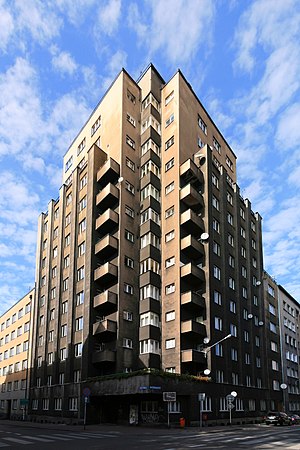
Drapacz Chmur
High-rise building in Katowice, Poland
Distance: Approx. 178 meters
Latitude and longitude: 50.25416667,19.01361111
Drapacz Chmur (English: Skyscraper) is a historical building in Katowice, Silesia, Poland. It was the second skyscraper built in post-World War I Poland. Finished in 1934 after five years of construction, it made pioneering Polish use of steel frame construction.

Great Synagogue (Katowice)
Destroyed synagogue in Katowice, Poland
Distance: Approx. 908 meters
Latitude and longitude: 50.26111111,19.01888889
The Great Synagogue (Polish: Synagoga Wielka w Katowicach; German: Große Synagoge in Kattowitz) was a former Jewish congregation and synagogue, that was located on Uferstrasse (contemporary Mickiewicza Street), in Katowice (Kattowitz), in the Silesian Voivodeship of Poland, in what was then the German Empire. Designed by Max Grünfeld in an eclectic mix of the Gothic Revival and Renaissance Revival styles, and completed in 1900, the synagogue served as a house of prayer until World War II when it was destroyed by Nazis by arson in early September 1939, during the invasion of Poland.
Katowice railway station
Railway station in Katowice, Poland
Distance: Approx. 611 meters
Latitude and longitude: 50.25833333,19.0175
Katowice railway station is a railway station in Katowice, Silesia, Poland, and the largest railway station in the Upper Silesian Industrial Region. Domestic and international trains connect at the station to most major cities in Europe; these are operated primarily by Polskie Koleje Państwowe. During 1972, Katowice railway station was officially completed, having been built as a replacement station for the city's old terminus, Katowice historic train station.

Cathedral of Christ the King, Katowice
Distance: Approx. 637 meters
Latitude and longitude: 50.25138889,19.01861111
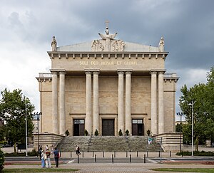
Archikatedra Chrystusa Króla w Katowicach (English: Archcathedral of Christ the King in Katowice) is a classicist and modernist archcathedral in Katowice-Śródmieście, Katowice, Poland. Constructed between 1927 and 1955, the Archcathedral of Christ the King is the largest archcathedral and cathedral in Poland, 120,000 metres cubed large. Construction began in the inter-war period and was funded by the autonomous Silesian Parliament (located within the Second Polish Republic).

Polish Radio Katowice
Radio station in Katowice
Distance: Approx. 745 meters
Latitude and longitude: 50.25305556,19.02138889
Polish Radio Katowice (Polish: Polskie Radio Katowice) is the largest regional station of Polish Radio. It was created in 1927. It can be received in the Silesian Voivodeship and bordering entities.

Roman Catholic Archdiocese of Katowice
Roman Catholic archdiocese in Poland
Distance: Approx. 709 meters
Latitude and longitude: 50.25055556,19.01888889
The Metropolitan Archdiocese of Katowice (Latin: Archidioecesis Metropolitae Katovicensis) is the Latin Metropolitan archdiocese of the Catholic Church in Poland. It is an ecclesiastical province in Western Poland.

3 Maja Street, Katowice
Distance: Approx. 728 meters
Latitude and longitude: 50.2596,19.0178
3 Maja Street in Katowice (3 May Street) is a street in the centre of Katowice. The street was built in the 19th century. During World War II the street was called Grundmannstraße, 1867−1922 Grundmannstraße, 1856−1867 Industriestraße.
Katowice historic railway station
Distance: Approx. 930 meters
Latitude and longitude: 50.25722222,19.02361111
Katowice historic railway station was the main railway station of Katowice, in the Silesia region of what is now Poland. Built in 1859 and reconstructed and expanded several times, it was judged obsolete after World War II, and in 1972 decommissioned and replaced by the newly built Katowice railway station. Three years later it was declared a National Monument.

Market Square, Katowice
Square in Katowice, Poland
Distance: Approx. 902 meters
Latitude and longitude: 50.25916667,19.02166667
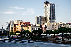
Market Square in Katowice (Polish: Rynek w Katowicach) is a central feature of the Śródmieście district in the city of Katowice, Poland. This market square, the main one in the city, dates to the late 19th century. It has been rebuilt several times, with the latest round of changes currently in progress.
Weather in this IP's area
few clouds
1 Celsius
-2 Celsius
0 Celsius
2 Celsius
1030 hPa
93 %
1030 hPa
995 hPa
10000 meters
2.91 m/s
7.49 m/s
93 degree
19 %
06:48:07
16:07:34

