176.29.169.141 - IP Lookup: Free IP Address Lookup, Postal Code Lookup, IP Location Lookup, IP ASN, Public IP
Country:
Region:
City:
Location:
Time Zone:
Postal Code:
ISP:
ASN:
language:
User-Agent:
Proxy IP:
Blacklist:
IP information under different IP Channel
ip-api
Country
Region
City
ASN
Time Zone
ISP
Blacklist
Proxy
Latitude
Longitude
Postal
Route
db-ip
Country
Region
City
ASN
Time Zone
ISP
Blacklist
Proxy
Latitude
Longitude
Postal
Route
IPinfo
Country
Region
City
ASN
Time Zone
ISP
Blacklist
Proxy
Latitude
Longitude
Postal
Route
IP2Location
176.29.169.141Country
Region
irbid
City
aydun
Time Zone
Asia/Amman
ISP
Language
User-Agent
Latitude
Longitude
Postal
ipdata
Country
Region
City
ASN
Time Zone
ISP
Blacklist
Proxy
Latitude
Longitude
Postal
Route
Popular places and events near this IP address
Gilead
Northern part of the region of Transjordan, also the name of several biblical figures
Distance: Approx. 4816 meters
Latitude and longitude: 32.55,35.85
Gilead or Gilad (UK: , US: ; Hebrew: גִּלְעָד Gilʿāḏ, Arabic: جلعاد, Ǧalʻād, Jalaad) is the ancient, historic, biblical name of the mountainous northern part of the region of Transjordan. The region is bounded in the west by the Jordan River, in the north by the deep ravine of the river Yarmouk and the region of Bashan, and in the southwest by what were known during antiquity as the "plains of Moab", with no definite boundary to the east. In some cases, "Gilead" is used in the Bible to refer to all the region east of the Jordan River.

Irbid
City in Irbid Governorate, Jordan
Distance: Approx. 4816 meters
Latitude and longitude: 32.55,35.85
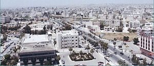
Irbid (Arabic: إِربِد), known in ancient times as Arabella or Arbela (Άρβηλα in Ancient Greek), is the capital and largest city of Irbid Governorate. It has the second-largest metropolitan population in Jordan after Amman, with a population of around 2,003,800. As a city, Irbid is Jordan's third-largest, after Amman and Zarqa.

Yarmouk University
Public university in Irbid, Jordan
Distance: Approx. 3378 meters
Latitude and longitude: 32.5375,35.85555556
Yarmouk University (Arabic: جامعة اليرموك), also abbreviated YU, is a comprehensive public and state supported university located near the city centre of Irbid in northern Jordan. Since its establishment in 1976, it has been at the forefront of Jordanian and Middle Eastern universities. The University consists of 15 faculties offering 52 bachelor's degrees, 64 master's degrees, and 18 PhD Programs in different disciplines.

Al-Husn
Town in Irbid Governorate, Jordan
Distance: Approx. 5440 meters
Latitude and longitude: 32.45833333,35.85833333
Al-Husn (Arabic: الحصن, also Romanized as Al Husn, Hisn and Husn) is a town in northern Jordan, located 65 km (40 mi) north of Amman, and about 7 km (4 mi) south of Irbid. It has a population of 35,085. The region has fertile soil which along with the moderate climate allows the growing of high quality crops.
Habaka
Town in Irbid Governorate, Jordan
Distance: Approx. 4567 meters
Latitude and longitude: 32.46666667,35.85
Habaka (Arabic: حَبَكا) is a small hill town in northern Jordan, located 75 km north of the capital Amman, and about 5 km south of Irbid. The region has a very fertile soil along with suitable climate allows the growing of a wide variety of high-quality crops. The main products are olives and grapes.

Al-Hassan Stadium
Multi-purpose stadium in Irbid, Jordan
Distance: Approx. 3383 meters
Latitude and longitude: 32.5375,35.86027778
Al-Hassan Stadium (Arabic: مَلعب الحَسن) is a multi-purpose stadium in Irbid, Jordan, located near Yarmouk University. It is currently used mostly for football matches. The stadium holds 12,000 people.

Johfiyeh
Village in Irbid Governorate, Jordan
Distance: Approx. 3544 meters
Latitude and longitude: 32.48916667,35.82638889
Johfiyeh (Arabic: جُحفية) also spelled Johfiyah, Juhfiyah or Juhfiyeh, is a historical village in northern Jordan, located 80 kilometers north of the capital Amman and about 7.5 km southwest of the city Irbid. It had a population of 4251 and the most populated family is Talafha. At the northern edge of the modern village is the archaeological site of Tell Johfiyeh with several more related sites, showing two main phases of settlement: Iron Age II and Byzantine-Umayyad.
Natifah
Town in Irbid Governorate, Jordan
Distance: Approx. 3594 meters
Latitude and longitude: 32.51916667,35.82194444
Natifah is a village in Jordan approximately 2 km south-west of Irbid.
Husn Camp
Palestinian refugee camp near Irbid in Jordan
Distance: Approx. 5722 meters
Latitude and longitude: 32.475,35.905
Husn Camp or Al-Husn Camp, known locally as Martyr Azmi el-Mufti camp, is a Palestinian refugee camp in Jordan. It is located near Al Husn, about 80 kilometres (50 mi) north of Amman. It was established in 1968 as an emergency camp to house 12,500 refugees who were displaced from the West Bank and the Gaza Strip during the 1967 Six-Day War.

Museum of Jordanian Heritage
Museum at Yarmouk University, Jordan
Distance: Approx. 3197 meters
Latitude and longitude: 32.535749,35.853812
The Museum of Jordanian Heritage (Arabic: متحف التراث الأردني) is part of the Faculty of Archeology and Anthropology at Yarmouk University. The museum also shows the stages of civilization development that Jordan witnessed during successive periods of time, focusing on cultural relations, contacts, population distribution, economic life, and various aspects of civilization.
Irbid Camp
Refugee camp in Irbid Governorate, Jordan
Distance: Approx. 4816 meters
Latitude and longitude: 32.55,35.85
Irbid Camp (Arabic: مخيم إربد) is one of the 10 officially recognized UNRWA Palestinian refugee camps in Jordan. It is located outside of Irbid. It was one of the four camps founded in Jordan to accommodate the refugees of the 1948 Palestinian expulsion and flight, the others being Jabal el-Hussein camp, Al-Wehdat refugee camp and Zarqa Camp.

Al-Hassan Hall
Indoor arena in Irbid, Jordan
Distance: Approx. 3269 meters
Latitude and longitude: 32.536334,35.861831
Al-Hassan Hall (Arabic: صالة الحسن) is an indoor arena located in Al-Hasan Sport City, Irbid, Jordan. The arena has a capacity of 2,000. It hosts indoor sporting events such as basketball, volleyball and handball, and has hosted the home matches of various Irbid-based clubs, such as Al-Ashrafieh, Al-Jalil, Shabab Bushra and Kafr Yuba.
Weather in this IP's area
overcast clouds
11 Celsius
9 Celsius
11 Celsius
11 Celsius
1021 hPa
43 %
1021 hPa
948 hPa
10000 meters
6.21 m/s
8.85 m/s
142 degree
100 %
