176.241.121.75 - IP Lookup: Free IP Address Lookup, Postal Code Lookup, IP Location Lookup, IP ASN, Public IP
Country:
 France
Region:
City:
Location:
Time Zone:
Postal Code:
ISP:
ASN:
language:
User-Agent:
Proxy IP:
Blacklist:
IP information under different IP Channel
ip-api
Country
Region
City
ASN
Time Zone
ISP
Blacklist
Proxy
Latitude
Longitude
Postal
Route
db-ip
Country
Region
City
ASN
Time Zone
ISP
Blacklist
Proxy
Latitude
Longitude
Postal
Route
IPinfo
Country
Region
City
ASN
Time Zone
ISP
Blacklist
Proxy
Latitude
Longitude
Postal
Route
IP2Location
176.241.121.75Country
frRegion
provence-alpes-cote-d'azur
City
saint-victoret
Time Zone
Europe/Paris
ISP
Language
User-Agent
Latitude
Longitude
Postal
ipdata
Country
Region
City
ASN
Time Zone
ISP
Blacklist
Proxy
Latitude
Longitude
Postal
Route
Popular places and events near this IP address

Vitrolles, Bouches-du-Rhône
Commune in Provence-Alpes-Côte d'Azur, France
Distance: Approx. 4650 meters
Latitude and longitude: 43.46,5.2486
Vitrolles (French pronunciation: [vitʁɔl]; Occitan: Vitròla) is a commune in the Bouches-du-Rhône département in the Provence-Alpes-Côte d'Azur region in southern France, located about 20.6 km (12.8 mi) from Marseille. It is the largest suburb of the city of Aix-en-Provence and is adjacent to its southwest side.

Air France Flight 8969
1994 aircraft hijacking
Distance: Approx. 2716 meters
Latitude and longitude: 43.43972222,5.215
Air France Flight 8969 was an Air France flight that was hijacked on 24 December 1994 by the Armed Islamic Group of Algeria (GIA) at Houari Boumediene Airport, Algiers. The militants murdered three passengers and their intention was either to detonate the aircraft over the Eiffel Tower or the Tour Montparnasse in Paris. When the aircraft reached Marseille, the National Gendarmerie Intervention Group (GIGN), a tier one counterterrorism and hostage rescue unit of the French National Gendarmerie, stormed the plane and killed all four hijackers.

Marignane
Commune in Provence-Alpes-Côte d'Azur, France
Distance: Approx. 1624 meters
Latitude and longitude: 43.416043,5.214526
Marignane (French pronunciation: [maʁiɲan]; Occitan: Marinhana) is a commune in the Bouches-du-Rhône department in the Provence-Alpes-Côte d'Azur region in southern France.

Marseille Provence Airport
International airport serving Marseille, France
Distance: Approx. 2443 meters
Latitude and longitude: 43.43666667,5.215
Marseille Provence Airport (French: Aéroport Marseille-Provence) (IATA: MRS, ICAO: LFML) is an international airport located 27 km (17 miles) northwest of Marseille, on the territory of Marignane, both communes of the Bouches-du-Rhône département in the Provence-Alpes-Côte d'Azur region of France. The airport's hinterland goes from Gap to Arles and from Toulon to Avignon.

Saint-Victoret
Commune in Provence-Alpes-Côte d'Azur, France
Distance: Approx. 223 meters
Latitude and longitude: 43.4216,5.2342
Saint-Victoret (French pronunciation: [sɛ̃ viktɔʁɛ]; Occitan: Sant Victoret) is a commune in the Bouches-du-Rhône department in the Provence-Alpes-Côte d'Azur region in southern France. It is located northwest of Marseille. Saint-Victoret is a small market town situated just next to Marignane, not far from the airport and just a few kilometres from the eastern shore of the Étang de Berre.

Pas-des-Lanciers station
Railway station in Marignane, France
Distance: Approx. 1930 meters
Latitude and longitude: 43.40972222,5.25361111
Pas-des-Lanciers is a railway station in southern France. It is located in the hamlet of Pas-des-Lanciers, on the territory of the commune of Saint-Victoret. It is situated on the Paris–Marseille railway.

Gignac-la-Nerthe
Commune in Provence-Alpes-Côte d'Azur, France
Distance: Approx. 2943 meters
Latitude and longitude: 43.39319,5.235583
Gignac-la-Nerthe (French pronunciation: [ʒiɲak la nɛʁt]; Occitan: Ginhac) is a commune in the Bouches-du-Rhône department in southern France. It is located about 10 km north-north-west of Marseille and is primarily a residential community.

Le Rove
Commune in Provence-Alpes-Côte d'Azur, France
Distance: Approx. 5763 meters
Latitude and longitude: 43.3692,5.2503
Le Rove (French pronunciation: [lə ʁɔv]; Occitan: Lo Rove) is a seaside commune in the Bouches-du-Rhône department in the Provence-Alpes-Côte d'Azur region in Southern France. It is located on the Côte Bleue just northwest of Marseille, neighbouring its 16th arrondissement within the larger Aix-Marseille-Provence Metropolis. It consists of a main village at Le Rove which houses the town hall, as well as a variety of hamlets and other settlements.
Marignane Gignac Côte Bleue FC
Football club based in Marignane, France
Distance: Approx. 1894 meters
Latitude and longitude: 43.417447,5.210765
Marignane Gignac Côte Bleue Football Club, also known as Marignane GCB, Marignane Gignac CB, Marignane Gignac, or Marignane, is a French football club based in Marignane, Bouches-du-Rhône. Competing in the Championnat National 2, the fourth-tier of French football, the club plays its home matches at the Stade Saint-Exupéry. The club played only one season in Division 2; the 1965–66 season.

Charlie Jazz Festival
Distance: Approx. 3811 meters
Latitude and longitude: 43.42055556,5.28111111
The Charlie Jazz Festival is an annual music festival held every summer in Vitrolles, Provence, France. It was established in 1998 by Charlie Free, a not-for-profit jazz organization which runs jazz sessions every two weeks at Le Moulin à Jazz, a famous jazz club in France. The festival is hosted at Le Domaine de Fontblanche, a public garden with hundred-year-old plane trees, the first weekend of July.

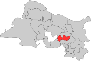
Canton of Marignane
Canton in Provence-Alpes-Côte d'Azur, France
Distance: Approx. 1941 meters
Latitude and longitude: 43.42,5.21
The canton of Marignane is an administrative division of the Bouches-du-Rhône department, in southeastern France. At the French canton reorganisation which came into effect in March 2015, it was expanded from 2 to 7 communes. Its seat is in Marignane.
Canton of Vitrolles
Canton in Provence-Alpes-Côte d'Azur, France
Distance: Approx. 4680 meters
Latitude and longitude: 43.46,5.25
The canton of Vitrolles is an administrative division of the Bouches-du-Rhône department, in southeastern France. At the French canton reorganisation which came into effect in March 2015, it was expanded from 1 to 4 communes. Its seat is in Vitrolles.
Weather in this IP's area
overcast clouds
15 Celsius
14 Celsius
14 Celsius
15 Celsius
1017 hPa
72 %
1017 hPa
1011 hPa
10000 meters
3.09 m/s
70 degree
100 %