176.216.228.80 - IP Lookup: Free IP Address Lookup, Postal Code Lookup, IP Location Lookup, IP ASN, Public IP
Country:
Region:
City:
Location:
Time Zone:
Postal Code:
ISP:
ASN:
language:
User-Agent:
Proxy IP:
Blacklist:
IP information under different IP Channel
ip-api
Country
Region
City
ASN
Time Zone
ISP
Blacklist
Proxy
Latitude
Longitude
Postal
Route
db-ip
Country
Region
City
ASN
Time Zone
ISP
Blacklist
Proxy
Latitude
Longitude
Postal
Route
IPinfo
Country
Region
City
ASN
Time Zone
ISP
Blacklist
Proxy
Latitude
Longitude
Postal
Route
IP2Location
176.216.228.80Country
Region
diyarbakir
City
ergani
Time Zone
Europe/Istanbul
ISP
Language
User-Agent
Latitude
Longitude
Postal
ipdata
Country
Region
City
ASN
Time Zone
ISP
Blacklist
Proxy
Latitude
Longitude
Postal
Route
Popular places and events near this IP address

Ergani
District and municipality in Diyarbakır, Turkey
Distance: Approx. 432 meters
Latitude and longitude: 38.26916667,39.76166667
Ergani (Ottoman Turkish: عثمانيه, romanized: Osmaniye, Kurdish: Erxenî), formerly known as Arghni or Arghana, is a municipality and district of Diyarbakır Province, Turkey. Its area is 1,510 km2, and its population is 136,099 (2022). Ergani District is located in the administrative as the Southeastern Anatolia Region, but as a geographical region it is located in Eastern Anatolia.

Çayönü
Neolithic settlement in Turkey
Distance: Approx. 6276 meters
Latitude and longitude: 38.21638889,39.72638889
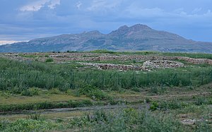
Çayönü Tepesi is a Neolithic settlement in southeastern Turkey which prospered from circa 8,630 to 6,800 BC. It is located in Diyarbakır Province forty kilometres north-west of Diyarbakır, at the foot of the Taurus mountains. It lies near the Boğazçay, a tributary of the upper Tigris River and the Bestakot, an intermittent stream. It is an early example of agriculture.
Bahçekaşı, Ergani
Village in Turkey
Distance: Approx. 2519 meters
Latitude and longitude: 38.26666667,39.73333333
Bahçekaşı is a neighbourhood in the municipality and district of Ergani, Diyarbakır Province in Turkey. Its population is 27 (2022).
Boğazköy, Ergani
Village in Turkey
Distance: Approx. 6105 meters
Latitude and longitude: 38.2728,39.6929
Boğazköy is a neighbourhood in the municipality and district of Ergani, located in Diyarbakır Province in Turkey. Its population is 105 (2022).
Boncuklu, Ergani
Village in Turkey
Distance: Approx. 5619 meters
Latitude and longitude: 38.2154,39.7524
Boncuklu is a neighbourhood in the municipality and district of Ergani, Diyarbakır Province in Turkey. Its population is 88 (2022).
Çukurdere, Ergani
Village in Turkey
Distance: Approx. 8050 meters
Latitude and longitude: 38.328,39.808
Çukurdere is a neighbourhood in the municipality and district of Ergani, Diyarbakır Province in Turkey. Its population is 247 (2022).
Karşıbağlar, Ergani
Village in Turkey
Distance: Approx. 7172 meters
Latitude and longitude: 38.23333333,39.83333333
Karşıbağlar is a neighbourhood in the municipality and district of Ergani, Diyarbakır Province in Turkey. Its population is 280 (2022).
Kavurmaküpü, Ergani
Village in Turkey
Distance: Approx. 5815 meters
Latitude and longitude: 38.31666667,39.75
Kavurmaküpü is a neighbourhood in the municipality and district of Ergani, Diyarbakır Province in Turkey. Its population is 39 (2022).
Kömürtaş, Ergani
Village in Turkey
Distance: Approx. 4862 meters
Latitude and longitude: 38.23333333,39.8
Kömürtaş is a neighbourhood in the municipality and district of Ergani, Diyarbakır Province in Turkey. Its population is 804 (2022).
Hilar, Ergani
Village in Turkey
Distance: Approx. 6715 meters
Latitude and longitude: 38.21666667,39.71666667
Hilar (formerly: Sesverenpınar) is a neighbourhood in the municipality and district of Ergani, Diyarbakır Province in Turkey. Its population is 101 (2022).
Sökündüzü, Ergani
Village in Turkey
Distance: Approx. 7692 meters
Latitude and longitude: 38.2,39.73333333
Sökündüzü is a neighbourhood in the municipality and district of Ergani, Diyarbakır Province in Turkey. Its population is 195 (2022).
Yolköprü, Ergani
Village in Turkey
Distance: Approx. 5689 meters
Latitude and longitude: 38.25,39.7
Yolköprü (Kurdish: Qalxane) is a neighbourhood in the municipality and district of Ergani, Diyarbakır Province in Turkey. The village is populated by Kurds of the Şadiyan tribe and had a population of 171 in 2022.
Weather in this IP's area
clear sky
5 Celsius
3 Celsius
5 Celsius
5 Celsius
1023 hPa
49 %
1023 hPa
915 hPa
10000 meters
2.28 m/s
2.13 m/s
350 degree