176.216.208.131 - IP Lookup: Free IP Address Lookup, Postal Code Lookup, IP Location Lookup, IP ASN, Public IP
Country:
Region:
City:
Location:
Time Zone:
Postal Code:
IP information under different IP Channel
ip-api
Country
Region
City
ASN
Time Zone
ISP
Blacklist
Proxy
Latitude
Longitude
Postal
Route
Luminati
Country
Region
06
City
ankara
ASN
Time Zone
Europe/Istanbul
ISP
Vodafone Telekomunikasyon A.S.
Latitude
Longitude
Postal
IPinfo
Country
Region
City
ASN
Time Zone
ISP
Blacklist
Proxy
Latitude
Longitude
Postal
Route
IP2Location
176.216.208.131Country
Region
amasya
City
suluova
Time Zone
Europe/Istanbul
ISP
Language
User-Agent
Latitude
Longitude
Postal
db-ip
Country
Region
City
ASN
Time Zone
ISP
Blacklist
Proxy
Latitude
Longitude
Postal
Route
ipdata
Country
Region
City
ASN
Time Zone
ISP
Blacklist
Proxy
Latitude
Longitude
Postal
Route
Popular places and events near this IP address
Suluova
Municipality in Amasya, Turkey
Distance: Approx. 287 meters
Latitude and longitude: 40.83333333,35.65
Suluova is a town in Amasya Province of Turkey, located on high ground inland within the central Black Sea region. It is the seat of Suluova District. Its population is 39,286 (2021).
Armutlu, Suluova
Village in Amasya, Turkey
Distance: Approx. 6458 meters
Latitude and longitude: 40.88916667,35.6425
Armutlu is a village in the Suluova District, Amasya Province, Turkey. Its population is 495 (2021).
Bayırlı, Suluova
Village in Amasya, Turkey
Distance: Approx. 6731 meters
Latitude and longitude: 40.8414,35.7267
Bayırlı is a village in the Suluova District, Amasya Province, Turkey. Its population is 251 (2021).
Gürlü, Suluova
Village in Amasya, Turkey
Distance: Approx. 4366 meters
Latitude and longitude: 40.8,35.61666667
Gürlü (also: Cürlü) is a village in the Suluova District, Amasya Province, Turkey. Its population is 245 (2021).
Dereköy, Suluova
Village in Amasya, Turkey
Distance: Approx. 7604 meters
Latitude and longitude: 40.8067,35.7321
Dereköy (also: Dere) is a village in the Suluova District, Amasya Province, Turkey. Its population is 193 (2021).
Kolay, Suluova
Village in Amasya, Turkey
Distance: Approx. 2993 meters
Latitude and longitude: 40.83333333,35.68333333
Kolay is a village in the Suluova District, Amasya Province, Turkey. Its population is 415 (2021).
Kutlu, Suluova
Village in Amasya, Turkey
Distance: Approx. 3048 meters
Latitude and longitude: 40.8161,35.678
Kutlu is a village in the Suluova District, Amasya Province, Turkey. Its population is 18 (2021).
Ortayazı, Suluova
Village in Amasya, Turkey
Distance: Approx. 5401 meters
Latitude and longitude: 40.7829,35.6435
Ortayazı is a village in the Suluova District, Amasya Province, Turkey. Its population is 169 (2021).
Oğulbağı, Suluova
Village in Amasya, Turkey
Distance: Approx. 2614 meters
Latitude and longitude: 40.85,35.66666667
Oğulbağı is a village in the Suluova District, Amasya Province, Turkey. Its population is 289 (2021).

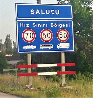
Salucu, Suluova
Village in Amasya, Turkey
Distance: Approx. 6118 meters
Latitude and longitude: 40.78333333,35.68333333
Salucu is a village in the Suluova District, Amasya Province, Turkey. Its population is 328 (2021).
Çayüstü, Suluova
Village in Amasya, Turkey
Distance: Approx. 3333 meters
Latitude and longitude: 40.8086,35.6221
Çayüstü is a village in the Suluova District, Amasya Province, Turkey. Its population is 174 (2021).

Suluova District
District of Amasya Province, Turkey
Distance: Approx. 287 meters
Latitude and longitude: 40.83333333,35.65
Suluova District is a district of Amasya Province of Turkey. Its seat is the town Suluova. Its area is 456 km2, and its population is 47,066 (2021).
Weather in this IP's area
overcast clouds
9 Celsius
7 Celsius
9 Celsius
9 Celsius
1018 hPa
69 %
1018 hPa
953 hPa
10000 meters
2.74 m/s
4.28 m/s
160 degree
100 %