176.216.179.67 - IP Lookup: Free IP Address Lookup, Postal Code Lookup, IP Location Lookup, IP ASN, Public IP
Country:
Region:
City:
Location:
Time Zone:
Postal Code:
IP information under different IP Channel
ip-api
Country
Region
City
ASN
Time Zone
ISP
Blacklist
Proxy
Latitude
Longitude
Postal
Route
Luminati
Country
Region
06
City
cankaya
ASN
Time Zone
Europe/Istanbul
ISP
Vodafone Telekomunikasyon A.S.
Latitude
Longitude
Postal
IPinfo
Country
Region
City
ASN
Time Zone
ISP
Blacklist
Proxy
Latitude
Longitude
Postal
Route
IP2Location
176.216.179.67Country
Region
eskisehir
City
eskisehir
Time Zone
Europe/Istanbul
ISP
Language
User-Agent
Latitude
Longitude
Postal
db-ip
Country
Region
City
ASN
Time Zone
ISP
Blacklist
Proxy
Latitude
Longitude
Postal
Route
ipdata
Country
Region
City
ASN
Time Zone
ISP
Blacklist
Proxy
Latitude
Longitude
Postal
Route
Popular places and events near this IP address

Dorylaeum
Ancient city in Anatolia, modern Turkey
Distance: Approx. 819 meters
Latitude and longitude: 39.78333333,30.51666667
Dorylaeum or Dorylaion (Greek: Δορύλαιον; Turkish: Şarhöyük) was an ancient city in Anatolia. It is now an archaeological site located near the city of Eskişehir, Turkey. Its original location was about 10 km southwest of Eskişehir, at a place now known as Karaca Hisar; about the end of the fourth century B.C. it was moved to a location north of modern Eskişehir.

Battle of Dorylaeum (1097)
Early battle during the First Crusade
Distance: Approx. 17 meters
Latitude and longitude: 39.7767,30.5206
The Battle of Dorylaeum took place during the First Crusade on 1 July 1097 between the crusader forces and the Seljuk Turks, near the city of Dorylaeum in Anatolia. Though the Turkish forces of Kilij Arslan nearly destroyed the Crusader contingent of Bohemond, other Crusaders arrived just in time to reverse the course of the battle.

Eskişehir
Metropolitan municipality in Central Anatolia, Turkey
Distance: Approx. 21 meters
Latitude and longitude: 39.77666667,30.52055556
Eskişehir (US: ES-kish-ə-HEER, Turkish: [esˈciʃehiɾ]; from eski 'old' and şehir 'city') is a city in northwestern Turkey and the capital of the Eskişehir Province. The urban population of the city is 898,369, with a metropolitan population of 797,708. The city is located on the banks of the Porsuk River, 792 m above sea level, where it overlooks the fertile Phrygian Valley.
Eskişehir Atatürk Stadium
Distance: Approx. 891 meters
Latitude and longitude: 39.77075,30.51383333
Eskişehir Atatürk Stadium (Turkish: Eskişehir Atatürk Stadı) was a multi-purpose stadium in Eskişehir, Turkey. Named after the Turkish statesman Mustafa Kemal Atatürk, it was mostly used for football matches as the home ground of Eskişehirspor. The stadium held 13,520 people and was built in 1953.

Battle of Dorylaeum (1147)
Part of the Second Crusade
Distance: Approx. 819 meters
Latitude and longitude: 39.78333333,30.51666667
The second Battle of Dorylaeum took place near Dorylaeum in October 1147, during the Second Crusade. It was not a single clash but consisted of a series of encounters over a number of days.

Eskişehir railway station
Railway station in Turkey
Distance: Approx. 1152 meters
Latitude and longitude: 39.7794,30.5078
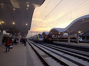
Eskişehir railway station (Turkish: Eskişehir garı) is the main railway station in Eskişehir, Turkey. The station is part of a major railway facility, which is one of the largest in the country. Prior to the cancellation of all non-high-speed trains between Ankara and Istanbul, Eskişehir station was one of the busiest stations in Turkey.

Dünya Müzeleri Müzesi
Distance: Approx. 635 meters
Latitude and longitude: 39.779514,30.527262
Museum of World Museums (Turkish: Dünya Müzeleri Müzesi) is a museum in Eskişehir, Turkey that displays reproductions whose originals appear in several historical areas and museums of the world. It has been established by the Aktiffelsefe Yeni Yüksektepe Kültür Derneği, a local cultural organization, and inaugurated on 8 May 2013, at Işıklar Mahallesi, Gültuğrul sokak No: 6. In its first year, the museum has been visited by more than 2000 people.
Holy Trinity Church, Eskişehir
Distance: Approx. 152 meters
Latitude and longitude: 39.7771,30.5191
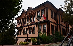
The Holy Trinity Church (Turkish: Kutsal Üçlü Ermeni Kilisesi, Armenian: Սուրբ Երրորդություն եկեղեցի) or Surp Yerrortut'yun Church is a historical Armenian Apostolic temple in the former Armenian quarter called Hoshnudiye (nowadays Tepebaşı) of the Western Turkish town of Eskishehir. It was turned into an adult theater after the Armenians of the town were deported and killed during the Armenian genocide. The church was built in the 19th century.

Yılmaz Büyükerşen Wax Museum
Wax Museum in Eskişehir, Turkey
Distance: Approx. 1306 meters
Latitude and longitude: 39.765,30.52194444
Yılmaz Büyükerşen Wax Museum, also known as Eskişehir Wax Museum, (Turkish: Yılmaz Büyükerşen Balmumu Heykeller Müzesi) is a wax museum in Odunpazarı second level municipality in Greater Eskişehir, Turkey. The museum is situated on Atatürk Boulevard at 39°45′54″N 30°31′19″E. It is next to various other museums. It was established on 19 May 2013 by Yılmaz Büyükerşen, sculptor and the mayor of Eskişehir Metropolitan Municipality.

Museum of Modern Glass Art, Eskişehir
Distance: Approx. 1306 meters
Latitude and longitude: 39.765,30.52194444
Museum of Modern Glass Art is a museum dedicated to contemporary glass art in Odunpazarı, Eskişehir, Turkey. The museum was established with the cooperation of Eskişehir Metropolitan Municipality, Anadolu University and Friends of Glass Group in 2007. It was created through the renovation of three historical houses.

Museum of Independence, Eskişehir
Museum in Eskişehir, Turkey
Distance: Approx. 1385 meters
Latitude and longitude: 39.76444444,30.52361111
Museum of Independence (Turkish: Kurtuluş Müzesi) is a history museum in Odunpazarı, Eskişehir, Turkey. Established in 2016, it is dedicated to the Turkish War of Independence. The museum was established by the Metropolitan Municipality of Eskişehr, and was inaugurated on October 29, 2016, the 93rd anniversary of the proclamation of the Turkish Republic.
Alaeddin Mosque (Eskişehir)
Distance: Approx. 1148 meters
Latitude and longitude: 39.76666667,30.52388889
Alaeddin Mosque, also known as Alaaddin Mosque (Turkish: Alaeddin Camii or Alaaddin Camii) is a historic mosque in Odunpazarı district of Eskişehir Province, Turkey. Alaeddin Mosque is situated in Alaeddin Park at Odunpazarı, Eskişehir. According to an inscription at the base of its minaret, it was built in 1267, during the reign of Seljuq Sultan of Rûm Gıyaseddin Keyhüsrev III (reigned 1265–1284).
Weather in this IP's area
overcast clouds
8 Celsius
6 Celsius
8 Celsius
8 Celsius
1011 hPa
77 %
1011 hPa
919 hPa
10000 meters
2.68 m/s
5.13 m/s
178 degree
100 %
