176.216.169.243 - IP Lookup: Free IP Address Lookup, Postal Code Lookup, IP Location Lookup, IP ASN, Public IP
Country:
Region:
City:
Location:
Time Zone:
Postal Code:
IP information under different IP Channel
ip-api
Country
Region
City
ASN
Time Zone
ISP
Blacklist
Proxy
Latitude
Longitude
Postal
Route
Luminati
Country
Region
06
City
ankara
ASN
Time Zone
Europe/Istanbul
ISP
Vodafone Telekomunikasyon A.S.
Latitude
Longitude
Postal
IPinfo
Country
Region
City
ASN
Time Zone
ISP
Blacklist
Proxy
Latitude
Longitude
Postal
Route
IP2Location
176.216.169.243Country
Region
corum
City
osmancik
Time Zone
Europe/Istanbul
ISP
Language
User-Agent
Latitude
Longitude
Postal
db-ip
Country
Region
City
ASN
Time Zone
ISP
Blacklist
Proxy
Latitude
Longitude
Postal
Route
ipdata
Country
Region
City
ASN
Time Zone
ISP
Blacklist
Proxy
Latitude
Longitude
Postal
Route
Popular places and events near this IP address

Osmancık
Municipality in Çorum, Turkey
Distance: Approx. 1343 meters
Latitude and longitude: 40.96666667,34.8
Osmancık is a town in Çorum Province in the Black Sea region of Turkey, located 59 km north of the city of Çorum. It is the seat of Osmancık District. Its population is 30,537 (2022).

Tekmen, Osmancık
Village in Turkey
Distance: Approx. 8608 meters
Latitude and longitude: 41.02777778,34.88333333
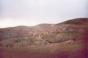
Tekmen is a village in the Black Sea Region of Turkey, in Osmancık District of Çorum Province. Its population is 190 (2022). Though it is in the Black Sea Region, it carries typical properties of villages of the Central Anatolia Region.

Koyunbaba Bridge
Bridge in Çorum, Turkey
Distance: Approx. 948 meters
Latitude and longitude: 40.97027778,34.80055556
Koyunbaba Bridge (Turkish: Koyunbaba Köprüsü) is a stone arch bridge crossing the Kızılırmak River in Çorum Province, Turkey. It was built between 1484 and 1489 and is the longest stone arch bridge built in Anatolia during Ottoman rule.
Pimolisa
Fortified town of ancient Paphlagonia
Distance: Approx. 8875 meters
Latitude and longitude: 41.013237,34.709815
Pimolisa (Ancient Greek: Πιμώλισα), or Pimolison, was a fortified town of ancient Paphlagonia on the Halys River, near the western border of Pontus. It had been destroyed by Strabo's time, but the district on both sides of the Halys was still called Pimolisene. Its site is located near Osmancık, Asiatic Turkey.
Ağıroğlan, Osmancık
Village in Turkey
Distance: Approx. 5095 meters
Latitude and longitude: 40.93333333,34.81666667
Ağıroğlan is a village in the Osmancık District of Çorum Province in Turkey. Its population is 20 (2022).
Baltacımehmetpaşa, Osmancık
Village in Turkey
Distance: Approx. 6691 meters
Latitude and longitude: 41.0357,34.7815
Baltacımehmetpaşa is a village in the Osmancık District of Çorum Province in Turkey. Its population is 157 (2022).
Belkavak, Osmancık
Village in Turkey
Distance: Approx. 5738 meters
Latitude and longitude: 40.9949,34.8693
Belkavak is a village in the Osmancık District of Çorum Province in Turkey. Its population is 77 (2022).
Girinoğlan, Osmancık
Village in Turkey
Distance: Approx. 7217 meters
Latitude and longitude: 40.93333333,34.86666667
Girinoğlan is a village in the Osmancık District of Çorum Province in Turkey. Its population is 242 (2022).
Kumbaba, Osmancık
Village in Turkey
Distance: Approx. 7838 meters
Latitude and longitude: 40.91666667,34.85
Kumbaba is a village in the Osmancık District of Çorum Province in Turkey. Its population is 275 (2022).
Yağsüzen, Osmancık
Village in Turkey
Distance: Approx. 5343 meters
Latitude and longitude: 41.01666667,34.76666667
Yağsüzen (formerly: Yağsıyan) is a village in the Osmancık District of Çorum Province in Turkey. Its population is 269 (2022).
Yenidanişment, Osmancık
Village in Turkey
Distance: Approx. 8968 meters
Latitude and longitude: 40.98,34.91138889
Yenidanişment is a village in the Osmancık District of Çorum Province in Turkey. Its population was 287 in 2022.

Osmancık District
District of Çorum Province, Turkey
Distance: Approx. 1343 meters
Latitude and longitude: 40.96666667,34.8
Osmancık District is a district of the Çorum Province of Turkey. Its seat is the town of Osmancık. Its area is 1,273 km2, and its population is 43,297 (2022).
Weather in this IP's area
overcast clouds
10 Celsius
9 Celsius
10 Celsius
10 Celsius
1017 hPa
76 %
1017 hPa
966 hPa
10000 meters
1.89 m/s
1.99 m/s
97 degree
100 %