176.204.238.58 - IP Lookup: Free IP Address Lookup, Postal Code Lookup, IP Location Lookup, IP ASN, Public IP
Country:
 United Arab Emirates
Region:
City:
Location:
Time Zone:
Postal Code:
ISP:
ASN:
language:
User-Agent:
Proxy IP:
Blacklist:
IP information under different IP Channel
ip-api
Country
Region
City
ASN
Time Zone
ISP
Blacklist
Proxy
Latitude
Longitude
Postal
Route
db-ip
Country
Region
City
ASN
Time Zone
ISP
Blacklist
Proxy
Latitude
Longitude
Postal
Route
IPinfo
Country
Region
City
ASN
Time Zone
ISP
Blacklist
Proxy
Latitude
Longitude
Postal
Route
IP2Location
176.204.238.58Country
aeRegion
'ajman
City
'ajman
Time Zone
Asia/Dubai
ISP
Language
User-Agent
Latitude
Longitude
Postal
ipdata
Country
Region
City
ASN
Time Zone
ISP
Blacklist
Proxy
Latitude
Longitude
Postal
Route
Popular places and events near this IP address

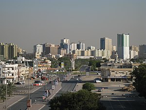
Ajman
Capital of the Emirate of Ajman, United Arab Emirates
Distance: Approx. 1105 meters
Latitude and longitude: 25.41361111,55.44555556
Ajman (Arabic: عجمان 'Aǧmān; Gulf Arabic: عيمان ʿYmān) is the capital of the emirate of Ajman in the United Arab Emirates. It is the fifth-largest city in UAE after Dubai, Abu Dhabi, Sharjah and Al Ain. Located along the Persian Gulf, it is engulfed by the larger emirate of Sharjah in territory.

Khalid bin Mohammed Stadium
Multi-use stadium in Sharjah, United Arab Emirates
Distance: Approx. 4287 meters
Latitude and longitude: 25.374202,55.423059
Khalid Bin Mohammed Stadium is a multi-use stadium in Sharjah, United Arab Emirates. It is currently used mostly for football matches and is the home ground of Al Shaab Club. The stadium holds 12,000 people.
Ajman Real Estate Regulatory Agency
Ajman, United Arab Emirates based government regulatory authority
Distance: Approx. 2054 meters
Latitude and longitude: 25.39277778,55.43611111
The Ajman Real Estate Regulatory Agency (ARRA, ARERA or Ajman RERA) is an Ajman, United Arab Emirates based government regulatory authority responsible for the regulation and licensing of Ajman's real estate market, consumer protection and dispute resolution. However, ARRA does not resolve disputes concerning rent of property units.

Al Heera
Place in Sharjah, United Arab Emirates
Distance: Approx. 4612 meters
Latitude and longitude: 25.38138889,55.40305556
Al Heera is a suburb in Northern Sharjah in the United Arab Emirates, traditionally home to the Al Bu Shamis section of the Na'im tribe. At one stage declaring its independence from Sharjah, with its own Sheikh, it formally became part of the Emirate of Sharjah in 1942 on the death of its Ruler, Abdulrahman bin Muhammad Al Shamsi. A coastal settlement with a small harbour formerly used by a number of fishermen and pleasure boat owners, its main distinguishing feature today is its police station, converted in 2019 into the 'Al Heera Literature Society' building.
Al Shaab Village
Distance: Approx. 4456 meters
Latitude and longitude: 25.37192,55.42635
Al Shaab Village is a shopping mall in the Emirate of Sharjah, United Arab Emirates.It has more than 270 shops, 30+ Abaya Shops, 400+ parking facilities, an indoor and outdoor food court with 30+ F & B, and as well as an exhibition hall, the largest ice skating rink in Sharjah, a billiard and gaming center, an amusement park, and a cinema. Located in Sheikh Khalid Bin Mohammed Al Qassimi Street in Al - Hazannah district of Sharjah Emirate, the combined exhibition-style shopping mall is a part of Al-Shaab CSC Complex. Based on the total area which includes Skate gate, the largest ice rink in Sharjah.
City Centre Ajman
Shopping mall in Ajman, United Arab Emirates
Distance: Approx. 4640 meters
Latitude and longitude: 25.39944444,55.47916667
City Centre Ajman (Arabic: سيتي سنتر عجمان) is a shopping mall in the emirate of Ajman, United Arab Emirates (UAE), which is owned and operated by Majid Al Futtaim. With 34,000 m2 (370,000 sq ft) of retail space and 10.5 million yearly visitors, it is the largest mall in the emirate. It is located on Al Ittihad Street (E11), in the district of Al Jurf, off Sheikh Khalifa Interchange and north of Sheikh Maktoum Bin Rashid Road.

Ajman Museum
Museum in Ajman, United Arab Emirates
Distance: Approx. 1116 meters
Latitude and longitude: 25.413578,55.445681
The Ajman Museum (Arabic: متحف عجمان) is a national museum located inside the Ajman Fort in the city of Ajman, United Arab Emirates. The museum includes several sections that offer a compelling glimpse of Ajman's past, including archaeology, manuscripts, folk costumes, souvenirs, and more. The museum displays are annotated in both Arabic and English.
Grand Mall Ajman
Shopping mall in Ajman, United Arab Emirates
Distance: Approx. 2109 meters
Latitude and longitude: 25.3926,55.4389
The Grand Mall Ajman (Arabic: جراند مول عجمان) is a shopping mall and apartment complex in the emirate of Ajman, United Arab Emirates (UAE), which is owned and operated by the Government of the Ajman Emirate.
Ajman Heritage District
Heritage District in Ajman
Distance: Approx. 1084 meters
Latitude and longitude: 25.4134,55.4454
The Ajman Heritage District is a cultural and tourism destination in the United Arab Emirates (UAE). It is located in the Emirate of Ajman. The district is known for its blend of antiquities, ancient trees, and historical landmarks, providing visitors with a cultural and recreational experience.
Al Rumailah
Residential area in Emirate of Ajman, UAE
Distance: Approx. 724 meters
Latitude and longitude: 25.40583,55.430841
Al Rumailah (Arabic: الرميلة) (also spell: Al Rumaila) also known as Rumailah Ajman or simply Al Rumailah 1 and Al Rumailah 2, is a populated residential area situated in the Ajman district of the central region area of Emirate of Ajman, in the United Arab Emirates. Al Rumailah is a part of the city near the Sharjah border. Al Rawda has a well-connected roadway near the Persian Gulf coast, Ajman beach, 18 kilometres from Sharjah International Airport.

Al Nuaimia
Residential area in Emirate of Ajman, UAE
Distance: Approx. 4298 meters
Latitude and longitude: 25.380999,55.461535
Al Nuaimia (Arabic: النعيمية) (also spell: Al Nuaimiya ) also known as Al Nuaimia Ajman or simply Nuaimia is a populated residential area situated in the Ajman district of the central region area of Emirate of Ajman, in the United Arab Emirates. Al Rumailah is a part of the city near the Sharjah border. Al Rawda has a well-connected roadway near the Persian Gulf coast, Ajman beach, 16 kilometres from Sharjah International Airport.

Al Nakhil
Residential area in Emirate of Ajman, UAE
Distance: Approx. 962 meters
Latitude and longitude: 25.4061513,55.4271375
Al Nakhil (Arabic: النخيل) also known as Al Nakhil Ajman or simply Nakhil is a populated residential area situated in the Ajman district of the central region area of Emirate of Ajman, in the United Arab Emirates. Al Nakhil is a 2-part development consisting of Al Nakhil 1 and Al Nakhil 2. It is a corniche area with many beach hotels and community parks.
Weather in this IP's area
clear sky
16 Celsius
15 Celsius
16 Celsius
17 Celsius
1017 hPa
55 %
1017 hPa
1016 hPa
10000 meters
2.57 m/s
130 degree