176.189.188.227 - IP Lookup: Free IP Address Lookup, Postal Code Lookup, IP Location Lookup, IP ASN, Public IP
Country:
Region:
City:
Location:
Time Zone:
Postal Code:
IP information under different IP Channel
ip-api
Country
Region
City
ASN
Time Zone
ISP
Blacklist
Proxy
Latitude
Longitude
Postal
Route
Luminati
Country
Region
nor
City
caen
ASN
Time Zone
Europe/Paris
ISP
Bouygues Telecom SA
Latitude
Longitude
Postal
IPinfo
Country
Region
City
ASN
Time Zone
ISP
Blacklist
Proxy
Latitude
Longitude
Postal
Route
IP2Location
176.189.188.227Country
Region
normandie
City
la ferriere-aux-etangs
Time Zone
Europe/Paris
ISP
Language
User-Agent
Latitude
Longitude
Postal
db-ip
Country
Region
City
ASN
Time Zone
ISP
Blacklist
Proxy
Latitude
Longitude
Postal
Route
ipdata
Country
Region
City
ASN
Time Zone
ISP
Blacklist
Proxy
Latitude
Longitude
Postal
Route
Popular places and events near this IP address
Champsecret
Commune in Normandy, France
Distance: Approx. 6221 meters
Latitude and longitude: 48.61,-0.5494
Champsecret (French pronunciation: [ʃɑ̃səkʁɛ] ) is a commune in the Orne department in north-western France.

Bellou-en-Houlme
Commune in Normandy, France
Distance: Approx. 6547 meters
Latitude and longitude: 48.6914,-0.4422
Bellou-en-Houlme is a commune in the Orne department in northwestern France.

Saint-André-de-Messei
Commune in Normandy, France
Distance: Approx. 3708 meters
Latitude and longitude: 48.6956,-0.5206
Saint-André-de-Messei (French pronunciation: [sɛ̃.t‿ɑ̃dʁe də mɛsɛ] , literally Saint-André of Messei) is a commune in the Orne department in north-western France.

Saires-la-Verrerie
Commune in Normandy, France
Distance: Approx. 3310 meters
Latitude and longitude: 48.6872,-0.495
Saires-la-Verrerie (French pronunciation: [sɛʁ la vɛʁ.ʁi] ) is a commune in the Orne department in north-western France.

Banvou
Commune in Normandy, France
Distance: Approx. 2392 meters
Latitude and longitude: 48.6658,-0.5517
Banvou (French pronunciation: [bɑ̃vu] ) is a commune in the Orne department in northwestern France.

Messei
Commune in Normandy, France
Distance: Approx. 5681 meters
Latitude and longitude: 48.7122,-0.5358
Messei (French pronunciation: [mɛsɛ] ) is a commune in the Orne department in north-western France.

La Ferrière-aux-Étangs
Commune in Normandy, France
Distance: Approx. 196 meters
Latitude and longitude: 48.6636,-0.5178
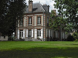
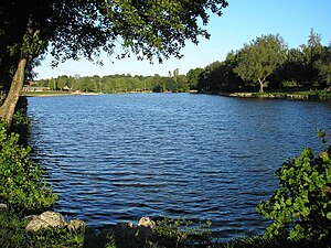
La Ferrière-aux-Étangs (French pronunciation: [la fɛʁjɛʁ o.z‿etɑ̃]) is a commune in the Orne department in north-western France.

La Chapelle-au-Moine
Commune in Normandy, France
Distance: Approx. 6978 meters
Latitude and longitude: 48.7089,-0.5831
La Chapelle-au-Moine (French pronunciation: [la ʃapɛl o mwan] ) is a commune in the Orne department in north-western France.

La Coulonche
Commune in Normandy, France
Distance: Approx. 5017 meters
Latitude and longitude: 48.6478,-0.455
La Coulonche (French pronunciation: [la kulɔ̃ʃ] ) is a commune in the Orne department in north-western France.
Dompierre, Orne
Commune in Normandy, France
Distance: Approx. 3979 meters
Latitude and longitude: 48.6331,-0.5508
Dompierre (French pronunciation: [dɔ̃pjɛʁ] ) is a commune in the Orne department in north-western France.
Le Châtellier, Orne
Commune in Normandy, France
Distance: Approx. 4742 meters
Latitude and longitude: 48.6767,-0.5803
Le Châtellier (French pronunciation: [lə ʃatəlje] ) is a commune in the Orne department in north-western France.
Arboretum de l'Étoile des Andaines
Arboretum in Champsecret, Orne, Normandy, France
Distance: Approx. 6211 meters
Latitude and longitude: 48.61,-0.549
The Arboretum de l'Étoile des Andaines (5400ha) is an arboretum located in Champsecret, Orne, Normandy, France.
Weather in this IP's area
overcast clouds
6 Celsius
3 Celsius
6 Celsius
6 Celsius
1027 hPa
92 %
1027 hPa
994 hPa
10000 meters
2.86 m/s
8.51 m/s
209 degree
100 %


