176.14.119.84 - IP Lookup: Free IP Address Lookup, Postal Code Lookup, IP Location Lookup, IP ASN, Public IP
Country:
Region:
City:
Location:
Time Zone:
Postal Code:
IP information under different IP Channel
ip-api
Country
Region
City
ASN
Time Zone
ISP
Blacklist
Proxy
Latitude
Longitude
Postal
Route
Luminati
Country
ASN
Time Zone
Europe/Moscow
ISP
PVimpelCom
Latitude
Longitude
Postal
IPinfo
Country
Region
City
ASN
Time Zone
ISP
Blacklist
Proxy
Latitude
Longitude
Postal
Route
IP2Location
176.14.119.84Country
Region
moskovskaya oblast'
City
fryazino
Time Zone
Europe/Moscow
ISP
Language
User-Agent
Latitude
Longitude
Postal
db-ip
Country
Region
City
ASN
Time Zone
ISP
Blacklist
Proxy
Latitude
Longitude
Postal
Route
ipdata
Country
Region
City
ASN
Time Zone
ISP
Blacklist
Proxy
Latitude
Longitude
Postal
Route
Popular places and events near this IP address

Star City, Russia
Area in Zvyozdny gorodok, Moscow Oblast, Russia
Distance: Approx. 9783 meters
Latitude and longitude: 55.8806,38.1105
Star City (Russian: Звёздный городок, romanized: Zvyozdny gorodok, lit. 'starry townlet') is an area in Zvyozdny gorodok, Moscow Oblast, Russia, which has since the 1960s been home to the Yuri Gagarin Cosmonaut Training Center (GCTC). Officially, the area was known as "closed military townlet No. 1" and at various times had also been designated as Shchyolkovo-14 (Щёлково-14) and Zvyozdny (Звёздный).

Fryazino
Town in Moscow Oblast, Russia
Distance: Approx. 1211 meters
Latitude and longitude: 55.95,38.05
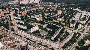
Fryazino (Russian: Фрязино, IPA: [ˈfrʲæzʲɪnə]) is a scientific town in Moscow Oblast, Russia, located on the Lyuboseyevka River, a tributary of the Vorya, 25 kilometers (16 mi) northeast of the city of Moscow. Population: 60,580 (2021 Census); 55,369 (2010 Census); 52,436 (2002 Census); 53,317 (1989 Soviet census). Fryazino is a center of excellence for Russian microwave electronics.

Shchyolkovo
City in Moscow Oblast, Russia
Distance: Approx. 5657 meters
Latitude and longitude: 55.91666667,38
Shchyolkovo (Russian: Щёлково, IPA: [ˈɕːɵlkəvə]) is a city and the administrative center of Shchyolkovsky District in Moscow Oblast, Russia, located on the Klyazma River (Oka's tributary), 20 kilometers (12 mi) northeast of Moscow. Population: 134,211 (2021 Census); 110,411 (2010 Census); 112,865 (2002 Census); 109,255 (1989 Census); 91,000 (1977).
Podmoskovie Stadium
Sports venue in Moscow Oblast, Russia
Distance: Approx. 5655 meters
Latitude and longitude: 55.91490278,38.00598611
Podmoskovie Stadium, situated in the suburb of Shchelkovo some 15 km from the centre of Moscow, is one of the oldest stadia in Russia. The Russian word Podmoskovye means "Moscow Region". Built in 1928, it underwent a refurbishment in 2003 to modernise its facilities.

Ucha (river)
River in Russia
Distance: Approx. 6261 meters
Latitude and longitude: 55.9392,37.9527
The Ucha (Russian: Уча́) is a river in Moscow Oblast, Russia. It is a left tributary of the Klyazma. The construction of the Moscow Canal has separated the upper course of the Ucha from its lower course.

Grebnevo, Moscow Oblast
Distance: Approx. 2635 meters
Latitude and longitude: 55.96555556,38.08694444
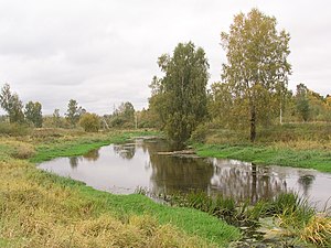
Grebnevo (Russian: Гребнево) is a rural locality (a selo) in Shchyolkovsky District of Moscow Oblast, Russia, located about 30 kilometers (19 mi) east of Moscow, on the outskirt of the town of Fryazino, on the bank of the Lyuboseyevka River.
Shchyolkovsky District
District in Moscow Oblast, Russia
Distance: Approx. 6307 meters
Latitude and longitude: 55.91694444,37.98111111
Shchyolkovsky District (Russian: Щёлковский райо́н) is an administrative and municipal district (raion), one of the thirty-six in Moscow Oblast, Russia. It is located in the northeast of the oblast. The area of the district is 704.88 square kilometers (272.16 sq mi).
Ivanteyevka, Moscow Oblast
Town in Moscow Oblast, Russia
Distance: Approx. 7437 meters
Latitude and longitude: 55.98333333,37.93333333
Ivanteyevka (Russian: Иванте́евка) is a town in Moscow Oblast, Russia, located on the Ucha River 20 kilometers (12 mi) northeast of Moscow. Population: 82,827 (2021 Census); 58,626 (2010 Census); 51,454 (2002 Census); 53,140 (1989 Soviet census).

Zagoryansky
Urban-type settlement in Moscow Oblast, Russia
Distance: Approx. 8569 meters
Latitude and longitude: 55.9203,37.9285
Zagoryansky (Russian: Загорянский) is an urban locality (an urban-type settlement) in Shchyolkovsky District of Moscow Oblast, Russia. Population: 7,997 (2010 Census); 7,576 (2002 Census); 5,177 (1989 Soviet census).
Sverdlovsky, Moscow Oblast
Urban-type settlement in Moscow Oblast, Russia
Distance: Approx. 9115 meters
Latitude and longitude: 55.902,38.1477
Sverdlovsky (Russian: Свердловский) is an urban locality (an urban-type settlement) in Moscow Oblast, Russia. Population: 6,763 (2010 Census); 5,683 (2002 Census); 6,127 (1989 Soviet census).
Weather in this IP's area
overcast clouds
-1 Celsius
-3 Celsius
-1 Celsius
0 Celsius
1029 hPa
100 %
1029 hPa
1009 hPa
2712 meters
1.57 m/s
2.76 m/s
262 degree
100 %

