Country:
 Switzerland
Region:
City:
Latitude and Longitude:
Time Zone:
Postal Code:
IP information under different IP Channel
ip-api
Country
Region
City
ASN
Time Zone
ISP
Blacklist
Proxy
Latitude
Longitude
Postal
Route
IPinfo
Country
Region
City
ASN
Time Zone
ISP
Blacklist
Proxy
Latitude
Longitude
Postal
Route
MaxMind
Country
Region
City
ASN
Time Zone
ISP
Blacklist
Proxy
Latitude
Longitude
Postal
Route
Luminati
Country
CHRegion
lu
City
ballwil
ASN
Time Zone
Europe/Zurich
ISP
Bluewin
Latitude
Longitude
Postal
db-ip
Country
Region
City
ASN
Time Zone
ISP
Blacklist
Proxy
Latitude
Longitude
Postal
Route
ipdata
Country
Region
City
ASN
Time Zone
ISP
Blacklist
Proxy
Latitude
Longitude
Postal
Route
Popular places and events near this IP address

Hochdorf District
District in Switzerland
Distance: Approx. 4519 meters
Latitude and longitude: 47.16666667,8.28333333
Hochdorf District was one of the five Ämtern, or districts, of the German-speaking Canton of Lucerne, Switzerland. Its capital is the town of Hochdorf. It has a population of 74,143 (as of 31 December 2020).

Abtwil, Aargau
Municipality in Aargau, Switzerland
Distance: Approx. 3212 meters
Latitude and longitude: 47.18333333,8.35
Abtwil is a municipality in the district of Muri in the canton of Aargau in Switzerland. It lies next to the border with the canton of Lucerne.
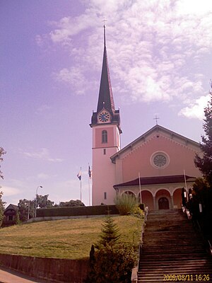
Ballwil
Municipality in Lucerne, Switzerland
Distance: Approx. 1902 meters
Latitude and longitude: 47.15,8.31666667
Ballwil is a municipality in the district of Hochdorf in the canton of Lucerne in Switzerland.

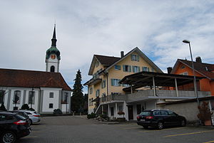
Eschenbach, Lucerne
Municipality in Lucerne, Switzerland
Distance: Approx. 3035 meters
Latitude and longitude: 47.13333333,8.31666667
Eschenbach is a municipality in the district of Hochdorf in the canton of Lucerne in Switzerland.

Hohenrain
Municipality in Lucerne, Switzerland
Distance: Approx. 3618 meters
Latitude and longitude: 47.18333333,8.31666667
Hohenrain is a municipality in the district of Hochdorf in the canton of Lucerne in Switzerland. Since January 1, 2007, Lieli has been part of the municipality.
Inwil
Municipality in Lucerne, Switzerland
Distance: Approx. 4348 meters
Latitude and longitude: 47.11666667,8.35
Inwil is a municipality in the district of Hochdorf in the canton of Lucerne in Switzerland.

A14 motorway (Switzerland)
Motorway in Switzerland
Distance: Approx. 4473 meters
Latitude and longitude: 47.117343,8.360392
The A14 motorway, an Autobahn in central Switzerland, is a divided highway connecting the A2 with the A4, within the Canton of Lucerne. The A14 is congruent with the National Road N14 and part of the main traffic artery between the Innerschweitz and the metropolitan area Zürich. It runs mostly along the Reuss (river), which it twice crosses.

Eschenbach railway station
Swiss railway station
Distance: Approx. 2875 meters
Latitude and longitude: 47.13239111,8.32277889
Eschenbach railway station (‹See Tfd›German: Bahnhof Eschenbach) is a railway station in the municipality of Eschenbach, in the Swiss canton of Lucerne. It is an intermediate stop on the standard gauge Seetal line of Swiss Federal Railways.

Ballwil railway station
Swiss railway station
Distance: Approx. 1803 meters
Latitude and longitude: 47.15376389,8.31688111
Ballwil railway station (‹See Tfd›German: Bahnhof Ballwil) is a railway station in the municipality of Ballwil, in the Swiss canton of Lucerne. It is an intermediate stop on the standard gauge Seetal line of Swiss Federal Railways.

Hochdorf Schönau railway station
Swiss railway station
Distance: Approx. 3377 meters
Latitude and longitude: 47.164655,8.29821194
Hochdorf Schönau railway station (‹See Tfd›German: Bahnhof Hochdorf Schönau) is a railway station in the municipality of Hochdorf, in the Swiss canton of Lucerne. It is an intermediate stop on the standard gauge Seetal line of Swiss Federal Railways.

Hochdorf railway station
Swiss railway station
Distance: Approx. 4142 meters
Latitude and longitude: 47.16697389,8.28868694
Hochdorf railway station (‹See Tfd›German: Bahnhof Hochdorf) is a railway station in the municipality of Hochdorf, in the Swiss canton of Lucerne. It is an intermediate stop on the standard gauge Seetal line of Swiss Federal Railways.

Eschenbach Abbey
Cistercian nunnery in Switzerland
Distance: Approx. 2900 meters
Latitude and longitude: 47.1327,8.3213
Eschenbach Abbey (‹See Tfd›German: Kloster Eschenbach; Latin: Abbatia B. M. V. et Sanctae Catharinae) is a community of Cistercian nuns in Eschenbach in Lucerne, Switzerland. The abbey was founded in about 1290 for Augustinian nuns, and became Cistercian in 1588.
Weather in this IP's area
overcast clouds
7 Celsius
7 Celsius
6 Celsius
9 Celsius
1017 hPa
92 %
1017 hPa
957 hPa
10000 meters
1.03 m/s
100 %
07:31:05
18:58:36